


<< Our Photo Pages >> Shionjiyama Kofun - Long Barrow in Japan in Honshū
Submitted by Aska on Saturday, 05 April 2014 Page Views: 2429
Iron Age and Later PrehistorySite Name: Shionjiyama Kofun Alternative Name: 心合寺山古墳Country: Japan
NOTE: This site is 0.476 km away from the location you searched for.
Region: Honshū Type: Long Barrow
Nearest Town: Yao (Ōsaka pref.) Nearest Village: Ōtake 大竹
Latitude: 34.639040N Longitude: 135.640490E
Condition:
| 5 | Perfect |
| 4 | Almost Perfect |
| 3 | Reasonable but with some damage |
| 2 | Ruined but still recognisable as an ancient site |
| 1 | Pretty much destroyed, possibly visible as crop marks |
| 0 | No data. |
| -1 | Completely destroyed |
| 5 | Superb |
| 4 | Good |
| 3 | Ordinary |
| 2 | Not Good |
| 1 | Awful |
| 0 | No data. |
| 5 | Can be driven to, probably with disabled access |
| 4 | Short walk on a footpath |
| 3 | Requiring a bit more of a walk |
| 2 | A long walk |
| 1 | In the middle of nowhere, a nightmare to find |
| 0 | No data. |
| 5 | co-ordinates taken by GPS or official recorded co-ordinates |
| 4 | co-ordinates scaled from a detailed map |
| 3 | co-ordinates scaled from a bad map |
| 2 | co-ordinates of the nearest village |
| 1 | co-ordinates of the nearest town |
| 0 | no data |
Internal Links:
External Links:
")
A reconstructed keyhole-shaped tumulus (160m) with reproduced tube-shaped haniwa's in a residential area. A museum attached. Closed on Tuesday, days after national holidays and days around the New Years Day.
You may be viewing yesterday's version of this page. To see the most up to date information please register for a free account.
Do not use the above information on other web sites or publications without permission of the contributor.
Nearby Images from Flickr


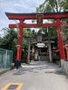
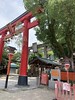
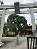
The above images may not be of the site on this page, but were taken nearby. They are loaded from Flickr so please click on them for image credits.
Click here to see more info for this site
Nearby sites
Click here to view sites on an interactive map of the areaKey: Red: member's photo, Blue: 3rd party photo, Yellow: other image, Green: no photo - please go there and take one, Grey: site destroyed
Download sites to:
KML (Google Earth)
GPX (GPS waypoints)
CSV (Garmin/Navman)
CSV (Excel)
To unlock full downloads you need to sign up as a Contributory Member. Otherwise downloads are limited to 50 sites.
Turn off the page maps and other distractions
Nearby sites listing. In the following links * = Image available
2.3km SSE 147° Takayasu-no-Ki* Hillfort
3.4km NNW 339° Hanazono Rugby Stadium* Modern Stone Circle etc
7.4km S 181° Takaida Yokoana* Rock Cut Tomb
7.5km NNW 331° Kōnoike Shinden hall* Modern Stone Circle etc
7.7km S 176° Matsuokayama Kofun* Holed Stone
7.8km S 177° ChausuZuka Kofun* Chambered Cairn
8.4km S 187° Anpuku-ji Yokoana* Rock Cut Tomb
8.5km S 187° Anpuku-ji Sekkan* Cist
9.0km E 83° Yata-dera temple* Modern Stone Circle etc
10.0km SSW 206° Yachū-ji temple* Sculptured Stone
10.5km S 187° Hayato-ishi (in Ōsaka)* Carving
11.4km W 279° Shitennō-ji temple* Ancient Temple
11.5km WNW 296° Hōkoku-jinja shrine* Modern Stone Circle etc
12.4km SE 135° Nagareyama Kofun* Long Barrow
12.7km N 7° Ishi-no-Hōden Kofun* Passage Grave
13.1km SE 139° Mitsuyoshi-Ishizuka Kofun* Long Barrow
13.4km W 278° Gansen-ji temple* Modern Stone Circle etc
13.5km SSE 168° Rokutan-ji temple* Ancient Temple
13.6km ENE 76° Bussoku-seki of Yakushi-ji temple* Carving
13.6km SSE 166° Iwaya temple* Ancient Temple
14.2km S 177° Yamada Takatsuka Kofun* Passage Grave
14.2km S 179° Koshimaezuka Kofun* Passage Grave
14.3km S 176° Futagozuka Kofun (in Ōsaka)* Passage Grave
15.1km ENE 64° Saki Misasagiyama Kofun* Long Barrow
15.6km ENE 71° Heijō-kyō Palace garden ruin (southern garden)* Modern Stone Circle etc
View more nearby sites and additional images


 We would like to know more about this location. Please feel free to add a brief description and any relevant information in your own language.
 Wir möchten mehr über diese Stätte erfahren. Bitte zögern Sie nicht, eine kurze Beschreibung und relevante Informationen in Deutsch hinzuzufügen.
 Nous aimerions en savoir encore un peu sur les lieux. S'il vous plaît n'hesitez pas à ajouter une courte description et tous les renseignements pertinents dans votre propre langue.
 Quisieramos informarnos un poco más de las lugares. No dude en añadir una breve descripción y otros datos relevantes en su propio idioma.