


<< Our Photo Pages >> Manpō-ji temple - Modern Stone Circle etc in Japan in Honshū
Submitted by Aska on Thursday, 14 March 2019 Page Views: 710
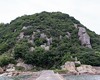
Modern SitesSite Name: Manpō-ji temple Alternative Name: 万宝寺 Manpo-ji Mampo-jiCountry: Japan
NOTE: This site is 7.393 km away from the location you searched for.
Region: Honshū Type: Modern Stone Circle etc
Nearest Town: Himeji (Hyōgo pref.) Nearest Village: Matogata-chō 的形ஹ
Latitude: 34.783530N Longitude: 134.738040E
Condition:
| 5 | Perfect |
| 4 | Almost Perfect |
| 3 | Reasonable but with some damage |
| 2 | Ruined but still recognisable as an ancient site |
| 1 | Pretty much destroyed, possibly visible as crop marks |
| 0 | No data. |
| -1 | Completely destroyed |
| 5 | Superb |
| 4 | Good |
| 3 | Ordinary |
| 2 | Not Good |
| 1 | Awful |
| 0 | No data. |
| 5 | Can be driven to, probably with disabled access |
| 4 | Short walk on a footpath |
| 3 | Requiring a bit more of a walk |
| 2 | A long walk |
| 1 | In the middle of nowhere, a nightmare to find |
| 0 | No data. |
| 5 | co-ordinates taken by GPS or official recorded co-ordinates |
| 4 | co-ordinates scaled from a detailed map |
| 3 | co-ordinates scaled from a bad map |
| 2 | co-ordinates of the nearest village |
| 1 | co-ordinates of the nearest town |
| 0 | no data |
Internal Links:
External Links:
")
Manpō-ji temple at the foot of a hill in a seaside village has a fine pond garden with stones and trees. Admission free (donation welcomed).
You may be viewing yesterday's version of this page. To see the most up to date information please register for a free account.
Do not use the above information on other web sites or publications without permission of the contributor.
Nearby Images from Flickr
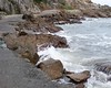
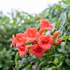
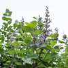

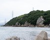
The above images may not be of the site on this page, but were taken nearby. They are loaded from Flickr so please click on them for image credits.
Click here to see more info for this site
Nearby sites
Click here to view sites on an interactive map of the areaKey: Red: member's photo, Blue: 3rd party photo, Yellow: other image, Green: no photo - please go there and take one, Grey: site destroyed
Download sites to:
KML (Google Earth)
GPX (GPS waypoints)
CSV (Garmin/Navman)
CSV (Excel)
To unlock full downloads you need to sign up as a Contributory Member. Otherwise downloads are limited to 50 sites.
Turn off the page maps and other distractions
Nearby sites listing. In the following links * = Image available
5.2km E 91° Ishi-no-Hōden cube* Sculptured Stone
11.3km ESE 107° Jōju-in* Modern Stone Circle etc
13.2km WNW 287° Yoro HisagoZuka Kofun* Long Barrow
15.5km NW 320° Taiyō Kōen park* Modern Stone Circle etc
17.5km ENE 76° Kibita Kofun* Chambered Cairn
18.9km W 271° Iwami Kitayama Kofungun* Chambered Cairn
19.0km NNE 26° Hōjō-no Gohyaku Rakan* Sculptured Stone
20.8km WNW 288° Yakuyama Kofungun* Barrow Cemetery
23.2km WNW 303° Kinoyama* Hillfort
23.5km NW 312° Shingū Miyauchi* Ancient Village or Settlement
25.2km W 265° Tsubone Kofungun* Chambered Cairn
25.8km NW 326° Shiono Rokkaku Kofun* Passage Grave
30.8km W 259° Tabuchi garden* Modern Stone Circle etc
31.6km ESE 108° An'yō-in temple* Modern Stone Circle etc
32.9km ESE 121° Goshikizuka Kofun* Long Barrow
33.7km NE 45° Hie Kofun* Chambered Cairn
34.9km W 279° Yoi-Taniguchi Kofungun* Chambered Cairn
36.1km NNE 24° Zuikō-ji temple* Modern Stone Circle etc
36.4km NW 309° Resso Jinja shrine* Modern Stone Circle etc
37.5km SSE 146° Myōshō-ji temple* Modern Stone Circle etc
41.0km SSE 166° Enichi-ji temple* Modern Stone Circle etc
41.4km WNW 298° Kuzaki Kyōzuka* Pyramid / Mastaba
46.5km WNW 303° Fukuyoshi Kyōzuka* Pyramid / Mastaba
48.6km SW 232° Hoshigajō* Hillfort
50.6km SW 229° Eikō-ji temple* Modern Stone Circle etc
View more nearby sites and additional images

")
 We would like to know more about this location. Please feel free to add a brief description and any relevant information in your own language.
 Wir möchten mehr über diese Stätte erfahren. Bitte zögern Sie nicht, eine kurze Beschreibung und relevante Informationen in Deutsch hinzuzufügen.
 Nous aimerions en savoir encore un peu sur les lieux. S'il vous plaît n'hesitez pas à ajouter une courte description et tous les renseignements pertinents dans votre propre langue.
 Quisieramos informarnos un poco más de las lugares. No dude en añadir una breve descripción y otros datos relevantes en su propio idioma.