


<< Our Photo Pages >> Kawakami Jinja Kofun - Passage Grave in Japan in Shikoku
Submitted by Aska on Sunday, 03 March 2013 Page Views: 2115
Iron Age and Later PrehistorySite Name: Kawakami Jinja Kofun Alternative Name: 川上神社古墳Country: Japan
NOTE: This site is 15.71 km away from the location you searched for.
Region: Shikoku Type: Passage Grave
Nearest Town: Tōon (Ehime pref.) Nearest Village: Minamigata 南方
Latitude: 33.800210N Longitude: 132.913970E
Condition:
| 5 | Perfect |
| 4 | Almost Perfect |
| 3 | Reasonable but with some damage |
| 2 | Ruined but still recognisable as an ancient site |
| 1 | Pretty much destroyed, possibly visible as crop marks |
| 0 | No data. |
| -1 | Completely destroyed |
| 5 | Superb |
| 4 | Good |
| 3 | Ordinary |
| 2 | Not Good |
| 1 | Awful |
| 0 | No data. |
| 5 | Can be driven to, probably with disabled access |
| 4 | Short walk on a footpath |
| 3 | Requiring a bit more of a walk |
| 2 | A long walk |
| 1 | In the middle of nowhere, a nightmare to find |
| 0 | No data. |
| 5 | co-ordinates taken by GPS or official recorded co-ordinates |
| 4 | co-ordinates scaled from a detailed map |
| 3 | co-ordinates scaled from a bad map |
| 2 | co-ordinates of the nearest village |
| 1 | co-ordinates of the nearest town |
| 0 | no data |
Internal Links:
External Links:
I have visited· I would like to visit
rrmoser visited on 30th Apr 2018 - their rating: Cond: 4 Amb: 5 Access: 4 Fantastic site. The chamber is constructed from huge megaliths unlike other sites I visited in the region that used many smaller stones done in a kind of dry masonry. the back wall is a single stone for example. It is very dark and you need a light. I only found one chamber.
")
Behind the building of Kawakami Jinja (川上神社) shrine, this tumulus with 2 chambers is located. From this tumulus, several harness were excavated. The mound was preserved as the holy wood for a long time, the trees grew too large, one of the entrances of the chambers is buried and the original shape of the tumulus is now uncertain, some scholars suspect it might be ... : rectangle, oval or double round (gourd) shaped.
You may be viewing yesterday's version of this page. To see the most up to date information please register for a free account.
")
Do not use the above information on other web sites or publications without permission of the contributor.
Nearby Images from Flickr

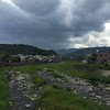
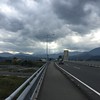
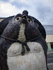
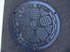
The above images may not be of the site on this page, but were taken nearby. They are loaded from Flickr so please click on them for image credits.
Click here to see more info for this site
Nearby sites
Click here to view sites on an interactive map of the areaKey: Red: member's photo, Blue: 3rd party photo, Yellow: other image, Green: no photo - please go there and take one, Grey: site destroyed
Download sites to:
KML (Google Earth)
GPX (GPS waypoints)
CSV (Garmin/Navman)
CSV (Excel)
To unlock full downloads you need to sign up as a Contributory Member. Otherwise downloads are limited to 50 sites.
Turn off the page maps and other distractions
Nearby sites listing. In the following links * = Image available
6.3km WNW 284° Hazaike Kofun* Long Barrow
11.9km WSW 252° Ōgeta Kofungun* Passage Grave
21.0km ENE 61° Busshin-ji temple* Modern Stone Circle etc
23.8km NNE 18° Takinomiya Kofungun* Chambered Cairn
23.8km NNE 33° Einōsan* Hillfort
27.0km ENE 68° Hōkoku-ji temple* Modern Stone Circle etc
28.8km N 3° Myōkensan Kofun* Long Barrow
41.6km SW 223° Hinaruwa Daba* Natural Stone / Erratic / Other Natural Feature
42.6km SW 225° Yakaidani* Standing Stone (Menhir)
42.6km SW 219° Narumi* Standing Stone (Menhir)
46.0km SW 225° Tomisuyama* Natural Stone / Erratic / Other Natural Feature
47.8km SW 230° Mishima Jinja shrine (in Ehime)* Standing Stone (Menhir)
48.3km SW 223° Momijiyama* Stone Circle
48.5km SW 230° Takayama-Nishinomiya* Standing Stone (Menhir)
48.7km SW 225° Awashima Jinja shrine* Natural Stone / Erratic / Other Natural Feature
49.6km SW 231° Semba* Standing Stone (Menhir)
50.5km N 9° Ōmishima Bijutsukan art gallery* Modern Stone Circle etc
58.5km NNW 327° Irifune-yama park* Modern Stone Circle etc
60.4km NNE 26° Ōjizuka* Chambered Cairn
61.7km N 352° Tonkararin (in Hiroshima)* Souterrain (Fogou, Earth House)
62.6km SSW 198° Iwaya* Stone Circle
66.0km ENE 69° Uma Mukaiyama Kofun* Long Barrow
70.5km NNW 346° Mitsujō Kofun* Long Barrow
72.0km SSW 206° Saigō-ji temple* Modern Stone Circle etc
73.3km NNE 22° Jōdo-ji temple* Modern Stone Circle etc
View more nearby sites and additional images


 We would like to know more about this location. Please feel free to add a brief description and any relevant information in your own language.
 Wir möchten mehr über diese Stätte erfahren. Bitte zögern Sie nicht, eine kurze Beschreibung und relevante Informationen in Deutsch hinzuzufügen.
 Nous aimerions en savoir encore un peu sur les lieux. S'il vous plaît n'hesitez pas à ajouter une courte description et tous les renseignements pertinents dans votre propre langue.
 Quisieramos informarnos un poco más de las lugares. No dude en añadir una breve descripción y otros datos relevantes en su propio idioma.