


<< Our Photo Pages >> Ōmishima Bijutsukan art gallery - Modern Stone Circle etc in Japan in Shikoku
Submitted by Aska on Sunday, 15 March 2020 Page Views: 407
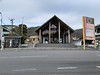
Modern SitesSite Name: Ōmishima Bijutsukan art gallery Alternative Name: 大三島美術館 Omishima Bijutsu-kanCountry: Japan
NOTE: This site is 15.405 km away from the location you searched for.
Region: Shikoku Type: Modern Stone Circle etc
Nearest Town: Imabari (Ehime prefecture) Nearest Village: ŌmishimachōMiyauchi 大&#
Latitude: 34.248890N Longitude: 133.002010E
Condition:
| 5 | Perfect |
| 4 | Almost Perfect |
| 3 | Reasonable but with some damage |
| 2 | Ruined but still recognisable as an ancient site |
| 1 | Pretty much destroyed, possibly visible as crop marks |
| 0 | No data. |
| -1 | Completely destroyed |
| 5 | Superb |
| 4 | Good |
| 3 | Ordinary |
| 2 | Not Good |
| 1 | Awful |
| 0 | No data. |
| 5 | Can be driven to, probably with disabled access |
| 4 | Short walk on a footpath |
| 3 | Requiring a bit more of a walk |
| 2 | A long walk |
| 1 | In the middle of nowhere, a nightmare to find |
| 0 | No data. |
| 5 | co-ordinates taken by GPS or official recorded co-ordinates |
| 4 | co-ordinates scaled from a detailed map |
| 3 | co-ordinates scaled from a bad map |
| 2 | co-ordinates of the nearest village |
| 1 | co-ordinates of the nearest town |
| 0 | no data |
Internal Links:
External Links:
")
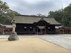
Behind this art gallery on Ōmishima island which contains the contemporary Japanese style paintings, there is a modern geometric dry landscape garden.
Official site in Japanese
You may be viewing yesterday's version of this page. To see the most up to date information please register for a free account.
Do not use the above information on other web sites or publications without permission of the contributor.
Nearby Images from Flickr
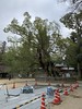
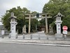
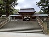
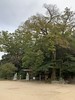
The above images may not be of the site on this page, but were taken nearby. They are loaded from Flickr so please click on them for image credits.
Click here to see more info for this site
Nearby sites
Click here to view sites on an interactive map of the areaKey: Red: member's photo, Blue: 3rd party photo, Yellow: other image, Green: no photo - please go there and take one, Grey: site destroyed
Download sites to:
KML (Google Earth)
GPX (GPS waypoints)
CSV (Garmin/Navman)
CSV (Excel)
To unlock full downloads you need to sign up as a Contributory Member. Otherwise downloads are limited to 50 sites.
Turn off the page maps and other distractions
Nearby sites listing. In the following links * = Image available
18.7km ENE 76° Ōjizuka* Chambered Cairn
20.0km NW 304° Tonkararin (in Hiroshima)* Souterrain (Fogou, Earth House)
22.1km SSW 197° Myōkensan Kofun* Long Barrow
26.4km NE 46° Jōdo-ji temple* Modern Stone Circle etc
27.3km S 181° Takinomiya Kofungun* Chambered Cairn
30.3km S 171° Einōsan* Hillfort
30.9km NW 307° Mitsujō Kofun* Long Barrow
33.3km NNE 12° Kui-no Gankai* Natural Stone / Erratic / Other Natural Feature
37.3km ENE 59° Jōkoku-ji temple* Modern Stone Circle etc
38.0km ENE 66° Ankoku-ji temple* Modern Stone Circle etc
40.3km W 269° Irifune-yama park* Modern Stone Circle etc
41.0km SSE 166° Busshin-ji temple* Modern Stone Circle etc
43.2km SSE 157° Hōkoku-ji temple* Modern Stone Circle etc
46.9km NNE 33° Oichi Kofun* Passage Grave
47.1km NNE 12° Yano-no Gankai* Natural Stone / Erratic / Other Natural Feature
49.3km WNW 287° Hambē restaurant* Modern Stone Circle etc
49.7km WNW 296° Senninzuka Kofun* Chambered Cairn
50.4km SSW 196° Hazaike Kofun* Long Barrow
50.5km S 189° Kawakami Jinja Kofun* Passage Grave
51.1km WNW 295° Yugama Kofun* Chambered Cairn
52.4km WNW 298° Saiganjiyama Funbogun* Cist
56.5km NW 304° Kyūjinhara Kofungun* Chambered Cairn
57.0km SSW 200° Ōgeta Kofungun* Passage Grave
60.0km ESE 117° Uma Mukaiyama Kofun* Long Barrow
60.8km ESE 102° Kōshōjiyama Kofungun* Passage Grave
View more nearby sites and additional images


 We would like to know more about this location. Please feel free to add a brief description and any relevant information in your own language.
 Wir möchten mehr über diese Stätte erfahren. Bitte zögern Sie nicht, eine kurze Beschreibung und relevante Informationen in Deutsch hinzuzufügen.
 Nous aimerions en savoir encore un peu sur les lieux. S'il vous plaît n'hesitez pas à ajouter une courte description et tous les renseignements pertinents dans votre propre langue.
 Quisieramos informarnos un poco más de las lugares. No dude en añadir una breve descripción y otros datos relevantes en su propio idioma.