


<< Our Photo Pages >> Irifune-yama park - Modern Stone Circle etc in Japan in Honshū
Submitted by Aska on Sunday, 01 March 2020 Page Views: 497
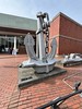
Modern SitesSite Name: Irifune-yama park Alternative Name: 入船山公園 Irifune-yama Kōen, Irifuneyama KoenCountry: Japan
NOTE: This site is 30.684 km away from the location you searched for.
Region: Honshū Type: Modern Stone Circle etc
Nearest Town: Kure (Hiroshima prefecture) Nearest Village: Saiwai-chō 幸町
Latitude: 34.239720N Longitude: 132.564210E
Condition:
| 5 | Perfect |
| 4 | Almost Perfect |
| 3 | Reasonable but with some damage |
| 2 | Ruined but still recognisable as an ancient site |
| 1 | Pretty much destroyed, possibly visible as crop marks |
| 0 | No data. |
| -1 | Completely destroyed |
| 5 | Superb |
| 4 | Good |
| 3 | Ordinary |
| 2 | Not Good |
| 1 | Awful |
| 0 | No data. |
| 5 | Can be driven to, probably with disabled access |
| 4 | Short walk on a footpath |
| 3 | Requiring a bit more of a walk |
| 2 | A long walk |
| 1 | In the middle of nowhere, a nightmare to find |
| 0 | No data. |
| 5 | co-ordinates taken by GPS or official recorded co-ordinates |
| 4 | co-ordinates scaled from a detailed map |
| 3 | co-ordinates scaled from a bad map |
| 2 | co-ordinates of the nearest village |
| 1 | co-ordinates of the nearest town |
| 0 | no data |
Internal Links:
External Links:
")
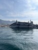
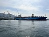
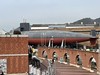
A municipal park including an art gallery and a memorial museum in the heart of ex-navy port town Kure has a dry landscape garden. Kure city was used for the scenes in yakuza film series “Battles without Honor and Humanity” and anti-war manga-anime “In this Corner of the World”.
You may be viewing yesterday's version of this page. To see the most up to date information please register for a free account.
Do not use the above information on other web sites or publications without permission of the contributor.
Nearby Images from Flickr

The above images may not be of the site on this page, but were taken nearby. They are loaded from Flickr so please click on them for image credits.
Click here to see more info for this site
Nearby sites
Click here to view sites on an interactive map of the areaKey: Red: member's photo, Blue: 3rd party photo, Yellow: other image, Green: no photo - please go there and take one, Grey: site destroyed
Download sites to:
KML (Google Earth)
GPX (GPS waypoints)
CSV (Garmin/Navman)
CSV (Excel)
To unlock full downloads you need to sign up as a Contributory Member. Otherwise downloads are limited to 50 sites.
Turn off the page maps and other distractions
Nearby sites listing. In the following links * = Image available
16.6km NNW 335° Hambē restaurant* Modern Stone Circle etc
23.0km NNW 348° Senninzuka Kofun* Chambered Cairn
23.3km NNW 344° Yugama Kofun* Chambered Cairn
25.1km NE 38° Mitsujō Kofun* Long Barrow
26.2km NNW 346° Saiganjiyama Funbogun* Cist
26.6km ENE 63° Tonkararin (in Hiroshima)* Souterrain (Fogou, Earth House)
33.0km NNW 348° Kyūjinhara Kofungun* Chambered Cairn
36.6km WSW 258° Mekada Family Residence garden* Modern Stone Circle etc
36.8km WSW 258° Yōkō-ji temple* Modern Stone Circle etc
39.3km ESE 121° Myōkensan Kofun* Long Barrow
40.3km E 88° Ōmishima Bijutsukan art gallery* Modern Stone Circle etc
47.6km ESE 123° Takinomiya Kofungun* Chambered Cairn
53.6km ESE 122° Einōsan* Hillfort
54.0km SSE 151° Hazaike Kofun* Long Barrow
55.8km WSW 240° Iwakiyama* Hillfort
56.6km SSE 158° Ōgeta Kofungun* Passage Grave
58.0km NE 55° Kui-no Gankai* Natural Stone / Erratic / Other Natural Feature
58.5km SSE 146° Kawakami Jinja Kofun* Passage Grave
58.7km E 85° Ōjizuka* Chambered Cairn
62.3km ENE 72° Jōdo-ji temple* Modern Stone Circle etc
63.6km SE 127° Busshin-ji temple* Modern Stone Circle etc
68.9km NE 47° Yano-no Gankai* Natural Stone / Erratic / Other Natural Feature
68.9km W 270° Kan’yō-ji temple* Modern Stone Circle etc
69.1km SE 124° Hōkoku-ji temple* Modern Stone Circle etc
75.1km ENE 74° Jōkoku-ji temple* Modern Stone Circle etc
View more nearby sites and additional images


 We would like to know more about this location. Please feel free to add a brief description and any relevant information in your own language.
 Wir möchten mehr über diese Stätte erfahren. Bitte zögern Sie nicht, eine kurze Beschreibung und relevante Informationen in Deutsch hinzuzufügen.
 Nous aimerions en savoir encore un peu sur les lieux. S'il vous plaît n'hesitez pas à ajouter une courte description et tous les renseignements pertinents dans votre propre langue.
 Quisieramos informarnos un poco más de las lugares. No dude en añadir una breve descripción y otros datos relevantes en su propio idioma.