


<< Our Photo Pages >> Yugama Kofun - Chambered Cairn in Japan in Honshū
Submitted by Aska on Tuesday, 18 September 2012 Page Views: 2761
Neolithic and Bronze AgeSite Name: Yugama Kofun Alternative Name: 湯釜古墳Country: Japan
NOTE: This site is 2.808 km away from the location you searched for.
Region: Honshū Type: Chambered Cairn
Nearest Town: Hiroshima (Hiroshima pref.) Nearest Village: Hesaka-chō 戸坂町
Latitude: 34.441220N Longitude: 132.496440E
Condition:
| 5 | Perfect |
| 4 | Almost Perfect |
| 3 | Reasonable but with some damage |
| 2 | Ruined but still recognisable as an ancient site |
| 1 | Pretty much destroyed, possibly visible as crop marks |
| 0 | No data. |
| -1 | Completely destroyed |
| 5 | Superb |
| 4 | Good |
| 3 | Ordinary |
| 2 | Not Good |
| 1 | Awful |
| 0 | No data. |
| 5 | Can be driven to, probably with disabled access |
| 4 | Short walk on a footpath |
| 3 | Requiring a bit more of a walk |
| 2 | A long walk |
| 1 | In the middle of nowhere, a nightmare to find |
| 0 | No data. |
| 5 | co-ordinates taken by GPS or official recorded co-ordinates |
| 4 | co-ordinates scaled from a detailed map |
| 3 | co-ordinates scaled from a bad map |
| 2 | co-ordinates of the nearest village |
| 1 | co-ordinates of the nearest town |
| 0 | no data |
Internal Links:
External Links:
")
A solitary chambered cairn on a branch ridge on the way to Mt.Matsukasa (松笠山) and Matsukasa Kannon (松笠観音) temple, the entrance of the trail starts in the precinct of uninhabited small temple Ryūsen-ji (龍泉寺). A signpost stands at the junction (alt. 240m approx.) of the main trail and the path to the cairn, but the letters "湯釜古墳" on it is almost vanishing. "Yugama" means a bathtub.
You may be viewing yesterday's version of this page. To see the most up to date information please register for a free account.
Do not use the above information on other web sites or publications without permission of the contributor.
Nearby Images from Flickr


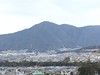
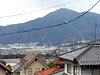
The above images may not be of the site on this page, but were taken nearby. They are loaded from Flickr so please click on them for image credits.
Click here to see more info for this site
Nearby sites
Click here to view sites on an interactive map of the areaKey: Red: member's photo, Blue: 3rd party photo, Yellow: other image, Green: no photo - please go there and take one, Grey: site destroyed
Download sites to:
KML (Google Earth)
GPX (GPS waypoints)
CSV (Garmin/Navman)
CSV (Excel)
To unlock full downloads you need to sign up as a Contributory Member. Otherwise downloads are limited to 50 sites.
Turn off the page maps and other distractions
Nearby sites listing. In the following links * = Image available
1.6km E 85° Senninzuka Kofun* Chambered Cairn
3.1km N 1° Saiganjiyama Funbogun* Cist
7.4km S 186° Hambē restaurant* Modern Stone Circle etc
9.9km N 356° Kyūjinhara Kofungun* Chambered Cairn
22.0km E 97° Mitsujō Kofun* Long Barrow
23.3km SSE 164° Irifune-yama park* Modern Stone Circle etc
31.5km ESE 109° Tonkararin (in Hiroshima)* Souterrain (Fogou, Earth House)
42.1km SW 225° Mekada Family Residence garden* Modern Stone Circle etc
42.4km SW 225° Yōkō-ji temple* Modern Stone Circle etc
51.1km ESE 115° Ōmishima Bijutsukan art gallery* Modern Stone Circle etc
54.6km ENE 78° Kui-no Gankai* Natural Stone / Erratic / Other Natural Feature
58.3km SE 137° Myōkensan Kofun* Long Barrow
61.1km NW 314° Taimasan Jinja shrine* Modern Stone Circle etc
61.6km ENE 66° Yano-no Gankai* Natural Stone / Erratic / Other Natural Feature
63.6km WNW 295° Ikō-ji temple* Modern Stone Circle etc
64.0km WNW 295° Mampuku-ji temple (in Shimane prefecture)* Modern Stone Circle etc
65.5km E 93° Jōdo-ji temple* Modern Stone Circle etc
65.7km SW 220° Iwakiyama* Hillfort
66.6km WSW 250° Kan’yō-ji temple* Modern Stone Circle etc
66.8km ESE 105° Ōjizuka* Chambered Cairn
66.9km SE 137° Takinomiya Kofungun* Chambered Cairn
67.6km NNW 336° Ogawa Family garden* Modern Stone Circle etc
72.6km SE 135° Einōsan* Hillfort
74.0km ENE 76° Oichi Kofun* Passage Grave
75.9km N 357° Iwami Ginzan silver mine* Modern Stone Circle etc
View more nearby sites and additional images


 We would like to know more about this location. Please feel free to add a brief description and any relevant information in your own language.
 Wir möchten mehr über diese Stätte erfahren. Bitte zögern Sie nicht, eine kurze Beschreibung und relevante Informationen in Deutsch hinzuzufügen.
 Nous aimerions en savoir encore un peu sur les lieux. S'il vous plaît n'hesitez pas à ajouter une courte description et tous les renseignements pertinents dans votre propre langue.
 Quisieramos informarnos un poco más de las lugares. No dude en añadir una breve descripción y otros datos relevantes en su propio idioma.