


<< Our Photo Pages >> Mekada Family Residence garden - Modern Stone Circle etc in Japan in Honshū
Submitted by Aska on Sunday, 01 March 2020 Page Views: 470
Modern SitesSite Name: Mekada Family Residence garden Alternative Name: 目加田家 Mekada-keCountry: Japan
NOTE: This site is 5.415 km away from the location you searched for.
Region: Honshū Type: Modern Stone Circle etc
Nearest Town: Iwakuni (Yamaguchi prefecture) Nearest Village: Yokoyama 横山
Latitude: 34.170750N Longitude: 132.175450E
Condition:
| 5 | Perfect |
| 4 | Almost Perfect |
| 3 | Reasonable but with some damage |
| 2 | Ruined but still recognisable as an ancient site |
| 1 | Pretty much destroyed, possibly visible as crop marks |
| 0 | No data. |
| -1 | Completely destroyed |
| 5 | Superb |
| 4 | Good |
| 3 | Ordinary |
| 2 | Not Good |
| 1 | Awful |
| 0 | No data. |
| 5 | Can be driven to, probably with disabled access |
| 4 | Short walk on a footpath |
| 3 | Requiring a bit more of a walk |
| 2 | A long walk |
| 1 | In the middle of nowhere, a nightmare to find |
| 0 | No data. |
| 5 | co-ordinates taken by GPS or official recorded co-ordinates |
| 4 | co-ordinates scaled from a detailed map |
| 3 | co-ordinates scaled from a bad map |
| 2 | co-ordinates of the nearest village |
| 1 | co-ordinates of the nearest town |
| 0 | no data |
Internal Links:
External Links:
")
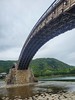
In a historical park beyond the Kintaikyō (錦帯橋) wooden arch bridge, one of the 3 great bridges in Japan, a house of a middle-class samurai family is preserved. It contains a low budget dry landscape garden.
Open 9:30-16:30, closed on Monday and the days around the New Year Day, admission free.
You may be viewing yesterday's version of this page. To see the most up to date information please register for a free account.
")
")
Do not use the above information on other web sites or publications without permission of the contributor.
Nearby Images from Flickr
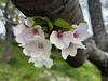
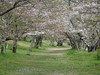
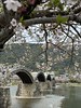
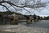
The above images may not be of the site on this page, but were taken nearby. They are loaded from Flickr so please click on them for image credits.
Click here to see more info for this site
Nearby sites
Click here to view sites on an interactive map of the areaKey: Red: member's photo, Blue: 3rd party photo, Yellow: other image, Green: no photo - please go there and take one, Grey: site destroyed
Download sites to:
KML (Google Earth)
GPX (GPS waypoints)
CSV (Garmin/Navman)
CSV (Excel)
To unlock full downloads you need to sign up as a Contributory Member. Otherwise downloads are limited to 50 sites.
Turn off the page maps and other distractions
Nearby sites listing. In the following links * = Image available
266m SW 232° Yōkō-ji temple* Modern Stone Circle etc
23.9km SSW 211° Iwakiyama* Hillfort
33.9km WNW 282° Kan’yō-ji temple* Modern Stone Circle etc
36.6km ENE 78° Irifune-yama park* Modern Stone Circle etc
36.6km NE 52° Hambē restaurant* Modern Stone Circle etc
42.1km NE 44° Yugama Kofun* Chambered Cairn
43.4km NE 46° Senninzuka Kofun* Chambered Cairn
44.4km NE 42° Saiganjiyama Funbogun* Cist
49.3km NE 36° Kyūjinhara Kofungun* Chambered Cairn
55.4km WSW 258° Mōri Family Residence garden* Modern Stone Circle etc
57.2km W 260° Katsura Family Residence garden* Modern Stone Circle etc
58.1km ENE 62° Mitsujō Kofun* Long Barrow
62.6km ENE 71° Tonkararin (in Hiroshima)* Souterrain (Fogou, Earth House)
63.1km W 273° Jōei-ji temple* Modern Stone Circle etc
63.4km NNW 333° Ikō-ji temple* Modern Stone Circle etc
63.5km NNW 333° Mampuku-ji temple (in Shimane prefecture)* Modern Stone Circle etc
70.2km W 270° Ryūzō-ji temple* Modern Stone Circle etc
70.6km E 100° Myōkensan Kofun* Long Barrow
72.4km SE 128° Ōgeta Kofungun* Passage Grave
73.6km ESE 122° Hazaike Kofun* Long Barrow
73.7km NNW 348° Taimasan Jinja shrine* Modern Stone Circle etc
76.5km E 83° Ōmishima Bijutsukan art gallery* Modern Stone Circle etc
76.7km WNW 291° Kiku-ya Family Residence garden* Modern Stone Circle etc
77.7km ESE 104° Takinomiya Kofungun* Chambered Cairn
78.7km SSE 157° Semba* Standing Stone (Menhir)
View more nearby sites and additional images

")
 We would like to know more about this location. Please feel free to add a brief description and any relevant information in your own language.
 Wir möchten mehr über diese Stätte erfahren. Bitte zögern Sie nicht, eine kurze Beschreibung und relevante Informationen in Deutsch hinzuzufügen.
 Nous aimerions en savoir encore un peu sur les lieux. S'il vous plaît n'hesitez pas à ajouter une courte description et tous les renseignements pertinents dans votre propre langue.
 Quisieramos informarnos un poco más de las lugares. No dude en añadir una breve descripción y otros datos relevantes en su propio idioma.