 with our Megalithic Portal iPhone app")

, Aubrey Burl")
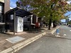
<< Our Photo Pages >> Jōei-ji temple - Modern Stone Circle etc in Japan in Honshū
Submitted by Aska on Sunday, 01 March 2020 Page Views: 536
Medieval (High and Late)Site Name: Jōei-ji temple Alternative Name: 常栄寺 Joei-jiCountry: Japan
NOTE: This site is 1.564 km away from the location you searched for.
Region: Honshū Type: Modern Stone Circle etc
Nearest Town: Yamaguchi (Yamaguchi prefecture) Nearest Village: MiyanoShimo 宮野下
Latitude: 34.197940N Longitude: 131.489780E
Condition:
| 5 | Perfect |
| 4 | Almost Perfect |
| 3 | Reasonable but with some damage |
| 2 | Ruined but still recognisable as an ancient site |
| 1 | Pretty much destroyed, possibly visible as crop marks |
| 0 | No data. |
| -1 | Completely destroyed |
| 5 | Superb |
| 4 | Good |
| 3 | Ordinary |
| 2 | Not Good |
| 1 | Awful |
| 0 | No data. |
| 5 | Can be driven to, probably with disabled access |
| 4 | Short walk on a footpath |
| 3 | Requiring a bit more of a walk |
| 2 | A long walk |
| 1 | In the middle of nowhere, a nightmare to find |
| 0 | No data. |
| 5 | co-ordinates taken by GPS or official recorded co-ordinates |
| 4 | co-ordinates scaled from a detailed map |
| 3 | co-ordinates scaled from a bad map |
| 2 | co-ordinates of the nearest village |
| 1 | co-ordinates of the nearest town |
| 0 | no data |
Internal Links:
External Links:
")
This temple situated at the foot of a hill in the northern area of Yamaguchi city centre has a pond garden with rocks designed by a painter monk Sesshū (1420-1506) in the backyard, and dry landscape gardens built by the modern gardener Mirei SHIGEMORI (1896-1975) in the front yard.
Open 8:00-17:00 (-16:30 Nov.-Mar.) all year around, admission 300 Japanese Yen (2024 price).
Official site in Japanese.
You may be viewing yesterday's version of this page. To see the most up to date information please register for a free account.
")
Do not use the above information on other web sites or publications without permission of the contributor.
Nearby Images from Flickr


The above images may not be of the site on this page, but were taken nearby. They are loaded from Flickr so please click on them for image credits.
Click here to see more info for this site
Nearby sites
Click here to view sites on an interactive map of the areaKey: Red: member's photo, Blue: 3rd party photo, Yellow: other image, Green: no photo - please go there and take one, Grey: site destroyed
Download sites to:
KML (Google Earth)
GPX (GPS waypoints)
CSV (Garmin/Navman)
CSV (Excel)
To unlock full downloads you need to sign up as a Contributory Member. Otherwise downloads are limited to 50 sites.
Turn off the page maps and other distractions
Nearby sites listing. In the following links * = Image available
7.9km WSW 244° Ryūzō-ji temple* Modern Stone Circle etc
15.0km SSE 153° Katsura Family Residence garden* Modern Stone Circle etc
17.5km SSE 149° Mōri Family Residence garden* Modern Stone Circle etc
25.5km NNW 340° Kiku-ya Family Residence garden* Modern Stone Circle etc
30.2km E 82° Kan’yō-ji temple* Modern Stone Circle etc
33.8km SW 220° Sōrin-ji temple* Modern Stone Circle etc
52.8km W 265° Nakanohama* Burial Chamber or Dolmen
55.9km ESE 115° Iwakiyama* Hillfort
56.0km WSW 249° Kajikurihama* Cist
56.5km WSW 242° Akama Jingū Shrine* Ancient Temple
56.5km WNW 284° Miurayama Kofun* Chambered Cairn
56.6km W 281° Doigahama Site Anthropological Museum* Museum
60.2km WSW 241° Sugita* Carving
61.7km WSW 243° Hikoshima Hachiman Jinja shrine* Carving
62.3km S 173° Kiko Resseki* Stone Circle
62.7km S 180° Myōkensha shrine* Stone Circle
62.9km E 93° Yōkō-ji temple* Modern Stone Circle etc
63.0km S 177° Kisaki-no-Yamanokami* Standing Stone (Menhir)
63.1km E 93° Mekada Family Residence garden* Modern Stone Circle etc
63.3km NNE 32° Mampuku-ji temple (in Shimane prefecture)* Modern Stone Circle etc
63.8km NNE 33° Ikō-ji temple* Modern Stone Circle etc
69.0km SSE 167° JindaiMoji-iwa* Carving
69.8km NNW 334° Jīkombo Kofungun* Chambered Cairn
70.0km NNW 334° Kasaishi* Standing Stone (Menhir)
71.3km S 181° Anase Yokoana* Rock Cut Tomb
View more nearby sites and additional images


 We would like to know more about this location. Please feel free to add a brief description and any relevant information in your own language.
 Wir möchten mehr über diese Stätte erfahren. Bitte zögern Sie nicht, eine kurze Beschreibung und relevante Informationen in Deutsch hinzuzufügen.
 Nous aimerions en savoir encore un peu sur les lieux. S'il vous plaît n'hesitez pas à ajouter une courte description et tous les renseignements pertinents dans votre propre langue.
 Quisieramos informarnos un poco más de las lugares. No dude en añadir una breve descripción y otros datos relevantes en su propio idioma.