


<< Our Photo Pages >> Kumamoto Castle - Modern Stone Circle etc in Japan in Kyūshū
Submitted by Aska on Saturday, 04 April 2020 Page Views: 503
Modern SitesSite Name: Kumamoto Castle Alternative Name: 熊本城 Kumamoto-jō, Kumamoto-joCountry: Japan
NOTE: This site is 3.983 km away from the location you searched for.
Region: Kyūshū Type: Modern Stone Circle etc
Nearest Town: Kumamoto (Kumamoto prefecture) Nearest Village: Miyauchi 宮内
Latitude: 32.804330N Longitude: 130.698810E
Condition:
| 5 | Perfect |
| 4 | Almost Perfect |
| 3 | Reasonable but with some damage |
| 2 | Ruined but still recognisable as an ancient site |
| 1 | Pretty much destroyed, possibly visible as crop marks |
| 0 | No data. |
| -1 | Completely destroyed |
| 5 | Superb |
| 4 | Good |
| 3 | Ordinary |
| 2 | Not Good |
| 1 | Awful |
| 0 | No data. |
| 5 | Can be driven to, probably with disabled access |
| 4 | Short walk on a footpath |
| 3 | Requiring a bit more of a walk |
| 2 | A long walk |
| 1 | In the middle of nowhere, a nightmare to find |
| 0 | No data. |
| 5 | co-ordinates taken by GPS or official recorded co-ordinates |
| 4 | co-ordinates scaled from a detailed map |
| 3 | co-ordinates scaled from a bad map |
| 2 | co-ordinates of the nearest village |
| 1 | co-ordinates of the nearest town |
| 0 | no data |
Internal Links:
External Links:
")
You may be viewing yesterday's version of this page. To see the most up to date information please register for a free account.
Do not use the above information on other web sites or publications without permission of the contributor.
Nearby Images from Flickr

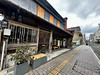
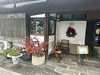
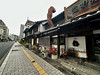
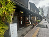
The above images may not be of the site on this page, but were taken nearby. They are loaded from Flickr so please click on them for image credits.
Click here to see more info for this site
Nearby sites
Click here to view sites on an interactive map of the areaKey: Red: member's photo, Blue: 3rd party photo, Yellow: other image, Green: no photo - please go there and take one, Grey: site destroyed
Download sites to:
KML (Google Earth)
GPX (GPS waypoints)
CSV (Garmin/Navman)
CSV (Excel)
To unlock full downloads you need to sign up as a Contributory Member. Otherwise downloads are limited to 50 sites.
Turn off the page maps and other distractions
Nearby sites listing. In the following links * = Image available
355m NNE 28° Kumamoto Kenritsu Bijutsukan art gallery* Museum
568m N 11° Hosokawa-Gyōbu Family Residence garden* Modern Stone Circle etc
1.0km SW 216° Kitaoka Park* Modern Stone Circle etc
10.3km NNW 344° Nerenoki Kannon* Standing Stones
10.6km ENE 58° Umenoki* Burial Chamber or Dolmen
12.2km NNE 19° Nagata* Burial Chamber or Dolmen
15.7km NE 34° Ishinomoto* Burial Chamber or Dolmen
16.1km NW 315° Ikura-kita Hachiman shrine* Burial Chamber or Dolmen
17.3km NW 314° Jōgasaki* Burial Chamber or Dolmen
17.4km N 6° Hirahata* Burial Chamber or Dolmen
18.0km NNE 23° Futatsukasan* Sculptured Stone
19.5km NW 318° Sugawara Jinja shrine (in Tamana)* Burial Chamber or Dolmen
20.2km NNW 334° Tonkararin (in Kumamoto)* Souterrain (Fogou, Earth House)
20.4km NW 305° Benzaiten Kofun* Passage Grave
20.7km NNW 334° Eta Funayama Kofun* Long Barrow
20.9km NNE 18° Nagarekawa* Burial Chamber or Dolmen
21.0km NW 308° Toshi-no-Kami* Burial Chamber or Dolmen
21.3km N 353° Kumamoto Kenritsu Sōshoku Kofun-kan museum* Museum
21.3km NNE 19° Okada* Burial Chamber or Dolmen
21.4km NNE 24° Otodo* Burial Chamber or Dolmen
21.8km NE 50° Mutabaru* Stone Circle
22.1km N 352° Nagaiwa* Rock Cut Tomb
22.1km NW 326° Ishinuki-Nagino* Rock Cut Tomb
22.3km NW 325° Ishinuki-Anakannon* Rock Cut Tomb
22.8km NE 44° Fujio* Burial Chamber or Dolmen
View more nearby sites and additional images


 We would like to know more about this location. Please feel free to add a brief description and any relevant information in your own language.
 Wir möchten mehr über diese Stätte erfahren. Bitte zögern Sie nicht, eine kurze Beschreibung und relevante Informationen in Deutsch hinzuzufügen.
 Nous aimerions en savoir encore un peu sur les lieux. S'il vous plaît n'hesitez pas à ajouter une courte description et tous les renseignements pertinents dans votre propre langue.
 Quisieramos informarnos un poco más de las lugares. No dude en añadir una breve descripción y otros datos relevantes en su propio idioma.