


<< Our Photo Pages >> Iwahata - Burial Chamber or Dolmen in Japan in Kyūshū
Submitted by Aska on Sunday, 08 April 2012 Page Views: 2019
Iron Age and Later PrehistorySite Name: Iwahata Alternative Name: 岩畑Country: Japan
NOTE: This site is 3.674 km away from the location you searched for.
Region: Kyūshū Type: Burial Chamber or Dolmen
Nearest Town: Miyama (Fukuoka pref.) Nearest Village: Takatamachi-Takei 高田
Latitude: 33.126040N Longitude: 130.498520E
Condition:
| 5 | Perfect |
| 4 | Almost Perfect |
| 3 | Reasonable but with some damage |
| 2 | Ruined but still recognisable as an ancient site |
| 1 | Pretty much destroyed, possibly visible as crop marks |
| 0 | No data. |
| -1 | Completely destroyed |
| 5 | Superb |
| 4 | Good |
| 3 | Ordinary |
| 2 | Not Good |
| 1 | Awful |
| 0 | No data. |
| 5 | Can be driven to, probably with disabled access |
| 4 | Short walk on a footpath |
| 3 | Requiring a bit more of a walk |
| 2 | A long walk |
| 1 | In the middle of nowhere, a nightmare to find |
| 0 | No data. |
| 5 | co-ordinates taken by GPS or official recorded co-ordinates |
| 4 | co-ordinates scaled from a detailed map |
| 3 | co-ordinates scaled from a bad map |
| 2 | co-ordinates of the nearest village |
| 1 | co-ordinates of the nearest town |
| 0 | no data |
Internal Links:
External Links:
")
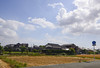
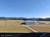
In a greenhouse in the backyard of a house, there lies a stone which is supposed to be the cap stone of a dolmen.
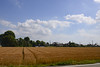
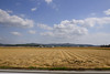
There seems that unnatural huge stones which may be the ruins of dolmens lie in the agricultural fields around this area.
You may be viewing yesterday's version of this page. To see the most up to date information please register for a free account.
Do not use the above information on other web sites or publications without permission of the contributor.
Nearby Images from Flickr

The above images may not be of the site on this page, but were taken nearby. They are loaded from Flickr so please click on them for image credits.
Click here to see more info for this site
Nearby sites
Click here to view sites on an interactive map of the areaKey: Red: member's photo, Blue: 3rd party photo, Yellow: other image, Green: no photo - please go there and take one, Grey: site destroyed
Download sites to:
KML (Google Earth)
GPX (GPS waypoints)
CSV (Garmin/Navman)
CSV (Excel)
To unlock full downloads you need to sign up as a Contributory Member. Otherwise downloads are limited to 50 sites.
Turn off the page maps and other distractions
Nearby sites listing. In the following links * = Image available
4.0km SSW 207° Ishigamiyama Kofun* Sculptured Stone
4.6km NNE 17° Zoyama* Hillfort
5.3km W 275° Taka-no-o Jinja shrine* Burial Chamber or Dolmen
7.4km N 352° Mizuta* Burial Chamber or Dolmen
11.0km WNW 303° Ōgi-no-uchi* Burial Chamber or Dolmen
11.2km NW 306° Mishima Jinja shrine (in Fukuoka)* Burial Chamber or Dolmen
12.4km N 9° Kōkadani Kofun* Passage Grave
12.5km N 8° Sekijin-san Kofun* Sculptured Stone
12.6km NNE 24° Tsurumiyama Kofun* Sculptured Stone
12.7km NNE 24° Iwatoyama Kofun* Sculptured Stone
13.6km NNE 31° Toyofuku* Sculptured Stone
13.9km S 191° Hagi-no-O Kofun* Passage Grave
14.1km SSW 193° San-no-miya* Sculptured Stone
14.2km NW 312° Isoraishi* Burial Chamber or Dolmen
14.6km NW 322° Nobori* Burial Chamber or Dolmen
14.7km NW 307° Kobo Hachiman Jinja shrine* Burial Chamber or Dolmen
15.2km SE 132° Usonomae* Burial Chamber or Dolmen
15.5km SSW 201° Manda Itsukushima Jinja shrine* Burial Chamber or Dolmen
18.4km SSE 161° Ishinuki-Anakannon* Rock Cut Tomb
18.6km SSE 161° Ishinuki-Nagino* Rock Cut Tomb
19.0km SE 124° Obusan Kofun* Passage Grave
19.2km SE 124° Chibusan Kofun* Passage Grave
19.6km SSE 151° Eta Funayama Kofun* Long Barrow
19.9km ESE 118° Ryūōzan Kofun (in Kumamoto)* Passage Grave
19.9km SE 126° Nabeta* Rock Cut Tomb
View more nearby sites and additional images


 We would like to know more about this location. Please feel free to add a brief description and any relevant information in your own language.
 Wir möchten mehr über diese Stätte erfahren. Bitte zögern Sie nicht, eine kurze Beschreibung und relevante Informationen in Deutsch hinzuzufügen.
 Nous aimerions en savoir encore un peu sur les lieux. S'il vous plaît n'hesitez pas à ajouter une courte description et tous les renseignements pertinents dans votre propre langue.
 Quisieramos informarnos un poco más de las lugares. No dude en añadir una breve descripción y otros datos relevantes en su propio idioma.