


<< Our Photo Pages >> Kongsrøysa - Cairn in Norway
Submitted by kenntha88 on Friday, 16 November 2007 Page Views: 2517
Neolithic and Bronze AgeSite Name: Kongsrøysa Alternative Name: The king`s cairnCountry: Norway
NOTE: This site is 7.73 km away from the location you searched for.
Type: Cairn
Nearest Town: Leknes
Latitude: 68.109524N Longitude: 13.675919E
Condition:
| 5 | Perfect |
| 4 | Almost Perfect |
| 3 | Reasonable but with some damage |
| 2 | Ruined but still recognisable as an ancient site |
| 1 | Pretty much destroyed, possibly visible as crop marks |
| 0 | No data. |
| -1 | Completely destroyed |
| 5 | Superb |
| 4 | Good |
| 3 | Ordinary |
| 2 | Not Good |
| 1 | Awful |
| 0 | No data. |
| 5 | Can be driven to, probably with disabled access |
| 4 | Short walk on a footpath |
| 3 | Requiring a bit more of a walk |
| 2 | A long walk |
| 1 | In the middle of nowhere, a nightmare to find |
| 0 | No data. |
| 5 | co-ordinates taken by GPS or official recorded co-ordinates |
| 4 | co-ordinates scaled from a detailed map |
| 3 | co-ordinates scaled from a bad map |
| 2 | co-ordinates of the nearest village |
| 1 | co-ordinates of the nearest town |
| 0 | no data |
Internal Links:
External Links:
")
It is called the king's cairn, but a excavation found the bones of a young woman, about 18-20 years old. It must have been a person of conciderable importance due to the location and size of the cairn.
It has also been speculations that this was a place of rituals and also have a mythical importance, because of the location and directly north of the cairn is a stone shaped as an altar.
As to if this has any importance, I should not speculate...
Note: Coordinates revised in August 2009
You may be viewing yesterday's version of this page. To see the most up to date information please register for a free account.
")
")
Do not use the above information on other web sites or publications without permission of the contributor.
Nearby Images from Flickr
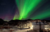
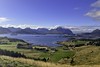
The above images may not be of the site on this page, but were taken nearby. They are loaded from Flickr so please click on them for image credits.
Click here to see more info for this site
Nearby sites
Click here to view sites on an interactive map of the areaKey: Red: member's photo, Blue: 3rd party photo, Yellow: other image, Green: no photo - please go there and take one, Grey: site destroyed
Download sites to:
KML (Google Earth)
GPX (GPS waypoints)
CSV (Garmin/Navman)
CSV (Excel)
To unlock full downloads you need to sign up as a Contributory Member. Otherwise downloads are limited to 50 sites.
Turn off the page maps and other distractions
Nearby sites listing. In the following links * = Image available
1.2km NW 309° Ramsvika* Standing Stone (Menhir)
3.2km NW 306° Holsøya Island burial field* Barrow Cemetery
4.5km NNW 331° Leknes settlement* Ancient Village or Settlement
4.5km NNW 335° Fygle* Cairn
4.9km NW 322° Myrbakk* Ancient Village or Settlement
5.4km NNW 343° Himmelsteinborga* Hillfort
6.6km NNW 341° Skullbru* Barrow Cemetery
9.1km WNW 302° Sversvika* Ancient Village or Settlement
13.5km WSW 254° Holsneset boat house* Ancient Village or Settlement
14.8km NNE 12° Borg longhouse* Ancient Village or Settlement
14.8km NNE 12° Lofotr Viking Museum Museum
15.5km NNE 16° Borgpollen* Ancient Village or Settlement
16.2km NNE 16° Bøstad* Ancient Village or Settlement
19.2km WSW 259° Pun`land* Ancient Village or Settlement
21.0km NE 51° Moland* Ancient Village or Settlement
21.8km NE 56° Malnes* Standing Stone (Menhir)
22.1km N 359° Utgarden* Ancient Village or Settlement
22.1km N 358° Eggum Stone Altar* Carving
25.6km ENE 65° Rørvika Stone Age Settlement* Ancient Village or Settlement
31.4km NE 35° Hov* Stone Row / Alignment
32.7km NE 44° Gimsøya monument* Standing Stones
34.8km ENE 71° Simon Krane cave* Cave or Rock Shelter
35.4km ENE 70° The troll's rock* Natural Stone / Erratic / Other Natural Feature
35.4km ENE 71° Konung Hågens Helle* Natural Stone / Erratic / Other Natural Feature
45.5km NE 45° Klinta* Round Barrow(s)
View more nearby sites and additional images


 We would like to know more about this location. Please feel free to add a brief description and any relevant information in your own language.
 Wir möchten mehr über diese Stätte erfahren. Bitte zögern Sie nicht, eine kurze Beschreibung und relevante Informationen in Deutsch hinzuzufügen.
 Nous aimerions en savoir encore un peu sur les lieux. S'il vous plaît n'hesitez pas à ajouter une courte description et tous les renseignements pertinents dans votre propre langue.
 Quisieramos informarnos un poco más de las lugares. No dude en añadir una breve descripción y otros datos relevantes en su propio idioma.