


<< Our Photo Pages >> Stora Ekstenen - Carving in Sweden in Västergötland
Submitted by CharcoalBurner89 on Thursday, 21 September 2023 Page Views: 133
Early Medieval (Dark Age)Site Name: Stora Ekstenen Alternative Name: Vg 4 / B 972 / L 1334Country: Sweden
NOTE: This site is 11.617 km away from the location you searched for.
Landskap: Västergötland Type: Carving
Nearest Town: Mariestad Nearest Village: Stora Ek
Latitude: 58.629930N Longitude: 13.821360E
Condition:
| 5 | Perfect |
| 4 | Almost Perfect |
| 3 | Reasonable but with some damage |
| 2 | Ruined but still recognisable as an ancient site |
| 1 | Pretty much destroyed, possibly visible as crop marks |
| 0 | No data. |
| -1 | Completely destroyed |
| 5 | Superb |
| 4 | Good |
| 3 | Ordinary |
| 2 | Not Good |
| 1 | Awful |
| 0 | No data. |
| 5 | Can be driven to, probably with disabled access |
| 4 | Short walk on a footpath |
| 3 | Requiring a bit more of a walk |
| 2 | A long walk |
| 1 | In the middle of nowhere, a nightmare to find |
| 0 | No data. |
| 5 | co-ordinates taken by GPS or official recorded co-ordinates |
| 4 | co-ordinates scaled from a detailed map |
| 3 | co-ordinates scaled from a bad map |
| 2 | co-ordinates of the nearest village |
| 1 | co-ordinates of the nearest town |
| 0 | no data |
Internal Links:
External Links:
")
- Transliteration: utr : skalt : raisti : stain : þinsi : aftir : þurstain : sun : sin : auk : stain:bru : karþi : (f)(i)(r)(i)(r) : (i)(s) : (a)(t)(i) : (þ)ria : buia : i : homri · auk : þria : tiauku : marka : at : airiki
- Transcription: Oddr Skald reisti stein þenna eptir Þorstein, son sinn, ok steinbrú gerði fyrir. Er átti þrjá býja í hamri ok þrjá tigu marka at Eiríki.
- Translation (Swedish): Udd skald reste denna sten efter Torsten, sin son, och gjorde stenbro för (honom). Han ägde tre gårdar i hammarskifte och trettio marker innestående hos Erik.
- Translation (English): Oddr Skald raised this stone and made the stone-bridge in memory of Þorsteinn, his son. He owned three estates in 'hamarr'-partition and thirty marks (deposit) with Eiríkr.
Year found: -
Dating: 980 - 1015 A.D.
You may be viewing yesterday's version of this page. To see the most up to date information please register for a free account.
")
")
Do not use the above information on other web sites or publications without permission of the contributor.
Nearby Images from Flickr
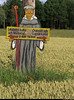

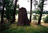
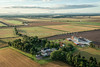
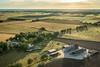
The above images may not be of the site on this page, but were taken nearby. They are loaded from Flickr so please click on them for image credits.
Click here to see more info for this site
Nearby sites
Click here to view sites on an interactive map of the areaKey: Red: member's photo, Blue: 3rd party photo, Yellow: other image, Green: no photo - please go there and take one, Grey: site destroyed
Download sites to:
KML (Google Earth)
GPX (GPS waypoints)
CSV (Garmin/Navman)
CSV (Excel)
To unlock full downloads you need to sign up as a Contributory Member. Otherwise downloads are limited to 50 sites.
Turn off the page maps and other distractions
Nearby sites listing. In the following links * = Image available
10.9km SSE 165° Stora Rör* Cairn
11.2km ESE 123° Askeberga* Stone Circle
11.3km SE 135° Kung Ranes hög* Round Barrow(s)
14.6km SE 136° Sörgårdenstenen* Carving
23.6km NE 41° Böckersboda Skeppssättning* Standing Stones
31.2km SSW 200° Amundtorp Gravfält* Standing Stones
32.2km WSW 246° Kallby stone circle* Stone Circle
32.5km WSW 245° Källby runstenar* Carving
32.5km WSW 245° Gravfältet vid Källby Hallar* Barrow Cemetery
32.5km SSW 201° Lilla Lycke Gravfält* Standing Stones
34.7km SW 220° Västergötlands museum* Museum
41.0km SSW 198° Girommen* Passage Grave
41.0km SSW 198° Ekornavallen* Passage Grave
41.1km SSW 198° Hornborga 32:1 Röse* Round Cairn
41.1km SSW 198° Hornborga 34:1 Passage grave* Passage Grave
43.7km WSW 259° Gösslundastenen (1)* Carving
44.7km S 188° Kuhögen Gånggrift* Passage Grave
44.9km SSW 197° Torestorpstenen* Carving
45.8km S 190° Högstena 20:1* Passage Grave
45.9km S 190° Högstena 19:1* Passage Grave
46.0km S 190° Högstena 18:1* Passage Grave
46.2km SSW 196° Valtorp 1:1* Passage Grave
46.2km SSW 196° Rössberga Hällkista* Cist
46.3km SSW 196° Rössberga Gånggrift* Passage Grave
46.4km SSW 196° Valtorp 3:1* Passage Grave
View more nearby sites and additional images


 We would like to know more about this location. Please feel free to add a brief description and any relevant information in your own language.
 Wir möchten mehr über diese Stätte erfahren. Bitte zögern Sie nicht, eine kurze Beschreibung und relevante Informationen in Deutsch hinzuzufügen.
 Nous aimerions en savoir encore un peu sur les lieux. S'il vous plaît n'hesitez pas à ajouter une courte description et tous les renseignements pertinents dans votre propre langue.
 Quisieramos informarnos un poco más de las lugares. No dude en añadir una breve descripción y otros datos relevantes en su propio idioma.