


<< Our Photo Pages >> Stora Rör - Cairn in Sweden in Västergötland
Submitted by DrewParsons on Saturday, 08 October 2011 Page Views: 2206
Neolithic and Bronze AgeSite Name: Stora Rör Alternative Name: Odensåker 19:1Country: Sweden
NOTE: This site is 11.69 km away from the location you searched for.
Landskap: Västergötland Type: Cairn
Nearest Town: Skövda Nearest Village: Binneberg
Latitude: 58.535550N Longitude: 13.869460E
Condition:
| 5 | Perfect |
| 4 | Almost Perfect |
| 3 | Reasonable but with some damage |
| 2 | Ruined but still recognisable as an ancient site |
| 1 | Pretty much destroyed, possibly visible as crop marks |
| 0 | No data. |
| -1 | Completely destroyed |
| 5 | Superb |
| 4 | Good |
| 3 | Ordinary |
| 2 | Not Good |
| 1 | Awful |
| 0 | No data. |
| 5 | Can be driven to, probably with disabled access |
| 4 | Short walk on a footpath |
| 3 | Requiring a bit more of a walk |
| 2 | A long walk |
| 1 | In the middle of nowhere, a nightmare to find |
| 0 | No data. |
| 5 | co-ordinates taken by GPS or official recorded co-ordinates |
| 4 | co-ordinates scaled from a detailed map |
| 3 | co-ordinates scaled from a bad map |
| 2 | co-ordinates of the nearest village |
| 1 | co-ordinates of the nearest town |
| 0 | no data |
Internal Links:
External Links:
I have visited· I would like to visit
DrewParsons has visited here
")
This Bronze Age cairn is typical of many in Sweden and is one of the largest in Västergötland measuring some 29 metres in diameter and 3.5 metres in height. The top is somewhat level with what may be three pits in evidence. The stones used to build it are between 0.1 and 0.3 metres in size. There is a low brim around the perimeter of the mound. To reach the site drive north from Skövda to the village of Horn. Drive north past the church and 2.5 kilometres after the church and just before a T junction the cairn is on the north (right) side of the road, right by the road. You could drive directly to the T junction from Skövda but this route gives you landmarks. Reference: Riksantikvarieämbetet Fornsök: Odensåker 19:1.
You may be viewing yesterday's version of this page. To see the most up to date information please register for a free account.
")
")
Do not use the above information on other web sites or publications without permission of the contributor.
Nearby Images from Flickr
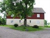
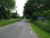
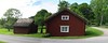

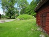
The above images may not be of the site on this page, but were taken nearby. They are loaded from Flickr so please click on them for image credits.
Click here to see more info for this site
Nearby sites
Click here to view sites on an interactive map of the areaKey: Red: member's photo, Blue: 3rd party photo, Yellow: other image, Green: no photo - please go there and take one, Grey: site destroyed
Download sites to:
KML (Google Earth)
GPX (GPS waypoints)
CSV (Garmin/Navman)
CSV (Excel)
To unlock full downloads you need to sign up as a Contributory Member. Otherwise downloads are limited to 50 sites.
Turn off the page maps and other distractions
Nearby sites listing. In the following links * = Image available
5.8km ENE 64° Kung Ranes hög* Round Barrow(s)
7.2km E 91° Sörgårdenstenen* Carving
8.0km ENE 56° Askeberga* Stone Circle
10.9km NNW 345° Stora Ekstenen* Carving
23.2km SW 216° Amundtorp Gravfält* Standing Stones
24.6km SW 216° Lilla Lycke Gravfält* Standing Stones
29.8km WSW 237° Västergötlands museum* Museum
31.1km NNE 24° Böckersboda Skeppssättning* Standing Stones
32.2km W 265° Kallby stone circle* Stone Circle
32.4km W 264° Källby runstenar* Carving
32.4km W 265° Gravfältet vid Källby Hallar* Barrow Cemetery
32.4km SSW 209° Ekornavallen* Passage Grave
32.4km SSW 209° Girommen* Passage Grave
32.5km SSW 209° Hornborga 32:1 Röse* Round Cairn
32.6km SSW 208° Hornborga 34:1 Passage grave* Passage Grave
35.0km SSW 195° Kuhögen Gånggrift* Passage Grave
36.1km SSW 206° Torestorpstenen* Carving
36.2km SSW 197° Högstena 20:1* Passage Grave
36.3km SSW 197° Högstena 19:1* Passage Grave
36.4km SSW 197° Högstena 18:1* Passage Grave
37.3km SSW 205° Valtorp 1:1* Passage Grave
37.3km SSW 204° Rössberga Hällkista* Cist
37.3km SSW 204° Rössberga Gånggrift* Passage Grave
37.5km SSW 204° Valtorp 3:1* Passage Grave
38.5km SSW 204° Torbjörntorp 12:1* Passage Grave
View more nearby sites and additional images


 We would like to know more about this location. Please feel free to add a brief description and any relevant information in your own language.
 Wir möchten mehr über diese Stätte erfahren. Bitte zögern Sie nicht, eine kurze Beschreibung und relevante Informationen in Deutsch hinzuzufügen.
 Nous aimerions en savoir encore un peu sur les lieux. S'il vous plaît n'hesitez pas à ajouter une courte description et tous les renseignements pertinents dans votre propre langue.
 Quisieramos informarnos un poco más de las lugares. No dude en añadir una breve descripción y otros datos relevantes en su propio idioma.