


<< Our Photo Pages >> Museum Hallstatt - Museum in Austria
Submitted by Harald_Platta on Thursday, 21 September 2017 Page Views: 1399
MuseumsSite Name: Museum Hallstatt Alternative Name: Welterbemuseum HallstattCountry: Austria
NOTE: This site is 2.047 km away from the location you searched for.
Type: Museum
Nearest Town: Hallstatt
Latitude: 47.561935N Longitude: 13.649009E
Condition:
| 5 | Perfect |
| 4 | Almost Perfect |
| 3 | Reasonable but with some damage |
| 2 | Ruined but still recognisable as an ancient site |
| 1 | Pretty much destroyed, possibly visible as crop marks |
| 0 | No data. |
| -1 | Completely destroyed |
| 5 | Superb |
| 4 | Good |
| 3 | Ordinary |
| 2 | Not Good |
| 1 | Awful |
| 0 | No data. |
| 5 | Can be driven to, probably with disabled access |
| 4 | Short walk on a footpath |
| 3 | Requiring a bit more of a walk |
| 2 | A long walk |
| 1 | In the middle of nowhere, a nightmare to find |
| 0 | No data. |
| 5 | co-ordinates taken by GPS or official recorded co-ordinates |
| 4 | co-ordinates scaled from a detailed map |
| 3 | co-ordinates scaled from a bad map |
| 2 | co-ordinates of the nearest village |
| 1 | co-ordinates of the nearest town |
| 0 | no data |
Internal Links:
External Links:
I have visited· I would like to visit
ELindey visited on 16th Feb 2020 - their rating: Cond: 5 Amb: 3 Access: 5 Lots of great artifacts.
")
Homepage: Museum Hallstatt
You may be viewing yesterday's version of this page. To see the most up to date information please register for a free account.
")
Do not use the above information on other web sites or publications without permission of the contributor.
Nearby Images from Flickr
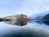
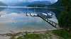
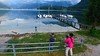
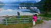
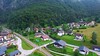
The above images may not be of the site on this page, but were taken nearby. They are loaded from Flickr so please click on them for image credits.
Click here to see more info for this site
Nearby sites
Click here to view sites on an interactive map of the areaKey: Red: member's photo, Blue: 3rd party photo, Yellow: other image, Green: no photo - please go there and take one, Grey: site destroyed
Download sites to:
KML (Google Earth)
GPX (GPS waypoints)
CSV (Garmin/Navman)
CSV (Excel)
To unlock full downloads you need to sign up as a Contributory Member. Otherwise downloads are limited to 50 sites.
Turn off the page maps and other distractions
Nearby sites listing. In the following links * = Image available
340m SW 215° Hallstatt-Dachstein* Barrow Cemetery
666m W 277° Hallstatt Salt Mines* Ancient Mine, Quarry or other Industry
14.5km SE 130° Notgasse Petroglyphen Rock Art
21.6km NNW 336° Kienbachklamm Rock Art
23.2km NNW 331° Lugberg Rock Art
34.6km NW 325° Lake Mondsee Prehistoric Village Ancient Village or Settlement
35.8km WSW 247° Sinnhubschlössl Ancient Village or Settlement
39.2km WSW 239° Arthurstollen Ancient Mine, Quarry or other Industry
50.0km E 79° In der Höll petroglyphs Rock Art
51.3km SW 236° Goldegger Passstelle Ancient Village or Settlement
63.0km WNW 286° Karlstein Celtic Settlement Ancient Village or Settlement
67.7km NW 308° Summstein Laufen Modern Stone Circle etc
70.7km SW 221° Schalenstein Oberer Bockhartsee Rock Art
79.8km SSW 200° Schalenstein Danielsberg Rock Art
80.8km WNW 291° Summstein Siegsdorf Modern Stone Circle etc
80.9km SW 229° Hochtor Ancient Road* Ancient Trackway
92.6km WSW 250° Hexenstein Felberturm Standing Stone (Menhir)
93.6km NNE 27° Kuernbergwald Huegelgraeberfeld Barrow Cemetery
94.3km WNW 300° Grabhügelfeld Stein an der Traun Barrow Cemetery
97.4km NE 38° Berglitzl Rock Art
97.6km WNW 298° Viereckschanze Truchtlaching* Misc. Earthwork
98.2km NW 312° Margarethenberg Hillfort
99.3km WNW 290° Herrenchimsee Ringwall Ancient Village or Settlement
102.2km NW 315° Station des Mesolithikums und vorgeschichtliche Siedlung Kastl Ancient Village or Settlement
102.8km NW 314° Grabhügel Kastl 2 Round Barrow(s)
View more nearby sites and additional images


 We would like to know more about this location. Please feel free to add a brief description and any relevant information in your own language.
 Wir möchten mehr über diese Stätte erfahren. Bitte zögern Sie nicht, eine kurze Beschreibung und relevante Informationen in Deutsch hinzuzufügen.
 Nous aimerions en savoir encore un peu sur les lieux. S'il vous plaît n'hesitez pas à ajouter une courte description et tous les renseignements pertinents dans votre propre langue.
 Quisieramos informarnos un poco más de las lugares. No dude en añadir una breve descripción y otros datos relevantes en su propio idioma.