


<< Our Photo Pages >> Himmelsteinborga - Hillfort in Norway in Nordland
Submitted by kenntha88 on Sunday, 21 November 2010 Page Views: 3177
Iron Age and Later PrehistorySite Name: Himmelsteinborga Alternative Name: BorgåsenCountry: Norway
NOTE: This site is 4.782 km away from the location you searched for.
Fylke: Nordland Type: Hillfort
Nearest Town: Leknes
Latitude: 68.155808N Longitude: 13.638153E
Condition:
| 5 | Perfect |
| 4 | Almost Perfect |
| 3 | Reasonable but with some damage |
| 2 | Ruined but still recognisable as an ancient site |
| 1 | Pretty much destroyed, possibly visible as crop marks |
| 0 | No data. |
| -1 | Completely destroyed |
| 5 | Superb |
| 4 | Good |
| 3 | Ordinary |
| 2 | Not Good |
| 1 | Awful |
| 0 | No data. |
| 5 | Can be driven to, probably with disabled access |
| 4 | Short walk on a footpath |
| 3 | Requiring a bit more of a walk |
| 2 | A long walk |
| 1 | In the middle of nowhere, a nightmare to find |
| 0 | No data. |
| 5 | co-ordinates taken by GPS or official recorded co-ordinates |
| 4 | co-ordinates scaled from a detailed map |
| 3 | co-ordinates scaled from a bad map |
| 2 | co-ordinates of the nearest village |
| 1 | co-ordinates of the nearest town |
| 0 | no data |
Internal Links:
External Links:
")
This hilltop has some ancient remains of walls going around all its edges except from the most steep north side. It is believed to have been the site of a hillfort from possibly iron age.
The tall hill has a very nice view over all the surrounding area. The sides on the north, west and south are very steep and very hard to climb. Only on the west side it is possible to come up easily. Here the remains of the walls was found. Today a narrow footpath leads up to the top of the hill.
The top is made of some very large builders and some huge flat cliffs, making the hill almost have a natural fortress like appearance. It must have been easy to defend this fort in ancient times.
I could not find the remains of the walls said to have been here, they are probably overgrown or fallen down but the hill and the surroundings make it easy to imagine how the fort would have looked like. Nearby are some ancient settlements in Leknes and Borg, maybe the fort was used by the people living there in the iron age?
You may be viewing yesterday's version of this page. To see the most up to date information please register for a free account.
")
")
")
")
Do not use the above information on other web sites or publications without permission of the contributor.
Nearby Images from Flickr
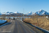
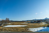


The above images may not be of the site on this page, but were taken nearby. They are loaded from Flickr so please click on them for image credits.
Click here to see more info for this site
Nearby sites
Click here to view sites on an interactive map of the areaKey: Red: member's photo, Blue: 3rd party photo, Yellow: other image, Green: no photo - please go there and take one, Grey: site destroyed
Download sites to:
KML (Google Earth)
GPX (GPS waypoints)
CSV (Garmin/Navman)
CSV (Excel)
To unlock full downloads you need to sign up as a Contributory Member. Otherwise downloads are limited to 50 sites.
Turn off the page maps and other distractions
Nearby sites listing. In the following links * = Image available
1.1km SSW 199° Fygle* Cairn
1.2km NNW 333° Skullbru* Barrow Cemetery
1.3km SSW 206° Leknes settlement* Ancient Village or Settlement
1.9km SW 227° Myrbakk* Ancient Village or Settlement
3.4km SSW 197° Holsøya Island burial field* Barrow Cemetery
4.5km S 172° Ramsvika* Standing Stone (Menhir)
5.4km SSE 163° Kongsrøysa* Cairn
6.2km W 267° Sversvika* Ancient Village or Settlement
10.4km NNE 26° Lofotr Viking Museum Museum
10.4km NNE 27° Borg longhouse* Ancient Village or Settlement
11.4km NNE 31° Borgpollen* Ancient Village or Settlement
12.0km NNE 29° Bøstad* Ancient Village or Settlement
14.4km SW 232° Holsneset boat house* Ancient Village or Settlement
16.9km N 3° Utgarden* Ancient Village or Settlement
17.0km N 2° Eggum Stone Altar* Carving
19.4km WSW 243° Pun`land* Ancient Village or Settlement
19.7km ENE 66° Moland* Ancient Village or Settlement
20.8km ENE 70° Malnes* Standing Stone (Menhir)
25.5km ENE 77° Rørvika Stone Age Settlement* Ancient Village or Settlement
28.4km NE 44° Hov* Stone Row / Alignment
30.4km NE 53° Gimsøya monument* Standing Stones
35.0km E 80° Simon Krane cave* Cave or Rock Shelter
35.5km E 79° The troll's rock* Natural Stone / Erratic / Other Natural Feature
35.6km E 79° Konung Hågens Helle* Natural Stone / Erratic / Other Natural Feature
43.2km NE 52° Klinta* Round Barrow(s)
View more nearby sites and additional images


 We would like to know more about this location. Please feel free to add a brief description and any relevant information in your own language.
 Wir möchten mehr über diese Stätte erfahren. Bitte zögern Sie nicht, eine kurze Beschreibung und relevante Informationen in Deutsch hinzuzufügen.
 Nous aimerions en savoir encore un peu sur les lieux. S'il vous plaît n'hesitez pas à ajouter une courte description et tous les renseignements pertinents dans votre propre langue.
 Quisieramos informarnos un poco más de las lugares. No dude en añadir una breve descripción y otros datos relevantes en su propio idioma.