 with our Megalithic Portal iPhone app")


<< Our Photo Pages >> Kuhögen Gånggrift - Passage Grave in Sweden in Västergötland
Submitted by DrewParsons on Tuesday, 11 October 2011 Page Views: 2162
Neolithic and Bronze AgeSite Name: Kuhögen Gånggrift Alternative Name: Högstena 6:1, Kuno högCountry: Sweden
NOTE: This site is 1.358 km away from the location you searched for.
Landskap: Västergötland Type: Passage Grave
Nearest Town: Falköping Nearest Village: Högstena
Latitude: 58.231670N Longitude: 13.715770E
Condition:
| 5 | Perfect |
| 4 | Almost Perfect |
| 3 | Reasonable but with some damage |
| 2 | Ruined but still recognisable as an ancient site |
| 1 | Pretty much destroyed, possibly visible as crop marks |
| 0 | No data. |
| -1 | Completely destroyed |
| 5 | Superb |
| 4 | Good |
| 3 | Ordinary |
| 2 | Not Good |
| 1 | Awful |
| 0 | No data. |
| 5 | Can be driven to, probably with disabled access |
| 4 | Short walk on a footpath |
| 3 | Requiring a bit more of a walk |
| 2 | A long walk |
| 1 | In the middle of nowhere, a nightmare to find |
| 0 | No data. |
| 5 | co-ordinates taken by GPS or official recorded co-ordinates |
| 4 | co-ordinates scaled from a detailed map |
| 3 | co-ordinates scaled from a bad map |
| 2 | co-ordinates of the nearest village |
| 1 | co-ordinates of the nearest town |
| 0 | no data |
Internal Links:
External Links:
I have visited· I would like to visit
DrewParsons has visited here
")
The site comprises a very large mound 30 metres by 22 metres orientated north west to south east although ploughing may have affected the original shape and size of the site. The chamber is estimated to be 6 metres long and of uncertain width. On the top of the mound there is a four metre pit with two orthostats. The site is 40 metres into a field from the road 200 metres to the south west of Högstena church. References: Riksantikvarieämbetet Fornsök: Högstena 6:1; Tilley C, The Dolmens and Passsage Graves of Sweden (page 181), University College, London, 1999.
You may be viewing yesterday's version of this page. To see the most up to date information please register for a free account.
")
")
Do not use the above information on other web sites or publications without permission of the contributor.
Nearby Images from Flickr
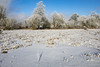
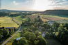
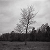
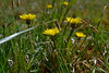
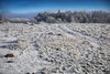
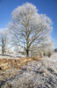
The above images may not be of the site on this page, but were taken nearby. They are loaded from Flickr so please click on them for image credits.
Click here to see more info for this site
Nearby sites
Click here to view sites on an interactive map of the areaKey: Red: member's photo, Blue: 3rd party photo, Yellow: other image, Green: no photo - please go there and take one, Grey: site destroyed
Download sites to:
KML (Google Earth)
GPX (GPS waypoints)
CSV (Garmin/Navman)
CSV (Excel)
To unlock full downloads you need to sign up as a Contributory Member. Otherwise downloads are limited to 50 sites.
Turn off the page maps and other distractions
Nearby sites listing. In the following links * = Image available
1.7km WSW 239° Högstena 20:1* Passage Grave
1.8km WSW 237° Högstena 19:1* Passage Grave
1.9km WSW 237° Högstena 18:1* Passage Grave
5.4km SSW 195° Åsle 23:1* Passage Grave
6.4km W 267° Valtorp 3:1* Passage Grave
6.4km W 268° Rössberga Hällkista* Cist
6.4km W 268° Rössberga Gånggrift* Passage Grave
6.5km W 269° Valtorp 1:1* Passage Grave
6.7km WSW 257° Torbjörntorp 12:1* Passage Grave
6.8km W 281° Torestorpstenen* Carving
8.3km NW 308° Hornborga 34:1 Passage grave* Passage Grave
8.4km NW 309° Ekornavallen* Passage Grave
8.5km NW 309° Girommen* Passage Grave
8.5km NW 308° Hornborga 32:1 Röse* Round Cairn
8.6km SSW 212° Karleby 82:1* Passage Grave
8.9km W 266° Kung Rånes grav* Standing Stone (Menhir)
9.0km SSW 210° Karleby 76:1 Passage Grave
9.5km SSW 208° Karleby 60:1* Passage Grave
9.7km SSW 208° Karleby 59:1* Passage Grave
9.8km SSW 208° Karleby 58:1* Passage Grave
9.9km SSW 208° Karleby 57:1* Passage Grave
10.6km SW 230° Hjelmarsrör Gånggrift* Passage Grave
10.8km SW 236° Falköping Stensättning 3* Stone Circle
10.8km SW 229° Åttagården* Passage Grave
10.9km SSW 206° Karleby 35:1* Passage Grave
View more nearby sites and additional images


 We would like to know more about this location. Please feel free to add a brief description and any relevant information in your own language.
 Wir möchten mehr über diese Stätte erfahren. Bitte zögern Sie nicht, eine kurze Beschreibung und relevante Informationen in Deutsch hinzuzufügen.
 Nous aimerions en savoir encore un peu sur les lieux. S'il vous plaît n'hesitez pas à ajouter une courte description et tous les renseignements pertinents dans votre propre langue.
 Quisieramos informarnos un poco más de las lugares. No dude en añadir una breve descripción y otros datos relevantes en su propio idioma.