


<< Our Photo Pages >> Åsle 23:1 - Passage Grave in Sweden in Västergötland
Submitted by DrewParsons on Tuesday, 11 October 2011 Page Views: 2000
Neolithic and Bronze AgeSite Name: Åsle 23:1Country: Sweden
NOTE: This site is 2.673 km away from the location you searched for.
Landskap: Västergötland Type: Passage Grave
Nearest Town: Falköping Nearest Village: Åsle
Latitude: 58.184660N Longitude: 13.692210E
Condition:
| 5 | Perfect |
| 4 | Almost Perfect |
| 3 | Reasonable but with some damage |
| 2 | Ruined but still recognisable as an ancient site |
| 1 | Pretty much destroyed, possibly visible as crop marks |
| 0 | No data. |
| -1 | Completely destroyed |
| 5 | Superb |
| 4 | Good |
| 3 | Ordinary |
| 2 | Not Good |
| 1 | Awful |
| 0 | No data. |
| 5 | Can be driven to, probably with disabled access |
| 4 | Short walk on a footpath |
| 3 | Requiring a bit more of a walk |
| 2 | A long walk |
| 1 | In the middle of nowhere, a nightmare to find |
| 0 | No data. |
| 5 | co-ordinates taken by GPS or official recorded co-ordinates |
| 4 | co-ordinates scaled from a detailed map |
| 3 | co-ordinates scaled from a bad map |
| 2 | co-ordinates of the nearest village |
| 1 | co-ordinates of the nearest town |
| 0 | no data |
Internal Links:
External Links:
I have visited· I would like to visit
DrewParsons has visited here
")
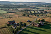
This passage grave or gånggrift stands in a mound approximately 18 metres in diameter and 1.6 metres high. The chamber is 6.7 metres long and is orientated NNE to SSW. To reach the site: Travelling from Tiarp westwards towards Åsle turn north 200 metres before the turning to Åsle church. Drive up this lane for 450 metres and just before the farm house on the left you can see the mound located in a paddock 30 metres west of the lane. Reference: Riksantikvarieämbetet Fornsök: Åsle 23:1
You may be viewing yesterday's version of this page. To see the most up to date information please register for a free account.
Do not use the above information on other web sites or publications without permission of the contributor.
Nearby Images from Flickr
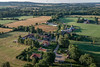
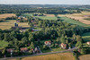
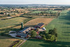
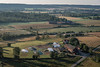

The above images may not be of the site on this page, but were taken nearby. They are loaded from Flickr so please click on them for image credits.
Click here to see more info for this site
Nearby sites
Click here to view sites on an interactive map of the areaKey: Red: member's photo, Blue: 3rd party photo, Yellow: other image, Green: no photo - please go there and take one, Grey: site destroyed
Download sites to:
KML (Google Earth)
GPX (GPS waypoints)
CSV (Garmin/Navman)
CSV (Excel)
To unlock full downloads you need to sign up as a Contributory Member. Otherwise downloads are limited to 50 sites.
Turn off the page maps and other distractions
Nearby sites listing. In the following links * = Image available
3.8km WSW 238° Karleby 82:1* Passage Grave
4.1km SW 231° Karleby 76:1 Passage Grave
4.2km N 357° Högstena 18:1* Passage Grave
4.2km N 358° Högstena 19:1* Passage Grave
4.4km N 359° Högstena 20:1* Passage Grave
4.4km SW 225° Karleby 60:1* Passage Grave
4.6km SW 224° Karleby 59:1* Passage Grave
4.7km SW 223° Karleby 58:1* Passage Grave
4.8km SW 222° Karleby 57:1* Passage Grave
5.4km NNE 15° Kuhögen Gånggrift* Passage Grave
5.7km SW 216° Karleby 35:1* Passage Grave
6.3km NW 306° Torbjörntorp 12:1* Passage Grave
6.9km WSW 256° Hjelmarsrör Gånggrift* Passage Grave
7.0km NW 314° Valtorp 3:1* Passage Grave
7.0km WSW 254° Åttagården* Passage Grave
7.1km NW 315° Rössberga Hällkista* Cist
7.1km NW 315° Rössberga Gånggrift* Passage Grave
7.2km NW 315° Valtorp 1:1* Passage Grave
7.2km WSW 254° Falköping Stensättning 1* Stone Circle
7.3km WSW 254° Skytten Hällkista* Cist
7.6km W 263° Falköping Stensättning 3* Stone Circle
7.9km W 262° Falköping Stensättning 2* Stone Circle
8.3km W 260° Falköping Hög 1* Round Barrow(s)
8.3km W 259° Falköping Gånggrift 1* Passage Grave
8.4km WSW 258° Falköping Museum* Museum
View more nearby sites and additional images


 We would like to know more about this location. Please feel free to add a brief description and any relevant information in your own language.
 Wir möchten mehr über diese Stätte erfahren. Bitte zögern Sie nicht, eine kurze Beschreibung und relevante Informationen in Deutsch hinzuzufügen.
 Nous aimerions en savoir encore un peu sur les lieux. S'il vous plaît n'hesitez pas à ajouter une courte description et tous les renseignements pertinents dans votre propre langue.
 Quisieramos informarnos un poco más de las lugares. No dude en añadir una breve descripción y otros datos relevantes en su propio idioma.