


<< Our Photo Pages >> Horshaga hällkista - Burial Chamber or Dolmen in Sweden in Småland
Submitted by Bjorn on Tuesday, 07 August 2007 Page Views: 3758
Neolithic and Bronze AgeSite Name: Horshaga hällkistaCountry: Sweden
NOTE: This site is 37.754 km away from the location you searched for.
Landskap: Småland Type: Burial Chamber or Dolmen
Nearest Town: Smålandsstenar Nearest Village: Horshaga
Latitude: 57.226671N Longitude: 13.443489E
Condition:
| 5 | Perfect |
| 4 | Almost Perfect |
| 3 | Reasonable but with some damage |
| 2 | Ruined but still recognisable as an ancient site |
| 1 | Pretty much destroyed, possibly visible as crop marks |
| 0 | No data. |
| -1 | Completely destroyed |
| 5 | Superb |
| 4 | Good |
| 3 | Ordinary |
| 2 | Not Good |
| 1 | Awful |
| 0 | No data. |
| 5 | Can be driven to, probably with disabled access |
| 4 | Short walk on a footpath |
| 3 | Requiring a bit more of a walk |
| 2 | A long walk |
| 1 | In the middle of nowhere, a nightmare to find |
| 0 | No data. |
| 5 | co-ordinates taken by GPS or official recorded co-ordinates |
| 4 | co-ordinates scaled from a detailed map |
| 3 | co-ordinates scaled from a bad map |
| 2 | co-ordinates of the nearest village |
| 1 | co-ordinates of the nearest town |
| 0 | no data |
Internal Links:
External Links:
I have visited· I would like to visit
Bjorn has visited here
")
The gallery grave on the hill is about 4000 years old. It is a monument of the first farmers of the fields. These ancient farmers preferred light soils like those here. The present-day swamp may have been a shallow lake with good fishing and birds' eggs to collect.
You may be viewing yesterday's version of this page. To see the most up to date information please register for a free account.
")
")
")
")
Do not use the above information on other web sites or publications without permission of the contributor.
Nearby Images from Flickr
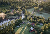
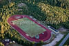
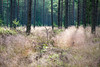
The above images may not be of the site on this page, but were taken nearby. They are loaded from Flickr so please click on them for image credits.
Click here to see more info for this site
Nearby sites
Click here to view sites on an interactive map of the areaKey: Red: member's photo, Blue: 3rd party photo, Yellow: other image, Green: no photo - please go there and take one, Grey: site destroyed
Download sites to:
KML (Google Earth)
GPX (GPS waypoints)
CSV (Garmin/Navman)
CSV (Excel)
To unlock full downloads you need to sign up as a Contributory Member. Otherwise downloads are limited to 50 sites.
Turn off the page maps and other distractions
Nearby sites listing. In the following links * = Image available
6.2km S 189° Smålandsstenar* Stone Circle
41.1km ESE 122° Toftaholm Runesten* Carving
41.3km ESE 124° Toftaholms Gravfält* Barrow Cemetery
47.8km W 268° Källsjö Passage Grave* Burial Chamber or Dolmen
54.6km SSE 148° Kånna Högar* Barrow Cemetery
56.9km WSW 251° Källekullen* Standing Stones
57.0km SW 226° Öinge treuddar* Misc. Earthwork
57.0km SW 231° Hagbards kulle* Round Barrow(s)
57.1km SW 231° Särestad* Standing Stones
57.1km SW 231° Särestad gravfält* Standing Stones
57.2km SW 228° Hagbards Galge* Standing Stones
57.7km SW 228° Asige bautastenar* Standing Stones
57.9km SW 226° Bostället* Cist
57.9km SW 227° Asige Bronsåldersgravar* Round Barrow(s)
58.1km SW 234° Munkakyrkan* Stone Circle
60.5km SW 225° Getinge bautastenar* Standing Stones
62.0km W 259° Högaberg* Barrow Cemetery
62.4km W 260° Runeberg* Cairn
64.1km SW 228° Klockstenarna Skeppssättning* Standing Stones
64.4km W 260° Grimeton* Stone Circle
64.4km W 260° Slummesten* Standing Stone (Menhir)
65.4km SSW 204° Tolarpsgraven* Passage Grave
66.3km SSW 210° Ivars Kulle* Round Barrow(s)
66.6km W 261° Stenstugan (Stone Cottage)* Burial Chamber or Dolmen
67.0km WSW 253° Tvååker Grave field* Standing Stones
View more nearby sites and additional images


 We would like to know more about this location. Please feel free to add a brief description and any relevant information in your own language.
 Wir möchten mehr über diese Stätte erfahren. Bitte zögern Sie nicht, eine kurze Beschreibung und relevante Informationen in Deutsch hinzuzufügen.
 Nous aimerions en savoir encore un peu sur les lieux. S'il vous plaît n'hesitez pas à ajouter une courte description et tous les renseignements pertinents dans votre propre langue.
 Quisieramos informarnos un poco más de las lugares. No dude en añadir una breve descripción y otros datos relevantes en su propio idioma.