


<< Our Photo Pages >> Burgwall Biesenthal - Ancient Village or Settlement in Germany in Brandenburg, Berlin
Submitted by KaiHofmann on Friday, 16 February 2018 Page Views: 852
Multi-periodSite Name: Burgwall BiesenthalCountry: Germany
NOTE: This site is 0.897 km away from the location you searched for.
Land: Brandenburg, Berlin Type: Ancient Village or Settlement
Nearest Town: Bernau Nearest Village: Biesenthal
Latitude: 52.769722N Longitude: 13.629001E
Condition:
| 5 | Perfect |
| 4 | Almost Perfect |
| 3 | Reasonable but with some damage |
| 2 | Ruined but still recognisable as an ancient site |
| 1 | Pretty much destroyed, possibly visible as crop marks |
| 0 | No data. |
| -1 | Completely destroyed |
| 5 | Superb |
| 4 | Good |
| 3 | Ordinary |
| 2 | Not Good |
| 1 | Awful |
| 0 | No data. |
| 5 | Can be driven to, probably with disabled access |
| 4 | Short walk on a footpath |
| 3 | Requiring a bit more of a walk |
| 2 | A long walk |
| 1 | In the middle of nowhere, a nightmare to find |
| 0 | No data. |
| 5 | co-ordinates taken by GPS or official recorded co-ordinates |
| 4 | co-ordinates scaled from a detailed map |
| 3 | co-ordinates scaled from a bad map |
| 2 | co-ordinates of the nearest village |
| 1 | co-ordinates of the nearest town |
| 0 | no data |
Internal Links:
External Links:
I have visited· I would like to visit
Boeddel visited on 17th May 2018 - their rating: Access: 4
")
Early Slavonic hillfort of the 7th century CE.
You may be viewing yesterday's version of this page. To see the most up to date information please register for a free account.
")
")
")
")
Do not use the above information on other web sites or publications without permission of the contributor.
Nearby Images from Flickr
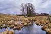
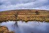
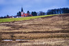
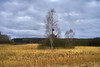
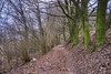
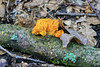
The above images may not be of the site on this page, but were taken nearby. They are loaded from Flickr so please click on them for image credits.
Click here to see more info for this site
Nearby sites
Click here to view sites on an interactive map of the areaKey: Red: member's photo, Blue: 3rd party photo, Yellow: other image, Green: no photo - please go there and take one, Grey: site destroyed
Download sites to:
KML (Google Earth)
GPX (GPS waypoints)
CSV (Garmin/Navman)
CSV (Excel)
To unlock full downloads you need to sign up as a Contributory Member. Otherwise downloads are limited to 50 sites.
Turn off the page maps and other distractions
Nearby sites listing. In the following links * = Image available
5.3km WNW 289° Riesenstein Prenden* Natural Stone / Erratic / Other Natural Feature
8.3km NNW 346° Schälchenstein Marienwerder* Rock Art
12.4km W 265° Riesenblock Rock Art
14.7km ENE 61° Museum Eberswalde* Museum
23.7km NE 54° Steinbruch Plagefenn Ancient Mine, Quarry or other Industry
23.7km NE 54° Plagefenn Findling Natural Stone / Erratic / Other Natural Feature
24.1km SW 227° Osterquelle* Holy Well or Sacred Spring
24.2km ENE 60° Hügelgräber Plagefenn* Barrow Cemetery
24.5km SSE 156° Altlandsberg Slawenburg Ancient Village or Settlement
24.6km SE 126° Semnonenstein* Natural Stone / Erratic / Other Natural Feature
25.6km N 4° Bärens Kirchhof* Stone Circle
25.7km S 188° Summstein Hasenholzer Allee* Modern Stone Circle etc
26.4km ENE 62° Schalenstein Rosinsee* Rock Art
26.5km W 267° Kreismuseum Oberhavel* Museum
27.3km NE 34° Summstein Ziethen* Modern Stone Circle etc
28.7km SW 229° Berlin Steinbergpark Steingrab* Modern Stone Circle etc
28.8km SSE 154° Steinkreuz Eggersdorf* Ancient Cross
29.0km WSW 258° Leegebruch Burgwall Ancient Village or Settlement
29.2km ENE 56° Koppelberg Dolmen Chambered Tomb
29.4km SW 215° Gesundbrunnen (Berlin-Wedding) Holy Well or Sacred Spring
29.5km ENE 57° Pehlitzwerder Schalenstein* Rock Art
29.6km E 92° Altranft Chambered Tomb
29.7km SSW 213° Riesenstein part II* Natural Stone / Erratic / Other Natural Feature
29.8km ENE 69° Albrechtsberg Slawenburg* Hillfort
30.3km WNW 300° Burgwall Liebenberg Promontory Fort / Cliff Castle
View more nearby sites and additional images


 We would like to know more about this location. Please feel free to add a brief description and any relevant information in your own language.
 Wir möchten mehr über diese Stätte erfahren. Bitte zögern Sie nicht, eine kurze Beschreibung und relevante Informationen in Deutsch hinzuzufügen.
 Nous aimerions en savoir encore un peu sur les lieux. S'il vous plaît n'hesitez pas à ajouter une courte description et tous les renseignements pertinents dans votre propre langue.
 Quisieramos informarnos un poco más de las lugares. No dude en añadir una breve descripción y otros datos relevantes en su propio idioma.