


<< Our Photo Pages >> Östra Herrestadstenen - Carving in Sweden in Skåne
Submitted by CharcoalBurner89 on Saturday, 01 April 2023 Page Views: 508
Early Medieval (Dark Age)Site Name: Östra Herrestadstenen Alternative Name: DR 343Country: Sweden
NOTE: This site is 10.735 km away from the location you searched for.
Landskap: Skåne Type: Carving
Nearest Town: Skurup Nearest Village: Rydsgard
Latitude: 55.465460N Longitude: 13.565510E
Condition:
| 5 | Perfect |
| 4 | Almost Perfect |
| 3 | Reasonable but with some damage |
| 2 | Ruined but still recognisable as an ancient site |
| 1 | Pretty much destroyed, possibly visible as crop marks |
| 0 | No data. |
| -1 | Completely destroyed |
| 5 | Superb |
| 4 | Good |
| 3 | Ordinary |
| 2 | Not Good |
| 1 | Awful |
| 0 | No data. |
| 5 | Can be driven to, probably with disabled access |
| 4 | Short walk on a footpath |
| 3 | Requiring a bit more of a walk |
| 2 | A long walk |
| 1 | In the middle of nowhere, a nightmare to find |
| 0 | No data. |
| 5 | co-ordinates taken by GPS or official recorded co-ordinates |
| 4 | co-ordinates scaled from a detailed map |
| 3 | co-ordinates scaled from a bad map |
| 2 | co-ordinates of the nearest village |
| 1 | co-ordinates of the nearest town |
| 0 | no data |
Internal Links:
External Links:
")
- Transliteration: bruþiʀ × auk × tuki × raisþu × stain × þansi × aftiʀ × fraþulf × faþur × sin × harþa / kuþan × þiakn ×
- Transcription: Broþiʀ ok Toki resþu sten þænsi æftiʀ Fraþulf/Friþulf, faþur sin, harþa goþan þægn.
- Translation (Swedish): Broder och Toke reste denna sten efter sin fader Fradulf, "en mycket god man".
- Translation (English): Brother and Toke raised this stone after their father Fradulf, "a very good man".
The stone was discovered in the 1880s in the north wall of the church and is now set up in the cemetery next to the western cemetery wall. The inscription is from the younger Viking age and is dated to the years 970-1020.
You may be viewing yesterday's version of this page. To see the most up to date information please register for a free account.
")
Do not use the above information on other web sites or publications without permission of the contributor.
Nearby Images from Flickr
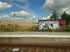
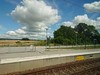
The above images may not be of the site on this page, but were taken nearby. They are loaded from Flickr so please click on them for image credits.
Click here to see more info for this site
Nearby sites
Click here to view sites on an interactive map of the areaKey: Red: member's photo, Blue: 3rd party photo, Yellow: other image, Green: no photo - please go there and take one, Grey: site destroyed
Download sites to:
KML (Google Earth)
GPX (GPS waypoints)
CSV (Garmin/Navman)
CSV (Excel)
To unlock full downloads you need to sign up as a Contributory Member. Otherwise downloads are limited to 50 sites.
Turn off the page maps and other distractions
Nearby sites listing. In the following links * = Image available
5.2km ESE 122° Sjörupstenen* Carving
5.4km SSW 202° Tofthög* Round Barrow(s)
6.5km SSW 213° Östra Vemmenhögstenen* Carving
8.8km SW 225° Tullstorpstenen* Carving
10.2km ESE 115° Disa Ting* Stone Circle
10.3km ESE 114° Svarte Standing Stone* Standing Stone (Menhir)
11.3km SSW 212° Skateholm Mesolithic Settlement Ancient Village or Settlement
11.6km E 92° Bjäresjöstenen 1* Carving
18.7km ENE 67° Baldringestenen* Carving
19.6km SW 229° Erkedösen Passage Grave* Passage Grave
21.4km NNW 333° Södra Ugglarp* Stone Circle
24.1km E 88° Stora Köpingestenen* Carving
24.2km E 90° Trollasten Dolmen* Burial Chamber or Dolmen
24.7km NNE 30° Tyge sten Natural Stone / Erratic / Other Natural Feature
28.2km E 95° Glemminge Klövasten* Natural Stone / Erratic / Other Natural Feature
28.7km E 96° Ingelstorp Skrepphög Passage Grave
28.8km W 271° Bolmers högar* Round Barrow(s)
30.4km WSW 258° Snarringe Transitional Long Dolmen* Burial Chamber or Dolmen
30.4km W 267° Fugliestenen 1* Carving
30.4km W 266° Fugliestenen 2* Carving
31.3km E 92° Glemminge Dyssestenen Burial Chamber or Dolmen
32.2km ESE 106° Ales stenar* Stone Circle
32.3km WSW 258° Skegrie Church Long Dolmen* Burial Chamber or Dolmen
35.7km WNW 288° Fosiestenen* Carving
36.0km E 100° Albertshög Passage Grave
View more nearby sites and additional images


 We would like to know more about this location. Please feel free to add a brief description and any relevant information in your own language.
 Wir möchten mehr über diese Stätte erfahren. Bitte zögern Sie nicht, eine kurze Beschreibung und relevante Informationen in Deutsch hinzuzufügen.
 Nous aimerions en savoir encore un peu sur les lieux. S'il vous plaît n'hesitez pas à ajouter une courte description et tous les renseignements pertinents dans votre propre langue.
 Quisieramos informarnos un poco más de las lugares. No dude en añadir una breve descripción y otros datos relevantes en su propio idioma.