


<< Image Pages >> Friedland Geldkeller - Chambered Tomb in Germany in Mecklenburg-Western Pomerania
Submitted by Klingon on Monday, 27 June 2005 Page Views: 2464
Neolithic and Bronze AgeSite Name: Friedland Geldkeller Alternative Name: Sprockhoff 450, GeldkellerbergCountry: Germany
NOTE: This site is 3.3 km away from the location you searched for.
Land: Mecklenburg-Western Pomerania Type: Chambered Tomb
Nearest Town: Friedland
Latitude: 53.690918N Longitude: 13.523831E
Condition:
| 5 | Perfect |
| 4 | Almost Perfect |
| 3 | Reasonable but with some damage |
| 2 | Ruined but still recognisable as an ancient site |
| 1 | Pretty much destroyed, possibly visible as crop marks |
| 0 | No data. |
| -1 | Completely destroyed |
| 5 | Superb |
| 4 | Good |
| 3 | Ordinary |
| 2 | Not Good |
| 1 | Awful |
| 0 | No data. |
| 5 | Can be driven to, probably with disabled access |
| 4 | Short walk on a footpath |
| 3 | Requiring a bit more of a walk |
| 2 | A long walk |
| 1 | In the middle of nowhere, a nightmare to find |
| 0 | No data. |
| 5 | co-ordinates taken by GPS or official recorded co-ordinates |
| 4 | co-ordinates scaled from a detailed map |
| 3 | co-ordinates scaled from a bad map |
| 2 | co-ordinates of the nearest village |
| 1 | co-ordinates of the nearest town |
| 0 | no data |
Internal Links:
External Links:
")
Geldkeller = money cellar
Geldkellerberg = money cellar mountain
You may be viewing yesterday's version of this page. To see the most up to date information please register for a free account.
Do not use the above information on other web sites or publications without permission of the contributor.
Nearby Images from Flickr
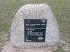
The above images may not be of the site on this page, but were taken nearby. They are loaded from Flickr so please click on them for image credits.
Click here to see more info for this site
Nearby sites
Click here to view sites on an interactive map of the areaKey: Red: member's photo, Blue: 3rd party photo, Yellow: other image, Green: no photo - please go there and take one, Grey: site destroyed
Download sites to:
KML (Google Earth)
GPX (GPS waypoints)
CSV (Garmin/Navman)
CSV (Excel)
To unlock full downloads you need to sign up as a Contributory Member. Otherwise downloads are limited to 50 sites.
Turn off the page maps and other distractions
Nearby sites listing. In the following links * = Image available
2.5km NNW 335° Langbett Bresewitz* Long Barrow
2.6km WSW 241° Großsteingrab Dorf Salow* Burial Chamber or Dolmen
3.1km NW 324° Hügelgräber Bresewitz* Barrow Cemetery
3.9km NW 318° Dishley (1)* Chambered Tomb
4.8km NW 312° Dishley (2)* Chambered Tomb
5.0km N 6° Borntin Chambered Tomb
5.3km SSW 192° Genzkow Steingrab 2 Chambered Tomb
5.7km NW 321° Schwanbeck (5)* Chambered Tomb
5.8km NW 321° Schwanbeck (2)* Chambered Tomb
6.0km NW 321° Schwanbeck (1)* Chambered Tomb
6.2km S 182° Genzkow Steingrab 1* Chambered Tomb
6.2km WNW 291° Schwanbeck (3) Chambered Tomb
6.9km SSE 152° Teufelsstein Friedland* Natural Stone / Erratic / Other Natural Feature
7.2km SSE 151° Schälchenstein Hohenstein* Rock Art
7.4km SE 136° Hügelgräber Lübbersdorf* Round Barrow(s)
7.5km NE 34° Sarnow (3) Chambered Tomb
7.5km NE 44° Sarnow (1) Chambered Tomb
7.6km W 262° Hügelgräber Brunn 2* Barrow Cemetery
8.0km WNW 303° Schwanbeck (4)* Chambered Tomb
8.0km NW 304° Schwanbeck (25)* Chambered Tomb
8.3km SSW 203° Genzkow Steingrab 3 Chambered Tomb
8.4km WNW 296° Siedenbollentin (1) Round Barrow(s)
8.5km NE 35° Sarnow (2) Chambered Tomb
8.8km NW 312° Siedenbollentin (3) Chambered Tomb
9.0km NW 313° Siedenbollentin (2) Chambered Tomb
View more nearby sites and additional images


 We would like to know more about this location. Please feel free to add a brief description and any relevant information in your own language.
 Wir möchten mehr über diese Stätte erfahren. Bitte zögern Sie nicht, eine kurze Beschreibung und relevante Informationen in Deutsch hinzuzufügen.
 Nous aimerions en savoir encore un peu sur les lieux. S'il vous plaît n'hesitez pas à ajouter une courte description et tous les renseignements pertinents dans votre propre langue.
 Quisieramos informarnos un poco más de las lugares. No dude en añadir una breve descripción y otros datos relevantes en su propio idioma.