 with our Megalithic Portal iPhone app")


<< Our Photo Pages >> Riesenstein Prenden - Natural Stone / Erratic / Other Natural Feature in Germany in Brandenburg, Berlin
Submitted by kaiHofmann on Monday, 26 March 2012 Page Views: 2503
Natural PlacesSite Name: Riesenstein PrendenCountry: Germany
NOTE: This site is 8.766 km away from the location you searched for.
Land: Brandenburg, Berlin Type: Natural Stone / Erratic / Other Natural Feature
Nearest Village: Prenden
Latitude: 52.785239N Longitude: 13.554809E
Condition:
| 5 | Perfect |
| 4 | Almost Perfect |
| 3 | Reasonable but with some damage |
| 2 | Ruined but still recognisable as an ancient site |
| 1 | Pretty much destroyed, possibly visible as crop marks |
| 0 | No data. |
| -1 | Completely destroyed |
| 5 | Superb |
| 4 | Good |
| 3 | Ordinary |
| 2 | Not Good |
| 1 | Awful |
| 0 | No data. |
| 5 | Can be driven to, probably with disabled access |
| 4 | Short walk on a footpath |
| 3 | Requiring a bit more of a walk |
| 2 | A long walk |
| 1 | In the middle of nowhere, a nightmare to find |
| 0 | No data. |
| 5 | co-ordinates taken by GPS or official recorded co-ordinates |
| 4 | co-ordinates scaled from a detailed map |
| 3 | co-ordinates scaled from a bad map |
| 2 | co-ordinates of the nearest village |
| 1 | co-ordinates of the nearest town |
| 0 | no data |
Internal Links:
External Links:
I have visited· I would like to visit
Boeddel visited on 5th Oct 2017 - their rating: Access: 4
")
A smaller stone which was lying close to the Riesenstein can be found today in the Humboldthain park in Berlin.
You may be viewing yesterday's version of this page. To see the most up to date information please register for a free account.
")
")
Do not use the above information on other web sites or publications without permission of the contributor.
Nearby Images from Flickr
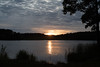
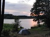
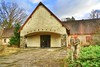
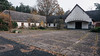
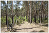
The above images may not be of the site on this page, but were taken nearby. They are loaded from Flickr so please click on them for image credits.
Click here to see more info for this site
Nearby sites
Click here to view sites on an interactive map of the areaKey: Red: member's photo, Blue: 3rd party photo, Yellow: other image, Green: no photo - please go there and take one, Grey: site destroyed
Download sites to:
KML (Google Earth)
GPX (GPS waypoints)
CSV (Garmin/Navman)
CSV (Excel)
To unlock full downloads you need to sign up as a Contributory Member. Otherwise downloads are limited to 50 sites.
Turn off the page maps and other distractions
Nearby sites listing. In the following links * = Image available
5.3km ESE 109° Burgwall Biesenthal* Ancient Village or Settlement
7.0km NNE 25° Schälchenstein Marienwerder* Rock Art
7.9km WSW 250° Riesenblock Rock Art
18.7km ENE 73° Museum Eberswalde* Museum
21.7km W 261° Kreismuseum Oberhavel* Museum
22.2km SW 215° Osterquelle* Holy Well or Sacred Spring
24.7km WSW 252° Leegebruch Burgwall Ancient Village or Settlement
24.8km NNE 16° Bärens Kirchhof* Stone Circle
25.1km WNW 302° Burgwall Liebenberg Promontory Fort / Cliff Castle
26.5km SW 219° Berlin Steinbergpark Steingrab* Modern Stone Circle etc
27.0km ENE 63° Steinbruch Plagefenn Ancient Mine, Quarry or other Industry
27.1km ENE 63° Plagefenn Findling Natural Stone / Erratic / Other Natural Feature
27.2km S 177° Summstein Hasenholzer Allee* Modern Stone Circle etc
27.9km ENE 68° Hügelgräber Plagefenn* Barrow Cemetery
28.3km SSE 148° Altlandsberg Slawenburg Ancient Village or Settlement
28.4km SSW 205° Gesundbrunnen (Berlin-Wedding) Holy Well or Sacred Spring
28.9km SSW 203° Riesenstein part II* Natural Stone / Erratic / Other Natural Feature
29.1km NE 44° Summstein Ziethen* Modern Stone Circle etc
29.7km ESE 123° Semnonenstein* Natural Stone / Erratic / Other Natural Feature
29.9km SW 222° Reiherwerder Opferschaechte Ancient Village or Settlement
30.1km SSW 198° Summstein Mendelssohnstraße Modern Stone Circle etc
30.2km ENE 69° Schalenstein Rosinsee* Rock Art
30.5km NW 311° Fuenffingerstein (five finger stone)* Rock Art
30.9km SSW 194° Summstein Weberwiese* Modern Stone Circle etc
31.0km NNE 20° Grabhuegel Ringenwalde* Barrow Cemetery
View more nearby sites and additional images


 We would like to know more about this location. Please feel free to add a brief description and any relevant information in your own language.
 Wir möchten mehr über diese Stätte erfahren. Bitte zögern Sie nicht, eine kurze Beschreibung und relevante Informationen in Deutsch hinzuzufügen.
 Nous aimerions en savoir encore un peu sur les lieux. S'il vous plaît n'hesitez pas à ajouter une courte description et tous les renseignements pertinents dans votre propre langue.
 Quisieramos informarnos un poco más de las lugares. No dude en añadir una breve descripción y otros datos relevantes en su propio idioma.