


<< Our Photo Pages >> Kung Rånes grav - Standing Stone (Menhir) in Sweden in Västergötland
Submitted by CharcoalBurner89 on Thursday, 21 September 2023 Page Views: 140
Iron Age and Later PrehistorySite Name: Kung Rånes grav Alternative Name: Rest sten Kung Rånes gravCountry: Sweden
NOTE: This site is 3.545 km away from the location you searched for.
Landskap: Västergötland Type: Standing Stone (Menhir)
Nearest Town: Falköping Nearest Village: Gudhem
Latitude: 58.226410N Longitude: 13.563910E
Condition:
| 5 | Perfect |
| 4 | Almost Perfect |
| 3 | Reasonable but with some damage |
| 2 | Ruined but still recognisable as an ancient site |
| 1 | Pretty much destroyed, possibly visible as crop marks |
| 0 | No data. |
| -1 | Completely destroyed |
| 5 | Superb |
| 4 | Good |
| 3 | Ordinary |
| 2 | Not Good |
| 1 | Awful |
| 0 | No data. |
| 5 | Can be driven to, probably with disabled access |
| 4 | Short walk on a footpath |
| 3 | Requiring a bit more of a walk |
| 2 | A long walk |
| 1 | In the middle of nowhere, a nightmare to find |
| 0 | No data. |
| 5 | co-ordinates taken by GPS or official recorded co-ordinates |
| 4 | co-ordinates scaled from a detailed map |
| 3 | co-ordinates scaled from a bad map |
| 2 | co-ordinates of the nearest village |
| 1 | co-ordinates of the nearest town |
| 0 | no data |
Internal Links:
External Links:
")
Menhir/Bautastein (Swedish: 'rest sten') with the name 'Kung Rånes grav' - 'King Råne's grave' is at the entrance to Gudhem's community, visible from the road. It marks an Iron Age grave.
There is also an information board in Swedish nearby with a small section in English.
You may be viewing yesterday's version of this page. To see the most up to date information please register for a free account.
")
")
")
Do not use the above information on other web sites or publications without permission of the contributor.
Nearby Images from Flickr
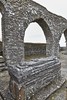
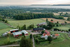
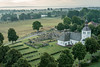
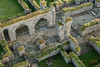
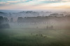
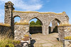
The above images may not be of the site on this page, but were taken nearby. They are loaded from Flickr so please click on them for image credits.
Click here to see more info for this site
Nearby sites
Click here to view sites on an interactive map of the areaKey: Red: member's photo, Blue: 3rd party photo, Yellow: other image, Green: no photo - please go there and take one, Grey: site destroyed
Download sites to:
KML (Google Earth)
GPX (GPS waypoints)
CSV (Garmin/Navman)
CSV (Excel)
To unlock full downloads you need to sign up as a Contributory Member. Otherwise downloads are limited to 50 sites.
Turn off the page maps and other distractions
Nearby sites listing. In the following links * = Image available
2.4km E 79° Valtorp 1:1* Passage Grave
2.5km E 82° Rössberga Gånggrift* Passage Grave
2.5km E 82° Rössberga Hällkista* Cist
2.5km E 86° Valtorp 3:1* Passage Grave
2.6km ESE 111° Torbjörntorp 12:1* Passage Grave
2.8km NE 50° Torestorpstenen* Carving
5.5km S 180° Falköping Stensättning 3* Stone Circle
5.7km S 190° Ängshögens Norra Gånggrift* Passage Grave
5.8km S 183° Falköping Stensättning 2* Stone Circle
5.8km S 190° Ängshögen Gånggrift* Passage Grave
5.9km S 190° Trädgårdens Gånggrift* Passage Grave
6.0km S 189° Falköping Hög 2* Round Barrow(s)
6.0km S 187° Lusthushögens Gånggrift* Passage Grave
6.0km S 189° Falköping Hällkista 4* Cist
6.0km S 191° Falköping Stensättning 4* Stone Circle
6.0km S 190° Ängskullens Gånggrift* Passage Grave
6.1km S 191° Falköping Stensättning 6* Stone Circle
6.1km S 190° Falköping Stensättning 5* Stone Circle
6.2km S 186° Falköping Hög 1* Round Barrow(s)
6.2km S 190° Falköping Hällkista 1* Cist
6.2km NNE 23° Hornborga 34:1 Passage grave* Passage Grave
6.2km S 188° Falköping Stensättning 8* Stone Circle
6.3km NNE 20° Hornborga 32:1 Röse* Round Cairn
6.3km S 185° Falköping Gånggrift 1* Passage Grave
6.3km SSW 192° Falköping Stensättning 7* Stone Circle
View more nearby sites and additional images


 We would like to know more about this location. Please feel free to add a brief description and any relevant information in your own language.
 Wir möchten mehr über diese Stätte erfahren. Bitte zögern Sie nicht, eine kurze Beschreibung und relevante Informationen in Deutsch hinzuzufügen.
 Nous aimerions en savoir encore un peu sur les lieux. S'il vous plaît n'hesitez pas à ajouter une courte description et tous les renseignements pertinents dans votre propre langue.
 Quisieramos informarnos un poco más de las lugares. No dude en añadir una breve descripción y otros datos relevantes en su propio idioma.