

<< Our Photo Pages >> Osterquelle - Holy Well or Sacred Spring in Germany in Brandenburg, Berlin
Submitted by KaiHofmann on Friday, 01 April 2011 Page Views: 4176
Springs and Holy WellsSite Name: Osterquelle Alternative Name: MarienquelleCountry: Germany Land: Brandenburg, Berlin Type: Holy Well or Sacred Spring
Nearest Town: Berlin Nearest Village: Luebars
Latitude: 52.621523N Longitude: 13.367422E
Condition:
| 5 | Perfect |
| 4 | Almost Perfect |
| 3 | Reasonable but with some damage |
| 2 | Ruined but still recognisable as an ancient site |
| 1 | Pretty much destroyed, possibly visible as crop marks |
| 0 | No data. |
| -1 | Completely destroyed |
| 5 | Superb |
| 4 | Good |
| 3 | Ordinary |
| 2 | Not Good |
| 1 | Awful |
| 0 | No data. |
| 5 | Can be driven to, probably with disabled access |
| 4 | Short walk on a footpath |
| 3 | Requiring a bit more of a walk |
| 2 | A long walk |
| 1 | In the middle of nowhere, a nightmare to find |
| 0 | No data. |
| 5 | co-ordinates taken by GPS or official recorded co-ordinates |
| 4 | co-ordinates scaled from a detailed map |
| 3 | co-ordinates scaled from a bad map |
| 2 | co-ordinates of the nearest village |
| 1 | co-ordinates of the nearest town |
| 0 | no data |
Internal Links:
External Links:
")
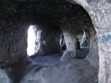
The last "open" well in Berlin. Probably a slavic sanctuary.
You may be viewing yesterday's version of this page. To see the most up to date information please register for a free account.
")
")
Do not use the above information on other web sites or publications without permission of the contributor.
Nearby Images from Flickr
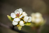
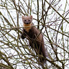
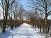
The above images may not be of the site on this page, but were taken nearby. They are loaded from Flickr so please click on them for image credits.
Click here to see more info for this site
Nearby sites
Click here to view sites on an interactive map of the areaKey: Red: member's photo, Blue: 3rd party photo, Yellow: other image, Green: no photo - please go there and take one, Grey: site destroyed
Download sites to:
KML (Google Earth)
GPX (GPS waypoints)
CSV (Garmin/Navman)
CSV (Excel)
To unlock full downloads you need to sign up as a Contributory Member. Otherwise downloads are limited to 50 sites.
Turn off the page maps and other distractions
Nearby sites listing. In the following links * = Image available
4.6km WSW 238° Berlin Steinbergpark Steingrab* Modern Stone Circle etc
7.6km S 174° Gesundbrunnen (Berlin-Wedding) Holy Well or Sacred Spring
8.4km WSW 241° Reiherwerder Opferschaechte Ancient Village or Settlement
8.5km S 171° Riesenstein part II* Natural Stone / Erratic / Other Natural Feature
11.1km SSE 162° Summstein Mendelssohnstraße Modern Stone Circle etc
11.4km S 170° Pergamon Museum* Museum
11.5km S 170° Neues Museum Berlin* Museum
11.5km S 169° Berlin Museum für Vor- und Frühgeschichte Museum
11.5km S 187° Summstein im Englischen Garten Modern Stone Circle etc
11.5km SSE 167° Steinkreuz Marienkirche* Ancient Cross
11.5km S 169° Altes Museum Berlin* Museum
12.4km SSE 165° Berlin Maerkisches Museum* Museum
13.0km SSE 156° Summstein Weberwiese* Modern Stone Circle etc
13.7km SSW 203° Findling Lietzensee* Natural Stone / Erratic / Other Natural Feature
14.1km W 259° Lasszinswiesen Natural Stone / Erratic / Other Natural Feature
15.1km NW 314° Leegebruch Burgwall Ancient Village or Settlement
15.4km SW 227° Spandauer Burgwall Ancient Village or Settlement
16.3km NNE 19° Riesenblock Rock Art
16.5km SW 221° Opferaltar (sacrifice altar) Rock Art
16.6km SSW 208° Findling vor Revierförsterei Eichkamp, Grünewald Natural Stone / Erratic / Other Natural Feature
16.7km ESE 122° Summstein Hasenholzer Allee* Modern Stone Circle etc
17.2km NNW 329° Kreismuseum Oberhavel* Museum
21.1km WNW 300° Vehlefanz Ringwall Ancient Village or Settlement
21.3km S 183° Elfenmuehle* Rock Art
22.2km NE 35° Riesenstein Prenden* Natural Stone / Erratic / Other Natural Feature
View more nearby sites and additional images

 We would like to know more about this location. Please feel free to add a brief description and any relevant information in your own language.
 Wir möchten mehr über diese Stätte erfahren. Bitte zögern Sie nicht, eine kurze Beschreibung und relevante Informationen in Deutsch hinzuzufügen.
 Nous aimerions en savoir encore un peu sur les lieux. S'il vous plaît n'hesitez pas à ajouter une courte description et tous les renseignements pertinents dans votre propre langue.
 Quisieramos informarnos un poco más de las lugares. No dude en añadir una breve descripción y otros datos relevantes en su propio idioma.