

<< Text Pages >> Ruddemin Grabhuegel 1 - Round Barrow(s) in Germany in Mecklenburg-Western Pomerania
Submitted by AlexHunger on Saturday, 25 March 2006 Page Views: 1658
Neolithic and Bronze AgeSite Name: Ruddemin Grabhuegel 1Country: Germany
NOTE: This site is 2.989 km away from the location you searched for.
Land: Mecklenburg-Western Pomerania Type: Round Barrow(s)
Nearest Town: Bergen Nearest Village: Garz/Rügen
Latitude: 54.290023N Longitude: 13.356074E
Condition:
| 5 | Perfect |
| 4 | Almost Perfect |
| 3 | Reasonable but with some damage |
| 2 | Ruined but still recognisable as an ancient site |
| 1 | Pretty much destroyed, possibly visible as crop marks |
| 0 | No data. |
| -1 | Completely destroyed |
| 5 | Superb |
| 4 | Good |
| 3 | Ordinary |
| 2 | Not Good |
| 1 | Awful |
| 0 | No data. |
| 5 | Can be driven to, probably with disabled access |
| 4 | Short walk on a footpath |
| 3 | Requiring a bit more of a walk |
| 2 | A long walk |
| 1 | In the middle of nowhere, a nightmare to find |
| 0 | No data. |
| 5 | co-ordinates taken by GPS or official recorded co-ordinates |
| 4 | co-ordinates scaled from a detailed map |
| 3 | co-ordinates scaled from a bad map |
| 2 | co-ordinates of the nearest village |
| 1 | co-ordinates of the nearest town |
| 0 | no data |
Internal Links:
External Links:
Tumulus in Mecklenburg-Western Pomerania
Island of Rügen.
Positional co-ordinates scaled from a map source.
You may be viewing yesterday's version of this page. To see the most up to date information please register for a free account.
Do not use the above information on other web sites or publications without permission of the contributor.
Nearby Images from Flickr
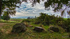
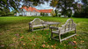
The above images may not be of the site on this page, but were taken nearby. They are loaded from Flickr so please click on them for image credits.
Click here to see more info for this site
Nearby sites
Click here to view sites on an interactive map of the areaKey: Red: member's photo, Blue: 3rd party photo, Yellow: other image, Green: no photo - please go there and take one, Grey: site destroyed
Download sites to:
KML (Google Earth)
GPX (GPS waypoints)
CSV (Garmin/Navman)
CSV (Excel)
To unlock full downloads you need to sign up as a Contributory Member. Otherwise downloads are limited to 50 sites.
Turn off the page maps and other distractions
Nearby sites listing. In the following links * = Image available
763m SW 215° Ruddemin Grabhuegel 2 Round Barrow(s)
1.7km ESE 107° Dumsevitz Steingrab 1 Chambered Tomb
1.8km E 93° Dumsevitz Steingrab 2 Chambered Tomb
2.0km E 91° Dumsevitz Steingrab 3* Chambered Tomb
2.2km ESE 107° Silmenitz Huegelgrab Round Barrow(s)
2.2km E 83° Dumsevitz Steingrab 4 Chambered Tomb
2.3km E 80° Dumsevitz Steingrab 5 Chambered Tomb
5.5km ENE 57° Altkamp Steingrab 2* Chambered Tomb
6.3km ENE 61° Altkamp Steingrab 1* Chambered Tomb
8.4km NE 49° Wreechen Steingrab* Chambered Tomb
9.3km WNW 297° Goetemitz Grabhuegel 1* Round Barrow(s)
9.7km WNW 296° Saalkow Grabhügel Round Barrow(s)
11.0km ENE 77° Vilm Steingrab Chambered Tomb
11.3km NE 47° Putbus Grabhuegel 2* Round Barrow(s)
11.4km ENE 57° Lauterbach Grabhuegel Round Barrow(s)
11.4km NE 54° Lonvitz Steingrab 1* Chambered Tomb
11.5km NNE 31° Neklade Steingrab 2 Chambered Tomb
11.7km NE 48° Putbus Grabhuegel 1 Round Barrow(s)
12.1km NE 36° Pastitz Steingrab 2* Burial Chamber or Dolmen
12.2km NE 36° Pastitz Steingrab 1* Long Barrow
12.3km NE 52° Lonvitz Steingrab 2* Chambered Tomb
12.3km NE 35° Neklade Steingrab 1* Chambered Tomb
14.2km ENE 59° Nadelitz Steingrab 1* Long Barrow
14.3km ENE 59° Nadelitz Steingrab 2* Long Barrow
14.3km NE 52° Posewald Steingrab* Chambered Tomb
View more nearby sites and additional images


 We would like to know more about this location. Please feel free to add a brief description and any relevant information in your own language.
 Wir möchten mehr über diese Stätte erfahren. Bitte zögern Sie nicht, eine kurze Beschreibung und relevante Informationen in Deutsch hinzuzufügen.
 Nous aimerions en savoir encore un peu sur les lieux. S'il vous plaît n'hesitez pas à ajouter une courte description et tous les renseignements pertinents dans votre propre langue.
 Quisieramos informarnos un poco más de las lugares. No dude en añadir una breve descripción y otros datos relevantes en su propio idioma.