


<< Text Pages >> Summstein Freiberg - Modern Stone Circle etc in Germany in Saxony
Submitted by Harald_Platta on Friday, 22 November 2019 Page Views: 509
Modern SitesSite Name: Summstein FreibergCountry: Germany
NOTE: This site is 12.035 km away from the location you searched for.
Land: Saxony Type: Modern Stone Circle etc
Nearest Town: Freiberg
Latitude: 50.905031N Longitude: 13.329354E
Condition:
| 5 | Perfect |
| 4 | Almost Perfect |
| 3 | Reasonable but with some damage |
| 2 | Ruined but still recognisable as an ancient site |
| 1 | Pretty much destroyed, possibly visible as crop marks |
| 0 | No data. |
| -1 | Completely destroyed |
| 5 | Superb |
| 4 | Good |
| 3 | Ordinary |
| 2 | Not Good |
| 1 | Awful |
| 0 | No data. |
| 5 | Can be driven to, probably with disabled access |
| 4 | Short walk on a footpath |
| 3 | Requiring a bit more of a walk |
| 2 | A long walk |
| 1 | In the middle of nowhere, a nightmare to find |
| 0 | No data. |
| 5 | co-ordinates taken by GPS or official recorded co-ordinates |
| 4 | co-ordinates scaled from a detailed map |
| 3 | co-ordinates scaled from a bad map |
| 2 | co-ordinates of the nearest village |
| 1 | co-ordinates of the nearest town |
| 0 | no data |
Be the first person to rate this site - see the 'Contribute!' box in the right hand menu.
Internal Links:
External Links:
The Summstein Freiberg is a modern stone sculpture situated in Freiberg (Saxony/Germany).
Further information and literature on Summsteine ("humming stones") in general: MP page Großer Summstein.
Reference:
OpenStreetMap: Knoten: Der Summstein (6336107106)
You may be viewing yesterday's version of this page. To see the most up to date information please register for a free account.
Do not use the above information on other web sites or publications without permission of the contributor.
Nearby Images from Flickr


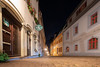
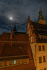
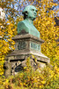
The above images may not be of the site on this page, but were taken nearby. They are loaded from Flickr so please click on them for image credits.
Click here to see more info for this site
Nearby sites
Click here to view sites on an interactive map of the areaKey: Red: member's photo, Blue: 3rd party photo, Yellow: other image, Green: no photo - please go there and take one, Grey: site destroyed
Download sites to:
KML (Google Earth)
GPX (GPS waypoints)
CSV (Garmin/Navman)
CSV (Excel)
To unlock full downloads you need to sign up as a Contributory Member. Otherwise downloads are limited to 50 sites.
Turn off the page maps and other distractions
Nearby sites listing. In the following links * = Image available
28.2km ENE 63° Heidenschanze Coschütz Hillfort
32.2km ENE 69° Heiliger Born Neuostra Holy Well or Sacred Spring
33.3km ENE 72° Kreisgrabenanlage Nickern DD-09 Henge
33.4km N 9° Burgberg Zeren* Hillfort
33.4km ENE 59° Dresden Museum für Völkerkunde Museum
33.6km ENE 72° Kreisgrabenanlage Nickern DD-98 Henge
33.9km ENE 72° Kreisgrabenanlage Nickern DD-02 Henge
34.0km ENE 75° Wallburg Lockwitz Hillfort
34.5km NNW 346° Steudten* Standing Stone (Menhir)
36.4km N 10° Wallburg Göhrisch* Hillfort
36.7km N 11° Burgberg Löbsal* Hillfort
37.6km N 10° Goldkuppe* Hillfort
40.0km SW 225° Greifensteine Natural Stone / Erratic / Other Natural Feature
44.4km NW 309° Maaschwitz Barrow Cemetery
44.9km NW 310° Lochstein Thümmlitzwald* Holed Stone
45.3km NW 310° Thümmlitzwald Monolith I* Standing Stone (Menhir)
45.4km NW 311° Thümmlitzwald Mühlstein* Natural Stone / Erratic / Other Natural Feature
45.4km NW 309° Thümmlitzwald Hügelgräber Barrow Cemetery
45.4km NW 311° Thümmlitzwald Menhir* Standing Stone (Menhir)
45.5km NW 311° Thümmlitzwald Teufelsstein* Rock Art
45.8km NW 308° Erlln Round Barrow(s)
45.9km NW 320° Draschwitz* Standing Stone (Menhir)
46.8km NW 311° Beatenkreuz Ancient Cross
50.7km S 172° Chomutov Propitiatory Cross* Ancient Cross
50.8km NW 311° Steinriese Modern Stone Circle etc
View more nearby sites and additional images


 We would like to know more about this location. Please feel free to add a brief description and any relevant information in your own language.
 Wir möchten mehr über diese Stätte erfahren. Bitte zögern Sie nicht, eine kurze Beschreibung und relevante Informationen in Deutsch hinzuzufügen.
 Nous aimerions en savoir encore un peu sur les lieux. S'il vous plaît n'hesitez pas à ajouter une courte description et tous les renseignements pertinents dans votre propre langue.
 Quisieramos informarnos un poco más de las lugares. No dude en añadir una breve descripción y otros datos relevantes en su propio idioma.