


<< Our Photo Pages >> Rabštejn propitiatory cross - Ancient Cross in Czech Republic in Bohemia
Submitted by ladrin on Saturday, 16 July 2016 Page Views: 938
Early Medieval (Dark Age)Site Name: Rabštejn propitiatory cross Alternative Name: Smírčí kříž RabštejnCountry: Czech Republic
NOTE: This site is 7.574 km away from the location you searched for.
Region: Bohemia Type: Ancient Cross
Nearest Town: Rabštejn nad Střelou
Latitude: 50.045795N Longitude: 13.294325E
Condition:
| 5 | Perfect |
| 4 | Almost Perfect |
| 3 | Reasonable but with some damage |
| 2 | Ruined but still recognisable as an ancient site |
| 1 | Pretty much destroyed, possibly visible as crop marks |
| 0 | No data. |
| -1 | Completely destroyed |
| 5 | Superb |
| 4 | Good |
| 3 | Ordinary |
| 2 | Not Good |
| 1 | Awful |
| 0 | No data. |
| 5 | Can be driven to, probably with disabled access |
| 4 | Short walk on a footpath |
| 3 | Requiring a bit more of a walk |
| 2 | A long walk |
| 1 | In the middle of nowhere, a nightmare to find |
| 0 | No data. |
| 5 | co-ordinates taken by GPS or official recorded co-ordinates |
| 4 | co-ordinates scaled from a detailed map |
| 3 | co-ordinates scaled from a bad map |
| 2 | co-ordinates of the nearest village |
| 1 | co-ordinates of the nearest town |
| 0 | no data |
Internal Links:
External Links:
")
Classic medieval propitiatory stone cross standing by the road just few steps from the old bridge in the picturesque town Rabštejn above Střela which is allegedly the smallest town in Europe. The cross is about 120cm tall and there is a well visible carving of a year 1584 on its front side.
Related old folk rumour talks about kidnapping of the bride by the local ruthless nobleman. When the bride tryed to escape, she died by falling from the high rock. The groom then ambushed the nobleman in the forest and beheaded him.
You may be viewing yesterday's version of this page. To see the most up to date information please register for a free account.
")
")
")
Do not use the above information on other web sites or publications without permission of the contributor.
Nearby Images from Flickr
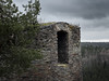
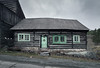


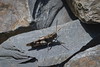
The above images may not be of the site on this page, but were taken nearby. They are loaded from Flickr so please click on them for image credits.
Click here to see more info for this site
Nearby sites
Click here to view sites on an interactive map of the areaKey: Red: member's photo, Blue: 3rd party photo, Yellow: other image, Green: no photo - please go there and take one, Grey: site destroyed
Download sites to:
KML (Google Earth)
GPX (GPS waypoints)
CSV (Garmin/Navman)
CSV (Excel)
To unlock full downloads you need to sign up as a Contributory Member. Otherwise downloads are limited to 50 sites.
Turn off the page maps and other distractions
Nearby sites listing. In the following links * = Image available
3.0km NE 48° Rock Town* Natural Stone / Erratic / Other Natural Feature
3.4km ENE 65° Logan Stones* Natural Stone / Erratic / Other Natural Feature
4.5km ENE 76° Dědek* Natural Stone / Erratic / Other Natural Feature
4.5km ENE 72° Bába* Natural Stone / Erratic / Other Natural Feature
5.8km E 91° Zihle Rocks* Natural Stone / Erratic / Other Natural Feature
6.8km WNW 302° Vladar Mountain Hillfort
7.5km NW 315° Protivec Propitiatory Cross 1* Ancient Cross
8.3km NW 318° Protivec Propitiatory Cross 2* Ancient Cross
10.9km ENE 66° Krty Devil's Stone* Natural Stone / Erratic / Other Natural Feature
11.1km WNW 300° Žlutice stones* Standing Stones
11.8km ENE 70° Petrified Heart* Natural Stone / Erratic / Other Natural Feature
12.4km NE 50° Stebno Stone Cross* Ancient Cross
13.6km ENE 68° Jesenice Cross Stone* Ancient Cross
13.7km NNW 349° Cross Stone Jeřeň* Standing Stone (Menhir)
14.0km ENE 65° Jesenice Propitiatory Crosses* Ancient Cross
16.6km E 86° Medieval Keep Smrk* Misc. Earthwork
17.3km ENE 76° God's Stone Soseň* Natural Stone / Erratic / Other Natural Feature
17.7km WNW 303° Údrč Propitiatory Cross* Ancient Cross
28.8km NE 35° Menhir Železná* Standing Stone (Menhir)
29.1km SW 232° Stone Cross Konstantinovy Lázně* Ancient Cross
29.2km SW 229° Hillfort Mountain* Hillfort
29.9km SSE 165° Menhir near Pilsen* Standing Stone (Menhir)
30.2km NW 317° Gnomes Rocks* Cave or Rock Shelter
31.6km W 262° Ringval Rankovice* Misc. Earthwork
31.7km ENE 75° Viereckschanze Na Kokrdech* Misc. Earthwork
View more nearby sites and additional images


 We would like to know more about this location. Please feel free to add a brief description and any relevant information in your own language.
 Wir möchten mehr über diese Stätte erfahren. Bitte zögern Sie nicht, eine kurze Beschreibung und relevante Informationen in Deutsch hinzuzufügen.
 Nous aimerions en savoir encore un peu sur les lieux. S'il vous plaît n'hesitez pas à ajouter une courte description et tous les renseignements pertinents dans votre propre langue.
 Quisieramos informarnos un poco más de las lugares. No dude en añadir una breve descripción y otros datos relevantes en su propio idioma.