


<< Our Photo Pages >> Alatri Temple - Ancient Temple in Italy in Lazio/Roma
Submitted by AlexHunger on Tuesday, 14 April 2009 Page Views: 8070
Roman, Greek and ClassicalSite Name: Alatri Temple Alternative Name: Aletrium Temple, Tempio di AlatriCountry: Italy
NOTE: This site is 14.308 km away from the location you searched for.
Region: Lazio/Roma Type: Ancient Temple
Nearest Town: Rome Nearest Village: Alatri
Latitude: 41.750753N Longitude: 13.350228E
Condition:
| 5 | Perfect |
| 4 | Almost Perfect |
| 3 | Reasonable but with some damage |
| 2 | Ruined but still recognisable as an ancient site |
| 1 | Pretty much destroyed, possibly visible as crop marks |
| 0 | No data. |
| -1 | Completely destroyed |
| 5 | Superb |
| 4 | Good |
| 3 | Ordinary |
| 2 | Not Good |
| 1 | Awful |
| 0 | No data. |
| 5 | Can be driven to, probably with disabled access |
| 4 | Short walk on a footpath |
| 3 | Requiring a bit more of a walk |
| 2 | A long walk |
| 1 | In the middle of nowhere, a nightmare to find |
| 0 | No data. |
| 5 | co-ordinates taken by GPS or official recorded co-ordinates |
| 4 | co-ordinates scaled from a detailed map |
| 3 | co-ordinates scaled from a bad map |
| 2 | co-ordinates of the nearest village |
| 1 | co-ordinates of the nearest town |
| 0 | no data |
Internal Links:
External Links:
")
Possible location of where an Etruscan Temple was found in 1889. A reconstruction was made in the courtyard of the Villa Giulia Museum in Rome, where some of the painted terracotta tyles are also displayed.
You may be viewing yesterday's version of this page. To see the most up to date information please register for a free account.
Do not use the above information on other web sites or publications without permission of the contributor.
Nearby Images from Flickr

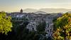
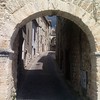

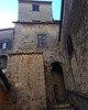
The above images may not be of the site on this page, but were taken nearby. They are loaded from Flickr so please click on them for image credits.
Click here to see more info for this site
Nearby sites
Click here to view sites on an interactive map of the areaKey: Red: member's photo, Blue: 3rd party photo, Yellow: other image, Green: no photo - please go there and take one, Grey: site destroyed
Download sites to:
KML (Google Earth)
GPX (GPS waypoints)
CSV (Garmin/Navman)
CSV (Excel)
To unlock full downloads you need to sign up as a Contributory Member. Otherwise downloads are limited to 50 sites.
Turn off the page maps and other distractions
Nearby sites listing. In the following links * = Image available
3.0km S 191° Alatri Acropolis* Hillfort
25.0km ESE 117° Arpino Acropolis* Ancient Village or Settlement
27.7km WSW 258° Giunone Moneta (Segni)* Ancient Village or Settlement
36.9km WSW 241° Antica Norba* Ancient Village or Settlement
51.1km NNE 17° Lu Termine* Standing Stone (Menhir)
53.2km W 267° Nemi Temple of Diana* Ancient Temple
61.6km N 11° Fossa Standing Stones* Stone Row / Alignment
61.7km SSW 201° Mura Ciclopiche San Felice Circeo Stone Fort or Dun
63.3km WSW 242° Nettuno Tomb Burial Chamber or Dolmen
71.7km WNW 282° Karnak Temple of Amun Lateran Obelisk* Standing Stone (Menhir)
72.6km WNW 284° Heliopolis Ramesses II Termini Obelisk* Standing Stone (Menhir)
73.5km WNW 283° Rome.* Ancient Village or Settlement
73.7km WNW 283° Lupercale Shrine* Cave or Rock Shelter
74.1km WNW 283° Sais - Piazza Minerva Obelisk* Standing Stone (Menhir)
74.6km WNW 284° Heliopolis Seti I Piazza del Popolo Obelisk* Standing Stone (Menhir)
76.2km WNW 283° Gregorian Etruscan Museum* Museum
81.6km SSE 147° Roccia San Sebastiano Cave or Rock Shelter
107.3km WNW 286° Cerveteri Necropoli della Banditaceia* Rock Cut Tomb
107.4km WNW 301° Sutri amphitheatre* Ancient Village or Settlement
107.4km WNW 301° Sutri Necropolis* Rock Cut Tomb
118.4km NNW 327° Carsulae Ancient Village or Settlement
119.2km WNW 299° Barbarano Romano Etruscan Necropolis Chambered Tomb
119.9km NW 308° Mount Cimino Votive Site* Ancient Temple
121.1km NW 312° Bomarzo Etruscan 'Pyramid' Altar* Ancient Temple
122.1km WNW 296° Civitella Cesi Etruscan Tomb* Rock Cut Tomb
View more nearby sites and additional images


 We would like to know more about this location. Please feel free to add a brief description and any relevant information in your own language.
 Wir möchten mehr über diese Stätte erfahren. Bitte zögern Sie nicht, eine kurze Beschreibung und relevante Informationen in Deutsch hinzuzufügen.
 Nous aimerions en savoir encore un peu sur les lieux. S'il vous plaît n'hesitez pas à ajouter une courte description et tous les renseignements pertinents dans votre propre langue.
 Quisieramos informarnos un poco más de las lugares. No dude en añadir una breve descripción y otros datos relevantes en su propio idioma.