


<< Our Photo Pages >> CheolMa seondol - Standing Stone (Menhir) in South Korea
Submitted by Aska on Monday, 12 November 2018 Page Views: 908
Neolithic and Bronze AgeSite Name: CheolMa seondol Alternative Name: 철마선돌 鐵馬立石Country: South Korea
NOTE: This site is 10.178 km away from the location you searched for.
Type: Standing Stone (Menhir)
Nearest Town: 부산광역시 Nearest Village: 철마면 송정
Latitude: 35.312760N Longitude: 129.115260E
Condition:
| 5 | Perfect |
| 4 | Almost Perfect |
| 3 | Reasonable but with some damage |
| 2 | Ruined but still recognisable as an ancient site |
| 1 | Pretty much destroyed, possibly visible as crop marks |
| 0 | No data. |
| -1 | Completely destroyed |
| 5 | Superb |
| 4 | Good |
| 3 | Ordinary |
| 2 | Not Good |
| 1 | Awful |
| 0 | No data. |
| 5 | Can be driven to, probably with disabled access |
| 4 | Short walk on a footpath |
| 3 | Requiring a bit more of a walk |
| 2 | A long walk |
| 1 | In the middle of nowhere, a nightmare to find |
| 0 | No data. |
| 5 | co-ordinates taken by GPS or official recorded co-ordinates |
| 4 | co-ordinates scaled from a detailed map |
| 3 | co-ordinates scaled from a bad map |
| 2 | co-ordinates of the nearest village |
| 1 | co-ordinates of the nearest town |
| 0 | no data |
Internal Links:
External Links:
")
3.96m high standing stone on an agricultural field in northern outskirt of Busan city. The field is situated on a river terrace so the stone cannot be found from nearby road which runs beneath the field, but might be seen through the window of KTX express train to Busan.
You may be viewing yesterday's version of this page. To see the most up to date information please register for a free account.
")
Do not use the above information on other web sites or publications without permission of the contributor.
Nearby Images from Flickr

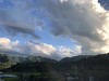
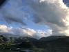

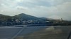
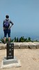
The above images may not be of the site on this page, but were taken nearby. They are loaded from Flickr so please click on them for image credits.
Click here to see more info for this site
Nearby sites
Click here to view sites on an interactive map of the areaKey: Red: member's photo, Blue: 3rd party photo, Yellow: other image, Green: no photo - please go there and take one, Grey: site destroyed
Download sites to:
KML (Google Earth)
GPX (GPS waypoints)
CSV (Garmin/Navman)
CSV (Excel)
To unlock full downloads you need to sign up as a Contributory Member. Otherwise downloads are limited to 50 sites.
Turn off the page maps and other distractions
Nearby sites listing. In the following links * = Image available
11.8km SSW 213° 농소리 Burial Chamber or Dolmen
17.3km NNE 14° Eunhyeon-ni cheokseokchong* Chambered Cairn
21.6km SSW 203° 동래 Burial Chamber or Dolmen
23.1km WSW 250° Gujibong* Burial Chamber or Dolmen
23.4km WSW 247° Gimae Hoehyeon-ni paechong* Ancient Village or Settlement
23.8km SW 231° 금곡동 Burial Chamber or Dolmen
24.7km WSW 251° Nae-dong chiseokmyo* Burial Chamber or Dolmen
27.3km NNE 32° 성산 Burial Chamber or Dolmen
28.3km W 280° 김해 Burial Chamber or Dolmen
29.6km SSW 198° 동삼동 Burial Chamber or Dolmen
30.0km N 11° Bangudae Petroglyphs* Rock Art
38.3km NNE 28° 판구대 Burial Chamber or Dolmen
44.5km NNE 27° KwanMon Sang* Hillfort
44.6km NW 321° Jeungcup City Menhir* Standing Stone (Menhir)
47.6km N 6° Ansim-ni petroglyph* NOT SET
47.8km NNE 26° Wonwon-sa temple* Ancient Temple
50.5km N 7° King Gyeongdeog mausoleum* Round Barrow(s)
51.6km N 9° Yangjang-ri dolmen* Burial Chamber or Dolmen
53.1km NNE 20° King Wonseong mausoleum* Round Barrow(s)
54.3km NNE 18° Gujeong-dong BanghyeonGubun* Barrow Cemetery
54.8km NNE 16° King Seongdeog mausoleum* Round Barrow(s)
55.7km N 9° Poseokjeong* Sculptured Stone
57.3km N 7° King Muyeol mausoleum* Barrow Cemetery
57.9km NNE 11° Queen Seongdeok mausoleum* Round Barrow(s)
58.2km N 11° Neungji-tap* Pyramid / Mastaba
View more nearby sites and additional images


 We would like to know more about this location. Please feel free to add a brief description and any relevant information in your own language.
 Wir möchten mehr über diese Stätte erfahren. Bitte zögern Sie nicht, eine kurze Beschreibung und relevante Informationen in Deutsch hinzuzufügen.
 Nous aimerions en savoir encore un peu sur les lieux. S'il vous plaît n'hesitez pas à ajouter une courte description et tous les renseignements pertinents dans votre propre langue.
 Quisieramos informarnos un poco más de las lugares. No dude en añadir una breve descripción y otros datos relevantes en su propio idioma.