


<< Our Photo Pages >> Iji Tōmiyā - Stone Circle in Japan in Kyūshū
Submitted by Aska on Sunday, 10 October 2021 Page Views: 273
The Far East and ChinaSite Name: Iji Tōmiyā Alternative Name: 伊地トーミヤー Iji Tomiya 伊地烽火Country: Japan
NOTE: This site is 9.613 km away from the location you searched for.
Region: Kyūshū Type: Stone Circle
Nearest Town: Kunigami-son (Okinawa prefecture) Nearest Village: Iji 伊地
Latitude: 26.759970N Longitude: 128.191740E
Condition:
| 5 | Perfect |
| 4 | Almost Perfect |
| 3 | Reasonable but with some damage |
| 2 | Ruined but still recognisable as an ancient site |
| 1 | Pretty much destroyed, possibly visible as crop marks |
| 0 | No data. |
| -1 | Completely destroyed |
| 5 | Superb |
| 4 | Good |
| 3 | Ordinary |
| 2 | Not Good |
| 1 | Awful |
| 0 | No data. |
| 5 | Can be driven to, probably with disabled access |
| 4 | Short walk on a footpath |
| 3 | Requiring a bit more of a walk |
| 2 | A long walk |
| 1 | In the middle of nowhere, a nightmare to find |
| 0 | No data. |
| 5 | co-ordinates taken by GPS or official recorded co-ordinates |
| 4 | co-ordinates scaled from a detailed map |
| 3 | co-ordinates scaled from a bad map |
| 2 | co-ordinates of the nearest village |
| 1 | co-ordinates of the nearest town |
| 0 | no data |
Internal Links:
External Links:
")
The path towards the site starts at 26.76252N,128.19638E.
You may be viewing yesterday's version of this page. To see the most up to date information please register for a free account.
")
Do not use the above information on other web sites or publications without permission of the contributor.
Nearby Images from Flickr


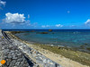

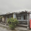
The above images may not be of the site on this page, but were taken nearby. They are loaded from Flickr so please click on them for image credits.
Click here to see more info for this site
Nearby sites
Click here to view sites on an interactive map of the areaKey: Red: member's photo, Blue: 3rd party photo, Yellow: other image, Green: no photo - please go there and take one, Grey: site destroyed
Download sites to:
KML (Google Earth)
GPX (GPS waypoints)
CSV (Garmin/Navman)
CSV (Excel)
To unlock full downloads you need to sign up as a Contributory Member. Otherwise downloads are limited to 50 sites.
Turn off the page maps and other distractions
Nearby sites listing. In the following links * = Image available
13.0km NNE 32° Tomb of King Gihon* Cist
18.3km WSW 251° Kouri Tūmiyā* Natural Stone / Erratic / Other Natural Feature
20.5km WSW 245° Ūnishi-baka* Rock Cut Tomb
20.5km WSW 245° Mumujana-baka* Rock Cut Tomb
23.7km WSW 253° Ichigusuku-baka* Rock Cut Tomb
27.1km WSW 254° Nakijin-jō* Hillfort
29.4km NW 306° Izena Tamaudun* Chambered Tomb
30.0km NW 305° Kurautchi-baka* Chambered Tomb
31.2km NW 307° Āga-yama* Artificial Mound
37.7km W 266° Kadabaru cave* Cave or Rock Shelter
38.8km NE 39° Ishuburi-baka* Rock Cut Tomb
39.0km NE 37° Noroshi-dai (in Yoron-jima island)* Artificial Mound
40.2km W 262° MinkaZantū* Holy Well or Sacred Spring
40.9km W 264° Gohezu cave* Cave or Rock Shelter
43.2km W 263° Amibōsha* Stone Circle
46.2km SSW 205° Usumē Hāmē* Standing Stones
48.9km SSW 205° Uehara Hītachī* Misc. Earthwork
52.9km SW 225° Iha Nūru-baka* Rock Cut Tomb
54.1km SW 219° Agena-jō* Hillfort
55.9km SW 220° Kanekadan Jōmīchā-baka* Rock Cut Tomb
57.0km SSW 213° Katsuren-jō* Hillfort
58.2km SW 221° Tomb of UniUfugushiku* Rock Cut Tomb
59.4km SW 229° Zakimi-jō* Hillfort
63.7km SW 224° Tomb of Noguni Sōkan* Rock Cut Tomb
63.9km SW 220° Tōbaru cave* Cave or Rock Shelter
View more nearby sites and additional images


 We would like to know more about this location. Please feel free to add a brief description and any relevant information in your own language.
 Wir möchten mehr über diese Stätte erfahren. Bitte zögern Sie nicht, eine kurze Beschreibung und relevante Informationen in Deutsch hinzuzufügen.
 Nous aimerions en savoir encore un peu sur les lieux. S'il vous plaît n'hesitez pas à ajouter une courte description et tous les renseignements pertinents dans votre propre langue.
 Quisieramos informarnos un poco más de las lugares. No dude en añadir una breve descripción y otros datos relevantes en su propio idioma.