


<< Our Photo Pages >> SamnyeonSanseong - Hillfort in South Korea
Submitted by Aska on Monday, 25 November 2019 Page Views: 1159
Iron Age and Later PrehistorySite Name: SamnyeonSanseong Alternative Name: 삼년산성 三年山城Country: South Korea
NOTE: This site is 15.844 km away from the location you searched for.
Type: Hillfort
Nearest Town: Boeun 보은 Nearest Village: Oam-ri 어암리
Latitude: 36.487890N Longitude: 127.740750E
Condition:
| 5 | Perfect |
| 4 | Almost Perfect |
| 3 | Reasonable but with some damage |
| 2 | Ruined but still recognisable as an ancient site |
| 1 | Pretty much destroyed, possibly visible as crop marks |
| 0 | No data. |
| -1 | Completely destroyed |
| 5 | Superb |
| 4 | Good |
| 3 | Ordinary |
| 2 | Not Good |
| 1 | Awful |
| 0 | No data. |
| 5 | Can be driven to, probably with disabled access |
| 4 | Short walk on a footpath |
| 3 | Requiring a bit more of a walk |
| 2 | A long walk |
| 1 | In the middle of nowhere, a nightmare to find |
| 0 | No data. |
| 5 | co-ordinates taken by GPS or official recorded co-ordinates |
| 4 | co-ordinates scaled from a detailed map |
| 3 | co-ordinates scaled from a bad map |
| 2 | co-ordinates of the nearest village |
| 1 | co-ordinates of the nearest town |
| 0 | no data |
Internal Links:
External Links:
")
You may be viewing yesterday's version of this page. To see the most up to date information please register for a free account.
Do not use the above information on other web sites or publications without permission of the contributor.
Nearby Images from Flickr


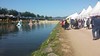


The above images may not be of the site on this page, but were taken nearby. They are loaded from Flickr so please click on them for image credits.
Click here to see more info for this site
Nearby sites
Click here to view sites on an interactive map of the areaKey: Red: member's photo, Blue: 3rd party photo, Yellow: other image, Green: no photo - please go there and take one, Grey: site destroyed
Download sites to:
KML (Google Earth)
GPX (GPS waypoints)
CSV (Garmin/Navman)
CSV (Excel)
To unlock full downloads you need to sign up as a Contributory Member. Otherwise downloads are limited to 50 sites.
Turn off the page maps and other distractions
Nearby sites listing. In the following links * = Image available
16.0km SSW 201° Dodeok-ri menhir* Standing Stone (Menhir)
17.5km SSW 201° Jongmi-ri menhir* Standing Stone (Menhir)
21.8km SSW 210° Seoktan-ni dolmen and menhir* Standing Stone (Menhir)
24.4km SSW 200° Seoktan-ri Menhir* Standing Stone (Menhir)
26.3km NW 317° SangdangSanseong* Hillfort
26.7km SSW 214° Chungbuk do* Burial Chamber or Dolmen
29.4km WSW 243° Birae-dong dolmens* Burial Chamber or Dolmen
51.7km WSW 251° 괴정동 Burial Chamber or Dolmen
52.1km W 271° 성원리 Burial Chamber or Dolmen
53.8km ENE 61° Mimyeonsa temple ruin* Pyramid / Mastaba
55.2km W 267° GongsanSeong* Hillfort
56.1km W 267° Songsan-ni gobungun* Rock Art
65.8km WSW 251° Sangick-ri Dolmen* Burial Chamber or Dolmen
66.3km ENE 74° Kaesim-sa temple* Ancient Temple
66.8km N 11° Buheung-sa temple* Pyramid / Mastaba
67.1km WNW 302° 남송리 Burial Chamber or Dolmen
70.6km NE 34° Jecheon Gyo-ri* Pyramid / Mastaba
73.9km WSW 240° 성궁리 Burial Chamber or Dolmen
75.0km WSW 252° Neungsan-ni gobungun* Rock Art
75.3km WSW 252° BuyeoNasang* Hillfort
76.3km NE 39° Gakgi-ri menhirs* Standing Stones
80.0km E 97° Uiseong Seoktam-ni* Pyramid / Mastaba
80.4km N 352° Cheo-ri Menhir* Standing Stone (Menhir)
81.3km ENE 73° Andong Seoktam-ni* Pyramid / Mastaba
82.8km SW 231° Mireuk-sa temple* Ancient Temple
View more nearby sites and additional images


 We would like to know more about this location. Please feel free to add a brief description and any relevant information in your own language.
 Wir möchten mehr über diese Stätte erfahren. Bitte zögern Sie nicht, eine kurze Beschreibung und relevante Informationen in Deutsch hinzuzufügen.
 Nous aimerions en savoir encore un peu sur les lieux. S'il vous plaît n'hesitez pas à ajouter une courte description et tous les renseignements pertinents dans votre propre langue.
 Quisieramos informarnos un poco más de las lugares. No dude en añadir una breve descripción y otros datos relevantes en su propio idioma.