


<< Our Photo Pages >> Tomb of Noguni Sōkan - Rock Cut Tomb in Japan in Kyūshū
Submitted by Aska on Sunday, 10 October 2021 Page Views: 659
Modern SitesSite Name: Tomb of Noguni Sōkan Alternative Name: 野国総管の墓 Noguni Sokan-no-hakaCountry: Japan
NOTE: This site is 1.799 km away from the location you searched for.
Region: Kyūshū Type: Rock Cut Tomb
Nearest Town: Kadena-chō (Okinawa prefecture) Nearest Village: Noguni 野国
Latitude: 26.348670N Longitude: 127.745500E
Condition:
| 5 | Perfect |
| 4 | Almost Perfect |
| 3 | Reasonable but with some damage |
| 2 | Ruined but still recognisable as an ancient site |
| 1 | Pretty much destroyed, possibly visible as crop marks |
| 0 | No data. |
| -1 | Completely destroyed |
| 5 | Superb |
| 4 | Good |
| 3 | Ordinary |
| 2 | Not Good |
| 1 | Awful |
| 0 | No data. |
| 5 | Can be driven to, probably with disabled access |
| 4 | Short walk on a footpath |
| 3 | Requiring a bit more of a walk |
| 2 | A long walk |
| 1 | In the middle of nowhere, a nightmare to find |
| 0 | No data. |
| 5 | co-ordinates taken by GPS or official recorded co-ordinates |
| 4 | co-ordinates scaled from a detailed map |
| 3 | co-ordinates scaled from a bad map |
| 2 | co-ordinates of the nearest village |
| 1 | co-ordinates of the nearest town |
| 0 | no data |
Be the first person to rate this site - see the 'Contribute!' box in the right hand menu.
Internal Links:
External Links:
")
The site is located inside “Kadena Marina” of US Kadena Air Base (out of Japanese territory) but anyone can visit the beach and the restaurant inside freely from 11:00 to 22:00.
You may be viewing yesterday's version of this page. To see the most up to date information please register for a free account.
")
Do not use the above information on other web sites or publications without permission of the contributor.
Nearby Images from Flickr
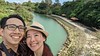
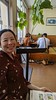
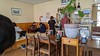
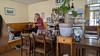
The above images may not be of the site on this page, but were taken nearby. They are loaded from Flickr so please click on them for image credits.
Click here to see more info for this site
Nearby sites
Click here to view sites on an interactive map of the areaKey: Red: member's photo, Blue: 3rd party photo, Yellow: other image, Green: no photo - please go there and take one, Grey: site destroyed
Download sites to:
KML (Google Earth)
GPX (GPS waypoints)
CSV (Garmin/Navman)
CSV (Excel)
To unlock full downloads you need to sign up as a Contributory Member. Otherwise downloads are limited to 50 sites.
Turn off the page maps and other distractions
Nearby sites listing. In the following links * = Image available
4.9km SE 134° Tōbaru cave* Cave or Rock Shelter
6.7km N 357° Zakimi-jō* Hillfort
6.7km ENE 77° Tomb of UniUfugushiku* Rock Cut Tomb
7.1km SE 143° Tomb of Nakagusuku Wakamatsu* Rock Cut Tomb
8.9km ENE 70° Kanekadan Jōmīchā-baka* Rock Cut Tomb
9.1km SE 142° Nakagusuku-jō* Hillfort
9.9km S 184° Oroku-baka* Rock Cut Tomb
10.5km SSE 149° YagiBishi-no Ibi* Standing Stones
10.6km S 191° Iso-no-Takauhaka* Rock Cut Tomb
10.9km NE 40° Iha Nūru-baka* Rock Cut Tomb
11.1km ENE 71° Agena-jō* Hillfort
11.3km S 187° Urasoe-jō* Hillfort
12.4km S 187° Tomb of Tamagusuku Chōkun* Chambered Tomb
12.8km SSW 193° Tomb of Urasoe branch royal family* Chambered Tomb
13.4km E 98° Katsuren-jō* Hillfort
13.6km SSW 194° Tomb of Ginowan branch royal family* Chambered Tomb
13.8km S 188° Tomb of Ie branch royal family* Chambered Tomb
13.8km S 186° Tomb of Yuntanza branch royal family* Chambered Tomb
14.0km SSW 200° Mekaru necropolis* Chambered Tomb
14.5km S 184° Hitatimō* Natural Stone / Erratic / Other Natural Feature
14.7km S 189° Banshō-in temple* Modern Stone Circle etc
14.8km SSW 192° Tama Udun* Chambered Tomb
14.9km S 190° Shuri-jō* Hillfort
15.5km SSW 192° Tomb of Takushi Uēkata* Chambered Tomb
15.7km S 183° Tomb of Mabuni branch royal family* Chambered Tomb
View more nearby sites and additional images


 We would like to know more about this location. Please feel free to add a brief description and any relevant information in your own language.
 Wir möchten mehr über diese Stätte erfahren. Bitte zögern Sie nicht, eine kurze Beschreibung und relevante Informationen in Deutsch hinzuzufügen.
 Nous aimerions en savoir encore un peu sur les lieux. S'il vous plaît n'hesitez pas à ajouter une courte description et tous les renseignements pertinents dans votre propre langue.
 Quisieramos informarnos un poco más de las lugares. No dude en añadir una breve descripción y otros datos relevantes en su propio idioma.