


<< Our Photo Pages >> Tomb of Tokashiki Sanrā - Chambered Tomb in Japan in Kyūshū
Submitted by Aska on Monday, 01 November 2021 Page Views: 257
Medieval (High and Late)Site Name: Tomb of Tokashiki Sanrā Alternative Name: 渡嘉敷三良の墓 Tokashiki Sanra-no-hakaCountry: Japan
NOTE: This site is 1.032 km away from the location you searched for.
Region: Kyūshū Type: Chambered Tomb
Nearest Town: Naha (Okinawa prefecture) Nearest Village: Makishi 牧志
Latitude: 26.217600N Longitude: 127.685510E
Condition:
| 5 | Perfect |
| 4 | Almost Perfect |
| 3 | Reasonable but with some damage |
| 2 | Ruined but still recognisable as an ancient site |
| 1 | Pretty much destroyed, possibly visible as crop marks |
| 0 | No data. |
| -1 | Completely destroyed |
| 5 | Superb |
| 4 | Good |
| 3 | Ordinary |
| 2 | Not Good |
| 1 | Awful |
| 0 | No data. |
| 5 | Can be driven to, probably with disabled access |
| 4 | Short walk on a footpath |
| 3 | Requiring a bit more of a walk |
| 2 | A long walk |
| 1 | In the middle of nowhere, a nightmare to find |
| 0 | No data. |
| 5 | co-ordinates taken by GPS or official recorded co-ordinates |
| 4 | co-ordinates scaled from a detailed map |
| 3 | co-ordinates scaled from a bad map |
| 2 | co-ordinates of the nearest village |
| 1 | co-ordinates of the nearest town |
| 0 | no data |
Internal Links:
External Links:
")
A rock cut tomb with front enclosure situated in the heart of Naha city. Sanrā TOKASHIKI was the 1st Okinawan ceramic roof tile manufacturer immigrated from Chinese Ming dynasty.
You may be viewing yesterday's version of this page. To see the most up to date information please register for a free account.
Do not use the above information on other web sites or publications without permission of the contributor.
Nearby Images from Flickr
![[S]](https://farm66.static.flickr.com/65535/53672038641_4d22e43e2e_t.jpg)
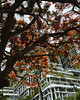

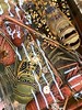

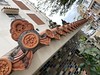
The above images may not be of the site on this page, but were taken nearby. They are loaded from Flickr so please click on them for image credits.
Click here to see more info for this site
Nearby sites
Click here to view sites on an interactive map of the areaKey: Red: member's photo, Blue: 3rd party photo, Yellow: other image, Green: no photo - please go there and take one, Grey: site destroyed
Download sites to:
KML (Google Earth)
GPX (GPS waypoints)
CSV (Garmin/Navman)
CSV (Excel)
To unlock full downloads you need to sign up as a Contributory Member. Otherwise downloads are limited to 50 sites.
Turn off the page maps and other distractions
Nearby sites listing. In the following links * = Image available
1.9km NE 38° Mekaru necropolis* Chambered Tomb
2.2km SSW 213° Yamashita-chō cave* Cave or Rock Shelter
2.9km E 89° Tama Udun* Chambered Tomb
3.0km ESE 102° Tomb of Takushi Uēkata* Chambered Tomb
3.1km ENE 62° Tomb of Ginowan branch royal family* Chambered Tomb
3.4km E 92° Shuri-jō* Hillfort
3.6km E 89° Banshō-in temple* Modern Stone Circle etc
3.7km NE 56° Tomb of Urasoe branch royal family* Chambered Tomb
4.1km ENE 77° Tomb of Ie branch royal family* Chambered Tomb
4.7km E 80° Tomb of Yuntanza branch royal family* Chambered Tomb
4.7km SW 217° Gushi Hitati* Natural Stone / Erratic / Other Natural Feature
5.0km ENE 63° Tomb of Tamagusuku Chōkun* Chambered Tomb
5.0km E 89° Hitatimō* Natural Stone / Erratic / Other Natural Feature
5.3km ESE 102° Tomb of Mabuni branch royal family* Chambered Tomb
5.7km NE 54° Urasoe-jō* Hillfort
5.7km NE 43° Iso-no-Takauhaka* Rock Cut Tomb
7.1km NE 48° Oroku-baka* Rock Cut Tomb
9.6km SE 125° Tomb of Ufugusuku Aji* Chambered Tomb
10.4km SE 144° Sakitari-dō cave* Cave or Rock Shelter
10.7km SE 133° Itokazu-jō* Hillfort
12.0km ESE 121° Sashiki Yōdore* Chambered Tomb
12.3km SE 143° Minatogawa fissure* Cave or Rock Shelter
12.4km ESE 114° Futchā-ishi* Standing Stone (Menhir)
12.5km SE 131° Tamagusuku-jō* Hillfort
12.7km ENE 64° YagiBishi-no Ibi* Standing Stones
View more nearby sites and additional images


 We would like to know more about this location. Please feel free to add a brief description and any relevant information in your own language.
 Wir möchten mehr über diese Stätte erfahren. Bitte zögern Sie nicht, eine kurze Beschreibung und relevante Informationen in Deutsch hinzuzufügen.
 Nous aimerions en savoir encore un peu sur les lieux. S'il vous plaît n'hesitez pas à ajouter une courte description et tous les renseignements pertinents dans votre propre langue.
 Quisieramos informarnos un poco más de las lugares. No dude en añadir una breve descripción y otros datos relevantes en su propio idioma.