


<< Text Pages >> Fotevikens Museum - Museum in Sweden in Skåne
Submitted by Klingon on Friday, 18 September 2009 Page Views: 7831
MuseumsSite Name: Fotevikens MuseumCountry: Sweden
NOTE: This site is 7.613 km away from the location you searched for.
Landskap: Skåne Type: Museum
Latitude: 55.429000N Longitude: 12.952000E
Condition:
| 5 | Perfect |
| 4 | Almost Perfect |
| 3 | Reasonable but with some damage |
| 2 | Ruined but still recognisable as an ancient site |
| 1 | Pretty much destroyed, possibly visible as crop marks |
| 0 | No data. |
| -1 | Completely destroyed |
| 5 | Superb |
| 4 | Good |
| 3 | Ordinary |
| 2 | Not Good |
| 1 | Awful |
| 0 | No data. |
| 5 | Can be driven to, probably with disabled access |
| 4 | Short walk on a footpath |
| 3 | Requiring a bit more of a walk |
| 2 | A long walk |
| 1 | In the middle of nowhere, a nightmare to find |
| 0 | No data. |
| 5 | co-ordinates taken by GPS or official recorded co-ordinates |
| 4 | co-ordinates scaled from a detailed map |
| 3 | co-ordinates scaled from a bad map |
| 2 | co-ordinates of the nearest village |
| 1 | co-ordinates of the nearest town |
| 0 | no data |
Be the first person to rate this site - see the 'Contribute!' box in the right hand menu.
Internal Links:
External Links:
Museum in Skåne
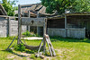
This museum shows an ancient Viking village.
You may be viewing yesterday's version of this page. To see the most up to date information please register for a free account.
Do not use the above information on other web sites or publications without permission of the contributor.
Nearby Images from Flickr
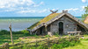

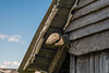
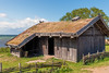
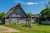
The above images may not be of the site on this page, but were taken nearby. They are loaded from Flickr so please click on them for image credits.
Click here to see more info for this site
Nearby sites
Click here to view sites on an interactive map of the areaKey: Red: member's photo, Blue: 3rd party photo, Yellow: other image, Green: no photo - please go there and take one, Grey: site destroyed
Download sites to:
KML (Google Earth)
GPX (GPS waypoints)
CSV (Garmin/Navman)
CSV (Excel)
To unlock full downloads you need to sign up as a Contributory Member. Otherwise downloads are limited to 50 sites.
Turn off the page maps and other distractions
Nearby sites listing. In the following links * = Image available
7.6km ESE 111° Skegrie Church Long Dolmen* Burial Chamber or Dolmen
8.6km ENE 76° Fugliestenen 2* Carving
8.6km ENE 76° Fugliestenen 1* Carving
9.2km ESE 103° Snarringe Transitional Long Dolmen* Burial Chamber or Dolmen
10.8km ENE 66° Bolmers högar* Round Barrow(s)
15.6km NNE 17° Fosiestenen* Carving
25.5km ESE 110° Erkedösen Passage Grave* Passage Grave
32.6km E 94° Tullstorpstenen* Carving
33.2km E 99° Skateholm Mesolithic Settlement Ancient Village or Settlement
34.0km NW 314° KKMotorbanens Dysse (modern)* Modern Stone Circle etc
34.8km NW 321° Badehuset* Rock Art
35.2km E 92° Östra Vemmenhögstenen* Carving
36.1km NW 319° Ny Carlesberg Glyptotek* Museum
36.2km NW 319° Nationalmuseet (National Museum)* Museum
36.7km E 91° Tofthög* Round Barrow(s)
37.0km NW 314° Vestre Kirkegård Gravdysse* Modern Stone Circle etc
37.1km N 359° Gillhög* Passage Grave
37.1km NE 51° Södra Ugglarp* Stone Circle
38.4km NW 315° Frederiksberg Have Dysse (modern)* Modern Stone Circle etc
38.8km W 264° Magleby Skov Langdysse Long Barrow
38.8km N 3° Manhögarna Passage Grave
38.9km E 84° Östra Herrestadstenen* Carving
39.2km NW 312° Danshøj* Round Barrow(s)
39.6km N 11° Hög Passage Grave* Passage Grave
41.0km WSW 244° Skørpinge Rundhøj* Round Barrow(s)
View more nearby sites and additional images


 We would like to know more about this location. Please feel free to add a brief description and any relevant information in your own language.
 Wir möchten mehr über diese Stätte erfahren. Bitte zögern Sie nicht, eine kurze Beschreibung und relevante Informationen in Deutsch hinzuzufügen.
 Nous aimerions en savoir encore un peu sur les lieux. S'il vous plaît n'hesitez pas à ajouter une courte description et tous les renseignements pertinents dans votre propre langue.
 Quisieramos informarnos un poco más de las lugares. No dude en añadir una breve descripción y otros datos relevantes en su propio idioma.