 with our Megalithic Portal iPhone app")


<< Our Photo Pages >> Källekullen - Standing Stones in Sweden in Halland
Submitted by Bjorn on Monday, 28 May 2007 Page Views: 3727
Neolithic and Bronze AgeSite Name: KällekullenCountry: Sweden
NOTE: This site is 6.711 km away from the location you searched for.
Landskap: Halland Type: Standing Stones
Nearest Town: Varberg Nearest Village: Ästad
Latitude: 57.058300N Longitude: 12.552700E
Condition:
| 5 | Perfect |
| 4 | Almost Perfect |
| 3 | Reasonable but with some damage |
| 2 | Ruined but still recognisable as an ancient site |
| 1 | Pretty much destroyed, possibly visible as crop marks |
| 0 | No data. |
| -1 | Completely destroyed |
| 5 | Superb |
| 4 | Good |
| 3 | Ordinary |
| 2 | Not Good |
| 1 | Awful |
| 0 | No data. |
| 5 | Can be driven to, probably with disabled access |
| 4 | Short walk on a footpath |
| 3 | Requiring a bit more of a walk |
| 2 | A long walk |
| 1 | In the middle of nowhere, a nightmare to find |
| 0 | No data. |
| 5 | co-ordinates taken by GPS or official recorded co-ordinates |
| 4 | co-ordinates scaled from a detailed map |
| 3 | co-ordinates scaled from a bad map |
| 2 | co-ordinates of the nearest village |
| 1 | co-ordinates of the nearest town |
| 0 | no data |
Internal Links:
External Links:
I have visited· I would like to visit
Bjorn has visited here
")
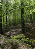
The standing stones are the remains of a larger stone ship.
You may be viewing yesterday's version of this page. To see the most up to date information please register for a free account.
")
")
")
Do not use the above information on other web sites or publications without permission of the contributor.
Nearby Images from Flickr
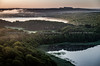
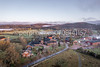
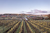
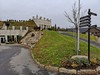

The above images may not be of the site on this page, but were taken nearby. They are loaded from Flickr so please click on them for image credits.
Click here to see more info for this site
Nearby sites
Click here to view sites on an interactive map of the areaKey: Red: member's photo, Blue: 3rd party photo, Yellow: other image, Green: no photo - please go there and take one, Grey: site destroyed
Download sites to:
KML (Google Earth)
GPX (GPS waypoints)
CSV (Garmin/Navman)
CSV (Excel)
To unlock full downloads you need to sign up as a Contributory Member. Otherwise downloads are limited to 50 sites.
Turn off the page maps and other distractions
Nearby sites listing. In the following links * = Image available
9.9km NW 314° Högaberg* Barrow Cemetery
10.2km W 262° Tvååker Grave field* Standing Stones
10.8km NW 314° Runeberg* Cairn
12.0km NW 307° Grimeton* Stone Circle
12.1km NW 307° Slummesten* Standing Stone (Menhir)
14.6km NW 304° Stenstugan (Stone Cottage)* Burial Chamber or Dolmen
15.3km WNW 293° Korsgata* Standing Stones
15.3km WNW 301° Klastorpsdösen* Burial Chamber or Dolmen
16.0km SSW 194° Stomma kulle* Cairn
17.7km SSE 156° Munkakyrkan* Stone Circle
17.8km W 281° Randens hög* Round Barrow(s)
17.9km NNE 19° Källsjö Passage Grave* Burial Chamber or Dolmen
18.5km WNW 282° Röda led* Rock Art
20.3km SSE 150° Hagbards kulle* Round Barrow(s)
20.4km SSE 151° Särestad gravfält* Standing Stones
20.4km SSE 151° Särestad* Standing Stones
22.3km WNW 300° Gamla Varberg* Cairn
22.5km SSE 150° Hagbards Galge* Standing Stones
22.5km WNW 287° Gubbanäsan* Cairn
23.3km SSE 151° Asige bautastenar* Standing Stones
23.6km SSE 151° Asige Bronsåldersgravar* Round Barrow(s)
24.5km SSE 148° Öinge treuddar* Misc. Earthwork
25.5km SSE 150° Bostället* Cist
25.6km SSE 165° Klockstenarna Skeppssättning* Standing Stones
26.6km SSE 155° Getinge bautastenar* Standing Stones
View more nearby sites and additional images


 We would like to know more about this location. Please feel free to add a brief description and any relevant information in your own language.
 Wir möchten mehr über diese Stätte erfahren. Bitte zögern Sie nicht, eine kurze Beschreibung und relevante Informationen in Deutsch hinzuzufügen.
 Nous aimerions en savoir encore un peu sur les lieux. S'il vous plaît n'hesitez pas à ajouter une courte description et tous les renseignements pertinents dans votre propre langue.
 Quisieramos informarnos un poco más de las lugares. No dude en añadir una breve descripción y otros datos relevantes en su propio idioma.