


<< Our Photo Pages >> Stone Cross Jindřichovice - Ancient Cross in Czech Republic in Bohemia
Submitted by ladrin on Tuesday, 13 October 2020 Page Views: 306
Early Medieval (Dark Age)Site Name: Stone Cross JindřichoviceCountry: Czech Republic
NOTE: This site is 1.03 km away from the location you searched for.
Region: Bohemia Type: Ancient Cross
Nearest Town: Sokolov Nearest Village: Jindrichovice
Latitude: 50.275621N Longitude: 12.615519E
Condition:
| 5 | Perfect |
| 4 | Almost Perfect |
| 3 | Reasonable but with some damage |
| 2 | Ruined but still recognisable as an ancient site |
| 1 | Pretty much destroyed, possibly visible as crop marks |
| 0 | No data. |
| -1 | Completely destroyed |
| 5 | Superb |
| 4 | Good |
| 3 | Ordinary |
| 2 | Not Good |
| 1 | Awful |
| 0 | No data. |
| 5 | Can be driven to, probably with disabled access |
| 4 | Short walk on a footpath |
| 3 | Requiring a bit more of a walk |
| 2 | A long walk |
| 1 | In the middle of nowhere, a nightmare to find |
| 0 | No data. |
| 5 | co-ordinates taken by GPS or official recorded co-ordinates |
| 4 | co-ordinates scaled from a detailed map |
| 3 | co-ordinates scaled from a bad map |
| 2 | co-ordinates of the nearest village |
| 1 | co-ordinates of the nearest town |
| 0 | no data |
Internal Links:
External Links:
")
Quite tall cross made of hard sandstone has almost 1,5m in height. This partly damaged medieval monument seems to be combination of a latin and knight cross. There is no visible decoration or carving on its surface.
The stone cross is not mentioned in old records and also any informations about the origin is missing. Equally there is no local folk tale related. The cross is easy to find. It is standing next to the communication tower SE of the village.
You may be viewing yesterday's version of this page. To see the most up to date information please register for a free account.
")
")
")
")
Do not use the above information on other web sites or publications without permission of the contributor.
Nearby Images from Flickr
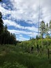


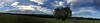
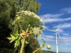
The above images may not be of the site on this page, but were taken nearby. They are loaded from Flickr so please click on them for image credits.
Click here to see more info for this site
Nearby sites
Click here to view sites on an interactive map of the areaKey: Red: member's photo, Blue: 3rd party photo, Yellow: other image, Green: no photo - please go there and take one, Grey: site destroyed
Download sites to:
KML (Google Earth)
GPX (GPS waypoints)
CSV (Garmin/Navman)
CSV (Excel)
To unlock full downloads you need to sign up as a Contributory Member. Otherwise downloads are limited to 50 sites.
Turn off the page maps and other distractions
Nearby sites listing. In the following links * = Image available
9.2km SW 222° Krajkova Stone Cross* Ancient Cross
10.7km SSE 157° Stone crosses Královské Poříčí* Ancient Cross
14.0km SSW 201° Stone Cross Chlum* Ancient Cross
14.0km WSW 251° Ringval Božetín* Misc. Earthwork
14.0km WNW 282° Reliéfy Kostelní* Sculptured Stone
14.7km SSW 195° Dasnice propitiatory cross* Ancient Cross
15.0km W 281° Vysoký Kámen (Kostelní)* Rock Outcrop
15.1km SSW 200° Svatá Studánka Chlum* Holy Well or Sacred Spring
15.1km SW 231° Ringval Mlýnek* Misc. Earthwork
15.2km SSW 204° Stone Cross Chlum II* Ancient Cross
15.6km SW 214° Ringval Hluboká* Misc. Earthwork
16.8km S 178° Stone Cross Rudolec* Ancient Cross
16.9km SW 226° Cross Stone Mostek* Standing Stone (Menhir)
17.6km SW 221° Milhostov 1 propitiatory crosses* Ancient Cross
17.6km S 171° Swedish stone* Standing Stone (Menhir)
17.6km WSW 251° Lomnička Stone Cross* Ancient Cross
18.0km SW 223° Milhostov 2 propitiatory crosses* Ancient Cross
19.9km E 99° Dalovice Stone Cross* Ancient Cross
20.5km WSW 253° Plesná stone crosses* Ancient Cross
20.6km SW 220° Povodí propitiatory cross* Ancient Cross
21.7km SW 223° Dvorek propitiatory cross* Ancient Cross
21.9km SE 145° Krásno Propitiatory Cross* Ancient Cross
22.8km E 93° Stone Cross in Bor* Ancient Cross
23.0km S 190° Ringval Těšov I* Misc. Earthwork
23.2km E 83° Ostrov Stone Cross 1* Ancient Cross
View more nearby sites and additional images


 We would like to know more about this location. Please feel free to add a brief description and any relevant information in your own language.
 Wir möchten mehr über diese Stätte erfahren. Bitte zögern Sie nicht, eine kurze Beschreibung und relevante Informationen in Deutsch hinzuzufügen.
 Nous aimerions en savoir encore un peu sur les lieux. S'il vous plaît n'hesitez pas à ajouter une courte description et tous les renseignements pertinents dans votre propre langue.
 Quisieramos informarnos un poco más de las lugares. No dude en añadir una breve descripción y otros datos relevantes en su propio idioma.