


<< Our Photo Pages >> Hornbæk Plantage Stensætning - Stone Circle in Denmark in Hovedstaden
Submitted by NeolithicFanatic on Sunday, 29 January 2023 Page Views: 316
Neolithic and Bronze AgeSite Name: Hornbæk Plantage StensætningCountry: Denmark
NOTE: This site is 6.961 km away from the location you searched for.
County: Hovedstaden Type: Stone Circle
Nearest Town: Hornbæk Nearest Village: Saunte
Latitude: 56.090340N Longitude: 12.499300E
Condition:
| 5 | Perfect |
| 4 | Almost Perfect |
| 3 | Reasonable but with some damage |
| 2 | Ruined but still recognisable as an ancient site |
| 1 | Pretty much destroyed, possibly visible as crop marks |
| 0 | No data. |
| -1 | Completely destroyed |
| 5 | Superb |
| 4 | Good |
| 3 | Ordinary |
| 2 | Not Good |
| 1 | Awful |
| 0 | No data. |
| 5 | Can be driven to, probably with disabled access |
| 4 | Short walk on a footpath |
| 3 | Requiring a bit more of a walk |
| 2 | A long walk |
| 1 | In the middle of nowhere, a nightmare to find |
| 0 | No data. |
| 5 | co-ordinates taken by GPS or official recorded co-ordinates |
| 4 | co-ordinates scaled from a detailed map |
| 3 | co-ordinates scaled from a bad map |
| 2 | co-ordinates of the nearest village |
| 1 | co-ordinates of the nearest town |
| 0 | no data |
Be the first person to rate this site - see the 'Contribute!' box in the right hand menu.
Internal Links:
External Links:
I have visited· I would like to visit
NeolithicFanatic has visited here
")
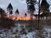
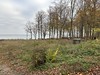
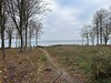
Located on the former ocean floor during the prehistoric periods of the Stone Age and Bronze are the remains of a form of stone setting. The site is officially listed as a stone setting from possibly the Iron Age. A circle of 13 stones are seen on a natural sandbank. The sandbank measures about 1,5 metres in height with the diameter of the circle being about 5,5 metres.
More information here: Fortidsminde 253011
You may be viewing yesterday's version of this page. To see the most up to date information please register for a free account.
")
")
")
")
Do not use the above information on other web sites or publications without permission of the contributor.
Nearby Images from Flickr
The above images may not be of the site on this page, but were taken nearby. They are loaded from Flickr so please click on them for image credits.
Click here to see more info for this site
Nearby sites
Click here to view sites on an interactive map of the areaKey: Red: member's photo, Blue: 3rd party photo, Yellow: other image, Green: no photo - please go there and take one, Grey: site destroyed
Download sites to:
KML (Google Earth)
GPX (GPS waypoints)
CSV (Garmin/Navman)
CSV (Excel)
To unlock full downloads you need to sign up as a Contributory Member. Otherwise downloads are limited to 50 sites.
Turn off the page maps and other distractions
Nearby sites listing. In the following links * = Image available
89m SW 228° Hornbæk Plantage Rundhøj 7* Round Barrow(s)
136m WSW 258° Hornbæk Plantage Gravrøse 1* Cairn
171m W 264° Hornbæk Plantage Rundhøj 6* Round Barrow(s)
305m SE 142° Hornbæk Plantage Rundhøj 8* Round Barrow(s)
338m W 268° Hornbæk Plantage Langdysse 2* Long Barrow
342m ESE 111° Hornbæk Plantage Rundhøj 9* Round Barrow(s)
1.1km W 273° Hornbæk Plantage Rundhøj 5* Round Barrow(s)
1.3km W 264° Hornbæk Plantage Runddysse* Burial Chamber or Dolmen
1.3km W 274° Hornbæk Plantage Rundhøj 4* Round Barrow(s)
1.3km W 274° Hornbæk Plantage Rundhøj 3* Round Barrow(s)
1.3km W 274° Hornbæk Plantage Rundhøj 2* Round Barrow(s)
1.5km W 261° Hornbæk Plantage Rundhøj 1* Round Barrow(s)
1.5km W 261° Hornbæk Plantage skåltegn* Rock Art
1.6km W 270° Hornbæk Plantage Langdysse 3* Long Barrow
1.7km W 273° Hornbæk Plantage Langdysse 1* Long Barrow
3.5km SSW 202° Munkhøi* Cairn
3.6km SSW 192° Borsholm Runddysse* Burial Chamber or Dolmen
3.6km SW 236° Risby Vang Runddysse* Burial Chamber or Dolmen
3.7km S 189° Horserød Runddysse* Burial Chamber or Dolmen
3.9km SW 233° Klosterriis Hegn Langdysse 2* Long Barrow
4.2km SW 219° Klosterriis Hegn Langdysse 1* Long Barrow
4.3km SSW 213° Risby Vang Langdysse 1* Long Barrow
4.3km SSW 213° Risby Vang Megalitgrav* Burial Chamber or Dolmen
4.3km SSW 213° Risby Vang Jættestue* Passage Grave
4.6km WSW 254° Horneby Langdysse* Long Barrow
View more nearby sites and additional images


 We would like to know more about this location. Please feel free to add a brief description and any relevant information in your own language.
 Wir möchten mehr über diese Stätte erfahren. Bitte zögern Sie nicht, eine kurze Beschreibung und relevante Informationen in Deutsch hinzuzufügen.
 Nous aimerions en savoir encore un peu sur les lieux. S'il vous plaît n'hesitez pas à ajouter une courte description et tous les renseignements pertinents dans votre propre langue.
 Quisieramos informarnos un poco más de las lugares. No dude en añadir una breve descripción y otros datos relevantes en su propio idioma.