


<< Our Photo Pages >> Folehaven Stensætning - Ring Cairn in Denmark in Hovedstaden
Submitted by NeolithicFanatic on Sunday, 12 July 2020 Page Views: 577
Neolithic and Bronze AgeSite Name: Folehaven StensætningCountry: Denmark
NOTE: This site is 0.772 km away from the location you searched for.
County: Hovedstaden Type: Ring Cairn
Nearest Town: Hillerød Nearest Village: Rungsted
Latitude: 55.878160N Longitude: 12.521590E
Condition:
| 5 | Perfect |
| 4 | Almost Perfect |
| 3 | Reasonable but with some damage |
| 2 | Ruined but still recognisable as an ancient site |
| 1 | Pretty much destroyed, possibly visible as crop marks |
| 0 | No data. |
| -1 | Completely destroyed |
| 5 | Superb |
| 4 | Good |
| 3 | Ordinary |
| 2 | Not Good |
| 1 | Awful |
| 0 | No data. |
| 5 | Can be driven to, probably with disabled access |
| 4 | Short walk on a footpath |
| 3 | Requiring a bit more of a walk |
| 2 | A long walk |
| 1 | In the middle of nowhere, a nightmare to find |
| 0 | No data. |
| 5 | co-ordinates taken by GPS or official recorded co-ordinates |
| 4 | co-ordinates scaled from a detailed map |
| 3 | co-ordinates scaled from a bad map |
| 2 | co-ordinates of the nearest village |
| 1 | co-ordinates of the nearest town |
| 0 | no data |
Be the first person to rate this site - see the 'Contribute!' box in the right hand menu.
Internal Links:
External Links:
I have visited· I would like to visit
NeolithicFanatic has visited here
")
More information here: Fortidsminder 283051
You may be viewing yesterday's version of this page. To see the most up to date information please register for a free account.
")
")
")
Do not use the above information on other web sites or publications without permission of the contributor.
Nearby Images from Flickr
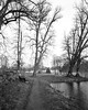

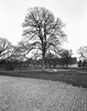
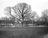
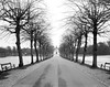
The above images may not be of the site on this page, but were taken nearby. They are loaded from Flickr so please click on them for image credits.
Click here to see more info for this site
Nearby sites
Click here to view sites on an interactive map of the areaKey: Red: member's photo, Blue: 3rd party photo, Yellow: other image, Green: no photo - please go there and take one, Grey: site destroyed
Download sites to:
KML (Google Earth)
GPX (GPS waypoints)
CSV (Garmin/Navman)
CSV (Excel)
To unlock full downloads you need to sign up as a Contributory Member. Otherwise downloads are limited to 50 sites.
Turn off the page maps and other distractions
Nearby sites listing. In the following links * = Image available
25m SSW 199° Folehaven Rundhøj 1* Round Barrow(s)
56m SSW 214° Folehaven Rundhøj 2* Round Barrow(s)
961m SSE 147° Folehaven Rundhøj 3* Round Barrow(s)
1.1km NNW 330° Vallerød Runddysse* Burial Chamber or Dolmen
1.1km SSE 154° Folehaven Rundhøj 4* Round Barrow(s)
1.4km SSW 193° Folehaven Langdysse 1* Long Barrow
1.4km SE 138° Folehaven Rundhøj 5* Round Barrow(s)
1.4km SE 138° Folehaven Rundhøj 6* Round Barrow(s)
1.5km SE 139° Folehaven Rundhøj 7* Round Barrow(s)
1.5km SSW 192° Folehaven Langdysse 3* Long Barrow
1.5km SSE 165° Folehaven Rundhøj 8* Round Barrow(s)
1.6km S 176° Folehaven Rundhøj 9* Round Barrow(s)
1.6km S 177° Folehaven Rundhøj 10* Round Barrow(s)
1.7km SSE 149° Folehaven Langdysse 2* Long Barrow
1.8km S 171° Sandbjerg Østerskov Hellekiste* Cist
1.8km SSE 167° Folehaven Langdysse 4* Long Barrow
2.3km SSE 162° Folehaven Rundhøj 11* Round Barrow(s)
2.3km SSE 161° Folehaven Rundhøj 12* Round Barrow(s)
2.9km S 187° Sandbjerg Langdysse* Long Barrow
3.8km SE 140° Vedbæk mesolithic cemetery* Ancient Village or Settlement
3.9km W 268° Nebbegård Jættestue* Passage Grave
3.9km W 268° Rævebakke Runddysse Burial Chamber or Dolmen
3.9km W 269° Sjælsø Lund Dysse (Afd. 296)* Burial Chamber or Dolmen
4.2km W 272° Holmehusets Jorder Jættestue* Passage Grave
4.3km WNW 299° Stasevang Megalitgrav* Burial Chamber or Dolmen
View more nearby sites and additional images


 We would like to know more about this location. Please feel free to add a brief description and any relevant information in your own language.
 Wir möchten mehr über diese Stätte erfahren. Bitte zögern Sie nicht, eine kurze Beschreibung und relevante Informationen in Deutsch hinzuzufügen.
 Nous aimerions en savoir encore un peu sur les lieux. S'il vous plaît n'hesitez pas à ajouter une courte description et tous les renseignements pertinents dans votre propre langue.
 Quisieramos informarnos un poco más de las lugares. No dude en añadir una breve descripción y otros datos relevantes en su propio idioma.