


<< Text Pages >> Findling vor der Steinhorst - Natural Stone / Erratic / Other Natural Feature in Germany in Mecklenburg-Western Pomerania
Submitted by KaiHofmann on Tuesday, 20 February 2018 Page Views: 581
Natural PlacesSite Name: Findling vor der SteinhorstCountry: Germany
NOTE: This site is 6.635 km away from the location you searched for.
Land: Mecklenburg-Western Pomerania Type: Natural Stone / Erratic / Other Natural Feature
Nearest Town: Rostock Nearest Village: Wesselstorf
Latitude: 53.976284N Longitude: 12.487090E
Condition:
| 5 | Perfect |
| 4 | Almost Perfect |
| 3 | Reasonable but with some damage |
| 2 | Ruined but still recognisable as an ancient site |
| 1 | Pretty much destroyed, possibly visible as crop marks |
| 0 | No data. |
| -1 | Completely destroyed |
| 5 | Superb |
| 4 | Good |
| 3 | Ordinary |
| 2 | Not Good |
| 1 | Awful |
| 0 | No data. |
| 5 | Can be driven to, probably with disabled access |
| 4 | Short walk on a footpath |
| 3 | Requiring a bit more of a walk |
| 2 | A long walk |
| 1 | In the middle of nowhere, a nightmare to find |
| 0 | No data. |
| 5 | co-ordinates taken by GPS or official recorded co-ordinates |
| 4 | co-ordinates scaled from a detailed map |
| 3 | co-ordinates scaled from a bad map |
| 2 | co-ordinates of the nearest village |
| 1 | co-ordinates of the nearest town |
| 0 | no data |
Internal Links:
External Links:
Natural Stone / Erratic / Other Natural Feature in Mecklenburg-Western Pomerania
Intersting large boulder on a hill besides an old oak.
You may be viewing yesterday's version of this page. To see the most up to date information please register for a free account.
Do not use the above information on other web sites or publications without permission of the contributor.
Nearby Images from Flickr
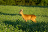
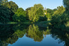
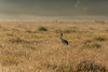
The above images may not be of the site on this page, but were taken nearby. They are loaded from Flickr so please click on them for image credits.
Click here to see more info for this site
Nearby sites
Click here to view sites on an interactive map of the areaKey: Red: member's photo, Blue: 3rd party photo, Yellow: other image, Green: no photo - please go there and take one, Grey: site destroyed
Download sites to:
KML (Google Earth)
GPX (GPS waypoints)
CSV (Garmin/Navman)
CSV (Excel)
To unlock full downloads you need to sign up as a Contributory Member. Otherwise downloads are limited to 50 sites.
Turn off the page maps and other distractions
Nearby sites listing. In the following links * = Image available
2.4km W 263° Gross Ridsenow Steingrab Hoelle* Chambered Tomb
4.5km ENE 72° Basse Steingrab Chambered Tomb
4.7km NNE 20° Vilz Steingrab* Chambered Tomb
5.3km W 260° Goritz Steingrab* Chambered Tomb
6.0km NW 314° Weitendorf-Wohrenstorf* Burial Chamber or Dolmen
6.6km NE 42° Kowalz Steingrab* Chambered Tomb
7.7km WNW 292° Cammin Steingrab* Chambered Tomb
7.8km N 352° Tessin Steingrab* Chambered Tomb
8.3km WNW 300° Forst Cammin Dolmen (2)* Burial Chamber or Dolmen
8.3km WNW 300° Forst Cammin Dolmen (1)* Burial Chamber or Dolmen
8.6km WSW 246° Schälchenstein Alt Kätwin* Rock Art
9.2km N 5° Zarnewanz Steingrab* Chambered Tomb
9.7km NNE 30° Thelkow Dolmen* Burial Chamber or Dolmen
9.7km NNE 32° Liepen Steingrab (2)* Chambered Tomb
9.9km NNE 32° Liepen Steingrab (3)* Chambered Tomb
10.0km NNE 27° Liepen Steingrab (4) Chambered Tomb
10.0km NE 36° Liepen Steingrab (1)* Chambered Tomb
10.0km NNW 345° Teutendorf Steingrab* Chambered Tomb
10.4km N 10° Gnewitz Steingrab 5* Passage Grave
10.5km NNE 26° Liepen Steingrab (5)* Chambered Tomb
10.7km N 11° Gnewitz Steingrab 6* Chambered Tomb
10.7km N 349° Stormstorf Steingrab 1* Chambered Tomb
10.8km N 350° Stormstorf Steingrab 2* Chambered Tomb
11.0km NE 54° Nustrow Steingrab 1* Chambered Tomb
11.1km NE 54° Nustrow Steingrab 2* Chambered Tomb
View more nearby sites and additional images


 We would like to know more about this location. Please feel free to add a brief description and any relevant information in your own language.
 Wir möchten mehr über diese Stätte erfahren. Bitte zögern Sie nicht, eine kurze Beschreibung und relevante Informationen in Deutsch hinzuzufügen.
 Nous aimerions en savoir encore un peu sur les lieux. S'il vous plaît n'hesitez pas à ajouter une courte description et tous les renseignements pertinents dans votre propre langue.
 Quisieramos informarnos un poco más de las lugares. No dude en añadir una breve descripción y otros datos relevantes en su propio idioma.