


<< Our Photo Pages >> Schälchenstein Alt Kätwin - Rock Art in Germany in Mecklenburg-Western Pomerania
Submitted by weldersdog- on Wednesday, 21 February 2024 Page Views: 35
Rock ArtSite Name: Schälchenstein Alt KätwinCountry: Germany
NOTE: This site is 3.536 km away from the location you searched for.
Land: Mecklenburg-Western Pomerania Type: Rock Art
Nearest Town: Schwaan
Latitude: 53.944860N Longitude: 12.366500E
Condition:
| 5 | Perfect |
| 4 | Almost Perfect |
| 3 | Reasonable but with some damage |
| 2 | Ruined but still recognisable as an ancient site |
| 1 | Pretty much destroyed, possibly visible as crop marks |
| 0 | No data. |
| -1 | Completely destroyed |
| 5 | Superb |
| 4 | Good |
| 3 | Ordinary |
| 2 | Not Good |
| 1 | Awful |
| 0 | No data. |
| 5 | Can be driven to, probably with disabled access |
| 4 | Short walk on a footpath |
| 3 | Requiring a bit more of a walk |
| 2 | A long walk |
| 1 | In the middle of nowhere, a nightmare to find |
| 0 | No data. |
| 5 | co-ordinates taken by GPS or official recorded co-ordinates |
| 4 | co-ordinates scaled from a detailed map |
| 3 | co-ordinates scaled from a bad map |
| 2 | co-ordinates of the nearest village |
| 1 | co-ordinates of the nearest town |
| 0 | no data |
Internal Links:
External Links:
")
A very distinctive cup marked stone in a beautyful forrest. If the stone is in its original position is not clear.
You may be viewing yesterday's version of this page. To see the most up to date information please register for a free account.
Do not use the above information on other web sites or publications without permission of the contributor.
Nearby Images from Flickr
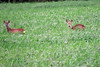
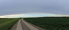
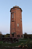
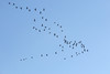
The above images may not be of the site on this page, but were taken nearby. They are loaded from Flickr so please click on them for image credits.
Click here to see more info for this site
Nearby sites
Click here to view sites on an interactive map of the areaKey: Red: member's photo, Blue: 3rd party photo, Yellow: other image, Green: no photo - please go there and take one, Grey: site destroyed
Download sites to:
KML (Google Earth)
GPX (GPS waypoints)
CSV (Garmin/Navman)
CSV (Excel)
To unlock full downloads you need to sign up as a Contributory Member. Otherwise downloads are limited to 50 sites.
Turn off the page maps and other distractions
Nearby sites listing. In the following links * = Image available
3.7km SW 228° Kronskamp Chambered Tomb
3.7km NE 46° Goritz Steingrab* Chambered Tomb
6.4km ENE 60° Gross Ridsenow Steingrab Hoelle* Chambered Tomb
6.5km N 7° Cammin Steingrab* Chambered Tomb
7.6km N 5° Forst Cammin Dolmen (2)* Burial Chamber or Dolmen
7.7km N 5° Forst Cammin Dolmen (1)* Burial Chamber or Dolmen
8.4km S 176° Dieckhof Steingrab* Chambered Tomb
8.5km NNE 25° Weitendorf-Wohrenstorf* Burial Chamber or Dolmen
8.6km ENE 66° Findling vor der Steinhorst Natural Stone / Erratic / Other Natural Feature
8.7km SSW 201° Recknitz Hügelgrab* Artificial Mound
9.7km SSW 198° Recknitz Chambered Tomb
10.3km S 185° Plaaz Dolmen* Chambered Tomb
11.5km S 172° Hügelgrab Lüningsdorf* Round Barrow(s)
12.4km NE 50° Vilz Steingrab* Chambered Tomb
13.1km ENE 68° Basse Steingrab Chambered Tomb
13.1km NNE 31° Tessin Steingrab* Chambered Tomb
14.1km NNE 22° Teutendorf Steingrab* Chambered Tomb
14.9km NE 56° Kowalz Steingrab* Chambered Tomb
15.2km NNE 22° Stormstorf Steingrab 1* Chambered Tomb
15.3km NE 35° Zarnewanz Steingrab* Chambered Tomb
15.4km NNE 23° Stormstorf Steingrab 2* Chambered Tomb
16.9km NE 35° Gnewitz Steingrab 5* Passage Grave
17.1km NE 35° Gnewitz Steingrab 6* Chambered Tomb
17.4km NE 47° Thelkow Dolmen* Burial Chamber or Dolmen
17.5km NE 45° Liepen Steingrab (4) Chambered Tomb
View more nearby sites and additional images


 We would like to know more about this location. Please feel free to add a brief description and any relevant information in your own language.
 Wir möchten mehr über diese Stätte erfahren. Bitte zögern Sie nicht, eine kurze Beschreibung und relevante Informationen in Deutsch hinzuzufügen.
 Nous aimerions en savoir encore un peu sur les lieux. S'il vous plaît n'hesitez pas à ajouter une courte description et tous les renseignements pertinents dans votre propre langue.
 Quisieramos informarnos un poco más de las lugares. No dude en añadir una breve descripción y otros datos relevantes en su propio idioma.