


<< Our Photo Pages >> Stormstorf Steingrab 1 - Chambered Tomb in Germany in Mecklenburg-Western Pomerania
Submitted by stollentroll on Tuesday, 20 December 2005 Page Views: 2240
Neolithic and Bronze AgeSite Name: Stormstorf Steingrab 1 Alternative Name: Sprockhoff 344, JudenkirchhofCountry: Germany
NOTE: This site is 12.278 km away from the location you searched for.
Land: Mecklenburg-Western Pomerania Type: Chambered Tomb
Nearest Town: Rostock Nearest Village: Stormstorf
Latitude: 54.071170N Longitude: 12.455640E
Condition:
| 5 | Perfect |
| 4 | Almost Perfect |
| 3 | Reasonable but with some damage |
| 2 | Ruined but still recognisable as an ancient site |
| 1 | Pretty much destroyed, possibly visible as crop marks |
| 0 | No data. |
| -1 | Completely destroyed |
| 5 | Superb |
| 4 | Good |
| 3 | Ordinary |
| 2 | Not Good |
| 1 | Awful |
| 0 | No data. |
| 5 | Can be driven to, probably with disabled access |
| 4 | Short walk on a footpath |
| 3 | Requiring a bit more of a walk |
| 2 | A long walk |
| 1 | In the middle of nowhere, a nightmare to find |
| 0 | No data. |
| 5 | co-ordinates taken by GPS or official recorded co-ordinates |
| 4 | co-ordinates scaled from a detailed map |
| 3 | co-ordinates scaled from a bad map |
| 2 | co-ordinates of the nearest village |
| 1 | co-ordinates of the nearest town |
| 0 | no data |
Internal Links:
External Links:
")
chambered tomb, 200 Meters north of a modern cemetery.
You may be viewing yesterday's version of this page. To see the most up to date information please register for a free account.
")
")
Do not use the above information on other web sites or publications without permission of the contributor.
Nearby Images from Flickr
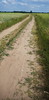
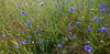
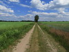
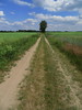
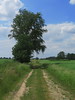
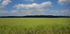
The above images may not be of the site on this page, but were taken nearby. They are loaded from Flickr so please click on them for image credits.
Click here to see more info for this site
Nearby sites
Click here to view sites on an interactive map of the areaKey: Red: member's photo, Blue: 3rd party photo, Yellow: other image, Green: no photo - please go there and take one, Grey: site destroyed
Download sites to:
KML (Google Earth)
GPX (GPS waypoints)
CSV (Garmin/Navman)
CSV (Excel)
To unlock full downloads you need to sign up as a Contributory Member. Otherwise downloads are limited to 50 sites.
Turn off the page maps and other distractions
Nearby sites listing. In the following links * = Image available
246m ENE 70° Stormstorf Steingrab 2* Chambered Tomb
1.1km SSW 212° Teutendorf Steingrab* Chambered Tomb
3.0km SSE 162° Tessin Steingrab* Chambered Tomb
3.0km NE 55° Barkvieren Steingrab 1* Chambered Tomb
3.2km ESE 116° Zarnewanz Steingrab* Chambered Tomb
3.3km NE 56° Barkvieren Steingrab 2* Chambered Tomb
3.4km NNE 33° Barkvieren Steingrab 3* Long Barrow
3.6km NE 55° Hügelgrab Barkvieren* Round Barrow(s)
4.0km E 94° Gnewitz Steingrab 5* Passage Grave
4.1km E 91° Gnewitz Steingrab 6* Chambered Tomb
4.6km E 86° Gnewitz Steingrab 1* Long Barrow
4.7km E 87° Gnewitz Steingrab 2* Long Barrow
4.8km E 87° Gnewitz Steingrab 3* Burial Chamber or Dolmen
4.8km E 87° Gnewitz Steingrab 4* Long Barrow
6.4km ENE 61° Koelzow Huegelgrab Round Barrow(s)
6.7km ESE 104° Liepen Steingrab (4) Chambered Tomb
6.7km SSW 200° Weitendorf-Wohrenstorf* Burial Chamber or Dolmen
6.7km E 99° Liepen Steingrab (5)* Chambered Tomb
7.2km SSE 149° Vilz Steingrab* Chambered Tomb
7.2km ESE 107° Thelkow Dolmen* Burial Chamber or Dolmen
7.6km ESE 108° Liepen Steingrab (2)* Chambered Tomb
7.6km ESE 106° Liepen Steingrab (3)* Chambered Tomb
7.9km E 96° Liepen Steingrab (6)* Chambered Tomb
8.0km E 95° Liepen Steingrab (17)* Chambered Tomb
8.2km SW 219° Forst Cammin Dolmen (1)* Burial Chamber or Dolmen
View more nearby sites and additional images


 We would like to know more about this location. Please feel free to add a brief description and any relevant information in your own language.
 Wir möchten mehr über diese Stätte erfahren. Bitte zögern Sie nicht, eine kurze Beschreibung und relevante Informationen in Deutsch hinzuzufügen.
 Nous aimerions en savoir encore un peu sur les lieux. S'il vous plaît n'hesitez pas à ajouter une courte description et tous les renseignements pertinents dans votre propre langue.
 Quisieramos informarnos un poco más de las lugares. No dude en añadir una breve descripción y otros datos relevantes en su propio idioma.