


<< Our Photo Pages >> Mount Cimino Votive Site - Ancient Temple in Italy in Lazio/Roma
Submitted by bat400 on Monday, 16 April 2012 Page Views: 5295
Roman, Greek and ClassicalSite Name: Mount Cimino Votive SiteCountry: Italy Region: Lazio/Roma Type: Ancient Temple
Nearest Town: Viterbo Nearest Village: Soriano nel Cimino
Latitude: 42.410000N Longitude: 12.200000E
Condition:
| 5 | Perfect |
| 4 | Almost Perfect |
| 3 | Reasonable but with some damage |
| 2 | Ruined but still recognisable as an ancient site |
| 1 | Pretty much destroyed, possibly visible as crop marks |
| 0 | No data. |
| -1 | Completely destroyed |
| 5 | Superb |
| 4 | Good |
| 3 | Ordinary |
| 2 | Not Good |
| 1 | Awful |
| 0 | No data. |
| 5 | Can be driven to, probably with disabled access |
| 4 | Short walk on a footpath |
| 3 | Requiring a bit more of a walk |
| 2 | A long walk |
| 1 | In the middle of nowhere, a nightmare to find |
| 0 | No data. |
| 5 | co-ordinates taken by GPS or official recorded co-ordinates |
| 4 | co-ordinates scaled from a detailed map |
| 3 | co-ordinates scaled from a bad map |
| 2 | co-ordinates of the nearest village |
| 1 | co-ordinates of the nearest town |
| 0 | no data |
Be the first person to rate this site - see the 'Contribute!' box in the right hand menu.
Internal Links:
External Links:
")
A number of materials were linked to cult fires and "clear evidence of votive offerings," Professor Andrea Cardarelli (La Sapienza University, Rome) said.
Note: Mountaintop Etruscan Site excavated
You may be viewing yesterday's version of this page. To see the most up to date information please register for a free account.
Do not use the above information on other web sites or publications without permission of the contributor.
Nearby Images from Flickr
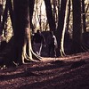
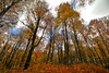
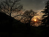
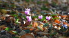
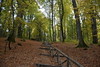
The above images may not be of the site on this page, but were taken nearby. They are loaded from Flickr so please click on them for image credits.
Click here to see more info for this site
Nearby sites
Click here to view sites on an interactive map of the areaKey: Red: member's photo, Blue: 3rd party photo, Yellow: other image, Green: no photo - please go there and take one, Grey: site destroyed
Download sites to:
KML (Google Earth)
GPX (GPS waypoints)
CSV (Garmin/Navman)
CSV (Excel)
To unlock full downloads you need to sign up as a Contributory Member. Otherwise downloads are limited to 50 sites.
Turn off the page maps and other distractions
Nearby sites listing. In the following links * = Image available
9.4km NNE 33° Bomarzo Etruscan 'Pyramid' Altar* Ancient Temple
18.9km SSW 211° Barbarano Romano Etruscan Necropolis Chambered Tomb
19.1km S 173° Sutri Necropolis* Rock Cut Tomb
19.2km S 173° Sutri amphitheatre* Ancient Village or Settlement
20.7km SW 228° Pian di Vescovo Rock Cut Tomb
22.4km WSW 249° Norchia Etruscan Necropolis* Rock Cut Tomb
25.7km SW 216° Civitella Cesi Etruscan Tomb* Rock Cut Tomb
26.2km SW 218° Casale Vignale Necropolis Chambered Cairn
35.2km W 270° San Giulano Rock Cut tombs Rock Cut Tomb
35.4km NNW 348° Necropoli del Crocifisso del Tufo Rock Cut Tomb
36.8km WSW 243° Tarquinia* Ancient Village or Settlement
38.9km NE 49° Carsulae Ancient Village or Settlement
45.6km S 190° Cerveteri Necropoli della Banditaceia* Rock Cut Tomb
47.6km NW 310° Vitozza* Cave or Rock Shelter
52.7km WNW 302° Sovana Necropolis* Rock Cut Tomb
53.4km WNW 301° Tomba della Sirena* Rock Cut Tomb
53.6km WNW 301° Via cava di S. Sebastiano* Ancient Trackway
54.0km WNW 301° Via Cava di Poggio Prisca* Ancient Trackway
54.0km WNW 301° Ildebranda Tomb* Rock Cut Tomb
59.8km SSE 159° Gregorian Etruscan Museum* Museum
60.0km SSE 158° Heliopolis Seti I Piazza del Popolo Obelisk* Standing Stone (Menhir)
61.4km SSE 158° Sais - Piazza Minerva Obelisk* Standing Stone (Menhir)
61.6km SSE 156° Heliopolis Ramesses II Termini Obelisk* Standing Stone (Menhir)
61.8km SSE 158° Lupercale Shrine* Cave or Rock Shelter
62.1km SSE 158° Rome.* Ancient Village or Settlement
View more nearby sites and additional images

")
 We would like to know more about this location. Please feel free to add a brief description and any relevant information in your own language.
 Wir möchten mehr über diese Stätte erfahren. Bitte zögern Sie nicht, eine kurze Beschreibung und relevante Informationen in Deutsch hinzuzufügen.
 Nous aimerions en savoir encore un peu sur les lieux. S'il vous plaît n'hesitez pas à ajouter une courte description et tous les renseignements pertinents dans votre propre langue.
 Quisieramos informarnos un poco más de las lugares. No dude en añadir una breve descripción y otros datos relevantes en su propio idioma.