 with our Megalithic Portal iPhone app")


<< Text Pages >> Hascherkeller Siedlung - Ancient Village or Settlement in Germany in Bavaria
Submitted by AlexHunger on Saturday, 18 February 2006 Page Views: 5882
Multi-periodSite Name: Hascherkeller SiedlungCountry: Germany
NOTE: This site is 3.266 km away from the location you searched for.
Land: Bavaria Type: Ancient Village or Settlement
Nearest Town: München Nearest Village: Landshut
Latitude: 48.560780N Longitude: 12.131060E
Condition:
| 5 | Perfect |
| 4 | Almost Perfect |
| 3 | Reasonable but with some damage |
| 2 | Ruined but still recognisable as an ancient site |
| 1 | Pretty much destroyed, possibly visible as crop marks |
| 0 | No data. |
| -1 | Completely destroyed |
| 5 | Superb |
| 4 | Good |
| 3 | Ordinary |
| 2 | Not Good |
| 1 | Awful |
| 0 | No data. |
| 5 | Can be driven to, probably with disabled access |
| 4 | Short walk on a footpath |
| 3 | Requiring a bit more of a walk |
| 2 | A long walk |
| 1 | In the middle of nowhere, a nightmare to find |
| 0 | No data. |
| 5 | co-ordinates taken by GPS or official recorded co-ordinates |
| 4 | co-ordinates scaled from a detailed map |
| 3 | co-ordinates scaled from a bad map |
| 2 | co-ordinates of the nearest village |
| 1 | co-ordinates of the nearest town |
| 0 | no data |
Internal Links:
External Links:
Settlement in Bavaria
IMPORTANT NOTE:Site believed to be near this position at North of town. Large Iron Age fortified settlement. Outline only visible via aerial photography.
You may be viewing yesterday's version of this page. To see the most up to date information please register for a free account.
Do not use the above information on other web sites or publications without permission of the contributor.
Nearby Images from Flickr
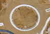
The above images may not be of the site on this page, but were taken nearby. They are loaded from Flickr so please click on them for image credits.
Click here to see more info for this site
Nearby sites
Click here to view sites on an interactive map of the areaKey: Red: member's photo, Blue: 3rd party photo, Yellow: other image, Green: no photo - please go there and take one, Grey: site destroyed
Download sites to:
KML (Google Earth)
GPX (GPS waypoints)
CSV (Garmin/Navman)
CSV (Excel)
To unlock full downloads you need to sign up as a Contributory Member. Otherwise downloads are limited to 50 sites.
Turn off the page maps and other distractions
Nearby sites listing. In the following links * = Image available
3.5km ENE 58° Ergolding Siedlung Ancient Village or Settlement
5.8km ENE 61° Altheim Siedlung Ancient Village or Settlement
7.0km NE 41° Mirskofen Siedlung Ancient Village or Settlement
14.0km SW 217° Niedererlbach Siedlung Ancient Village or Settlement
30.2km SSW 198° Grabhügel D 1-7638-0002* Round Barrow(s)
34.5km NNE 32° Geiselhöring Grabhügelfeld Barrow Cemetery
36.3km ENE 56° Hailing Keltische Viereckschanze Ancient Village or Settlement
37.4km SSW 206° Teufstetten Keltische Viereckschanzen Misc. Earthwork
39.0km NW 324° Sandharlanden Grabhügel Artificial Mound
40.8km N 355° Viereckschanze Poign* Misc. Earthwork
41.5km WSW 248° Bernstorf Ringwall Hillfort
41.6km NNW 345° Alkofen Siedlung Ancient Village or Settlement
42.3km NNE 15° Sengkofen LBK Cemetery* Barrow Cemetery
42.5km NNE 22° Riekofen Ringheiligtum Henge
43.0km NW 311° Pförring Siedlung Ancient Village or Settlement
43.2km NNW 329° Weltenburg Siedlung Ancient Village or Settlement
44.0km NNW 334° Archaeologisches Museum Kelheim Museum
44.2km NW 310° Ettling Siedlung Ancient Village or Settlement
44.7km NE 41° Alburg Siedlung Ancient Village or Settlement
44.7km NNW 333° Oppidum Alkimoennis Ancient Village or Settlement
44.8km NNW 332° Erzgrubenfeld Michelsberg Ancient Mine, Quarry or other Industry
45.0km W 266° Summstein Pfaffenhofen an der Ilm Modern Stone Circle etc
45.0km NW 310° Kelsbachquellen Holy Well or Sacred Spring
45.2km SW 232° Neufahrn Ringheiligtum* Henge
45.7km ENE 73° Oberframmering Siedlung Ancient Village or Settlement
View more nearby sites and additional images


 We would like to know more about this location. Please feel free to add a brief description and any relevant information in your own language.
 Wir möchten mehr über diese Stätte erfahren. Bitte zögern Sie nicht, eine kurze Beschreibung und relevante Informationen in Deutsch hinzuzufügen.
 Nous aimerions en savoir encore un peu sur les lieux. S'il vous plaît n'hesitez pas à ajouter une courte description et tous les renseignements pertinents dans votre propre langue.
 Quisieramos informarnos un poco más de las lugares. No dude en añadir una breve descripción y otros datos relevantes en su propio idioma.