


<< Text Pages >> Necropoli del Crocifisso del Tufo - Rock Cut Tomb in Italy in Umbria
Submitted by AlexHunger on Saturday, 09 February 2008 Page Views: 4152
Multi-periodSite Name: Necropoli del Crocifisso del Tufo Alternative Name: Orvieto tombsCountry: Italy
NOTE: This site is 13.556 km away from the location you searched for.
Region: Umbria Type: Rock Cut Tomb
Nearest Town: Perugia Nearest Village: Orvieto
Latitude: 42.721133N Longitude: 12.106161E
Condition:
| 5 | Perfect |
| 4 | Almost Perfect |
| 3 | Reasonable but with some damage |
| 2 | Ruined but still recognisable as an ancient site |
| 1 | Pretty much destroyed, possibly visible as crop marks |
| 0 | No data. |
| -1 | Completely destroyed |
| 5 | Superb |
| 4 | Good |
| 3 | Ordinary |
| 2 | Not Good |
| 1 | Awful |
| 0 | No data. |
| 5 | Can be driven to, probably with disabled access |
| 4 | Short walk on a footpath |
| 3 | Requiring a bit more of a walk |
| 2 | A long walk |
| 1 | In the middle of nowhere, a nightmare to find |
| 0 | No data. |
| 5 | co-ordinates taken by GPS or official recorded co-ordinates |
| 4 | co-ordinates scaled from a detailed map |
| 3 | co-ordinates scaled from a bad map |
| 2 | co-ordinates of the nearest village |
| 1 | co-ordinates of the nearest town |
| 0 | no data |
Internal Links:
External Links:
Rock Cut Tombs in Umbria
Etruscan tombs north of fortified town dating back to Villanova culture around 11th century BCE.
You may be viewing yesterday's version of this page. To see the most up to date information please register for a free account.
Do not use the above information on other web sites or publications without permission of the contributor.
Nearby Images from Flickr
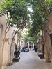
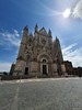
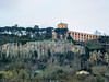
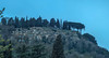
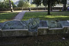
The above images may not be of the site on this page, but were taken nearby. They are loaded from Flickr so please click on them for image credits.
Click here to see more info for this site
Nearby sites
Click here to view sites on an interactive map of the areaKey: Red: member's photo, Blue: 3rd party photo, Yellow: other image, Green: no photo - please go there and take one, Grey: site destroyed
Download sites to:
KML (Google Earth)
GPX (GPS waypoints)
CSV (Garmin/Navman)
CSV (Excel)
To unlock full downloads you need to sign up as a Contributory Member. Otherwise downloads are limited to 50 sites.
Turn off the page maps and other distractions
Nearby sites listing. In the following links * = Image available
29.3km W 262° Vitozza* Cave or Rock Shelter
29.6km SSE 154° Bomarzo Etruscan 'Pyramid' Altar* Ancient Temple
35.4km SSE 167° Mount Cimino Votive Site* Ancient Temple
35.6km NNW 327° Civic Archaeological Museum* Museum
37.8km W 259° Sovana Necropolis* Rock Cut Tomb
38.1km ESE 104° Carsulae Ancient Village or Settlement
38.8km W 259° Tomba della Sirena* Rock Cut Tomb
39.0km W 259° Via cava di S. Sebastiano* Ancient Trackway
39.2km W 260° Via Cava di Poggio Prisca* Ancient Trackway
39.3km W 260° Ildebranda Tomb* Rock Cut Tomb
44.2km SW 219° San Giulano Rock Cut tombs Rock Cut Tomb
44.6km SSW 197° Norchia Etruscan Necropolis* Rock Cut Tomb
49.1km NNE 28° The Hypogeum of the Volumni* Rock Cut Tomb
49.1km S 189° Pian di Vescovo Rock Cut Tomb
49.5km NNE 28° Perugia Arch* Stone Fort or Dun
50.9km S 182° Barbarano Romano Etruscan Necropolis Chambered Tomb
54.5km S 169° Sutri Necropolis* Rock Cut Tomb
54.6km S 169° Sutri amphitheatre* Ancient Village or Settlement
54.9km ENE 56° Hispellum* Ancient Village or Settlement
55.8km S 189° Casale Vignale Necropolis Chambered Cairn
55.9km S 188° Civitella Cesi Etruscan Tomb* Rock Cut Tomb
56.8km NE 47° Assisi Ancient Village or Settlement
57.2km SSW 206° Tarquinia* Ancient Village or Settlement
75.4km WSW 243° Cosa.* Hillfort
76.2km NW 310° Poggio Civitate Ancient Village or Settlement
View more nearby sites and additional images


 We would like to know more about this location. Please feel free to add a brief description and any relevant information in your own language.
 Wir möchten mehr über diese Stätte erfahren. Bitte zögern Sie nicht, eine kurze Beschreibung und relevante Informationen in Deutsch hinzuzufügen.
 Nous aimerions en savoir encore un peu sur les lieux. S'il vous plaît n'hesitez pas à ajouter une courte description et tous les renseignements pertinents dans votre propre langue.
 Quisieramos informarnos un poco más de las lugares. No dude en añadir una breve descripción y otros datos relevantes en su propio idioma.