

<< Text Pages >> Schwedenschanze Horst - Hillfort in Germany in Brandenburg, Berlin
Submitted by KaiHofmann on Wednesday, 11 September 2013 Page Views: 1061
Iron Age and Later PrehistorySite Name: Schwedenschanze HorstCountry: Germany
NOTE: This site is 9.702 km away from the location you searched for.
Land: Brandenburg, Berlin Type: Hillfort
Nearest Town: Pritzwalk Nearest Village: Horst
Latitude: 53.163131N Longitude: 12.063535E
Condition:
| 5 | Perfect |
| 4 | Almost Perfect |
| 3 | Reasonable but with some damage |
| 2 | Ruined but still recognisable as an ancient site |
| 1 | Pretty much destroyed, possibly visible as crop marks |
| 0 | No data. |
| -1 | Completely destroyed |
| 5 | Superb |
| 4 | Good |
| 3 | Ordinary |
| 2 | Not Good |
| 1 | Awful |
| 0 | No data. |
| 5 | Can be driven to, probably with disabled access |
| 4 | Short walk on a footpath |
| 3 | Requiring a bit more of a walk |
| 2 | A long walk |
| 1 | In the middle of nowhere, a nightmare to find |
| 0 | No data. |
| 5 | co-ordinates taken by GPS or official recorded co-ordinates |
| 4 | co-ordinates scaled from a detailed map |
| 3 | co-ordinates scaled from a bad map |
| 2 | co-ordinates of the nearest village |
| 1 | co-ordinates of the nearest town |
| 0 | no data |
Be the first person to rate this site - see the 'Contribute!' box in the right hand menu.
Internal Links:
External Links:
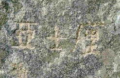
Bronze-age hillfort, later re-used by the slavonic settlers.
You may be viewing yesterday's version of this page. To see the most up to date information please register for a free account.
Do not use the above information on other web sites or publications without permission of the contributor.
Nearby Images from Flickr
The above images may not be of the site on this page, but were taken nearby. They are loaded from Flickr so please click on them for image credits.
Click here to see more info for this site
Nearby sites
Click here to view sites on an interactive map of the areaKey: Red: member's photo, Blue: 3rd party photo, Yellow: other image, Green: no photo - please go there and take one, Grey: site destroyed
Download sites to:
KML (Google Earth)
GPX (GPS waypoints)
CSV (Garmin/Navman)
CSV (Excel)
To unlock full downloads you need to sign up as a Contributory Member. Otherwise downloads are limited to 50 sites.
Turn off the page maps and other distractions
Nearby sites listing. In the following links * = Image available
2.2km WSW 250° Teufelsberg* Stone Circle
4.2km SW 227° Opferstein Wolfshagen* Natural Stone / Erratic / Other Natural Feature
6.7km WSW 243° Königsgrab von Seddin* Round Barrow(s)
14.9km ENE 71° Brotsteine Chambered Tomb
17.4km SSW 200° Riesenstein Ponitz Rock Art
18.0km SE 142° Dannenwalde Huegelgraeber Barrow Cemetery
20.6km W 268° Schalenstein Karstaedt Rock Art
20.8km E 81° Zaatzke Grabhuegelfeld Barrow Cemetery
22.3km N 4° Wahlstorf Chambered Tomb
22.4km NNW 336° Marlow Huegelgrab Round Barrow(s)
24.1km N 4° Wilsen Steingrab* Chambered Tomb
24.3km SE 128° Blutstein Natural Stone / Erratic / Other Natural Feature
25.6km E 86° Jabel Burgwall Ancient Village or Settlement
28.0km NNW 346° Siggelkow Steingrab* Chambered Tomb
28.4km NNW 340° Neuburg Steingrab Chambered Tomb
29.3km NNE 18° Forst Sandkrug Steingrab 3 Chambered Tomb
29.4km NNE 28° Twietfort Steingrab 1* Burial Chamber or Dolmen
29.4km NNE 28° Twietfort Steingrab 2* Chambered Tomb
29.5km NNE 33° Stuer Steingrab 1 Long Barrow
29.7km NE 34° Stuer Steingrab 2* Long Barrow
29.8km NE 37° Stuer Steingrab 3* Long Barrow
29.8km NE 37° Stuer Steingrab 4* Chambered Tomb
30.1km NE 39° Stuer Steingrab 5* Long Barrow
30.2km NE 34° Stuer Steingrab 7* Chambered Tomb
30.4km ENE 68° Wredenhagen (1) Chambered Tomb
View more nearby sites and additional images


 We would like to know more about this location. Please feel free to add a brief description and any relevant information in your own language.
 Wir möchten mehr über diese Stätte erfahren. Bitte zögern Sie nicht, eine kurze Beschreibung und relevante Informationen in Deutsch hinzuzufügen.
 Nous aimerions en savoir encore un peu sur les lieux. S'il vous plaît n'hesitez pas à ajouter une courte description et tous les renseignements pertinents dans votre propre langue.
 Quisieramos informarnos un poco más de las lugares. No dude en añadir una breve descripción y otros datos relevantes en su propio idioma.