


<< Our Photo Pages >> White Horse Temple - Ancient Temple in China
Submitted by DrewParsons on Thursday, 08 July 2010 Page Views: 4705
Multi-periodSite Name: White Horse Temple Alternative Name: 白马寺 ; 白馬寺 ; Báimǎ SìCountry: China
NOTE: This site is 3.874 km away from the location you searched for.
Type: Ancient Temple
Nearest Town: Luoyang
Latitude: 34.721000N Longitude: 112.642000E
Condition:
| 5 | Perfect |
| 4 | Almost Perfect |
| 3 | Reasonable but with some damage |
| 2 | Ruined but still recognisable as an ancient site |
| 1 | Pretty much destroyed, possibly visible as crop marks |
| 0 | No data. |
| -1 | Completely destroyed |
| 5 | Superb |
| 4 | Good |
| 3 | Ordinary |
| 2 | Not Good |
| 1 | Awful |
| 0 | No data. |
| 5 | Can be driven to, probably with disabled access |
| 4 | Short walk on a footpath |
| 3 | Requiring a bit more of a walk |
| 2 | A long walk |
| 1 | In the middle of nowhere, a nightmare to find |
| 0 | No data. |
| 5 | co-ordinates taken by GPS or official recorded co-ordinates |
| 4 | co-ordinates scaled from a detailed map |
| 3 | co-ordinates scaled from a bad map |
| 2 | co-ordinates of the nearest village |
| 1 | co-ordinates of the nearest town |
| 0 | no data |
Internal Links:
External Links:
I have visited· I would like to visit
DrewParsons has visited here
")
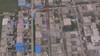
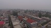
The White Horse Temple in Luoyang is considered to be the first Buddhist Temple in China. It was built in 68 AD to commemorate the introduction of Buddhism to the country. Four years earlier Emperor Ming of the Eastern Han Dynasty had sent two envoys to research Buddhism in the Indian subcontinent. During their extended travels they met two Indian monks in Afghanistan who agreed to accompany them back to Luoyang and assist in introducing Buddhism to China. After three years away they and the Indian monks - She Moteng and Zhu Falan (their adopted Chinese names) arrived in Luoyang travelling with either one or two white horses (depending on the version of the story you believe) carrying Buddhist carvings and writings. It is after the white horse(s) that the temple is named. Commissioned by the emperor, it became a centre of learning where the Indian monks translated the Buddhist sutras into Chinese and propagated the religion. The temple is located about 12 kilometres east of the city centre and is famous across China.
You may be viewing yesterday's version of this page. To see the most up to date information please register for a free account.
")
Do not use the above information on other web sites or publications without permission of the contributor.
Nearby Images from Flickr


The above images may not be of the site on this page, but were taken nearby. They are loaded from Flickr so please click on them for image credits.
Click here to see more info for this site
Nearby sites
Click here to view sites on an interactive map of the areaKey: Red: member's photo, Blue: 3rd party photo, Yellow: other image, Green: no photo - please go there and take one, Grey: site destroyed
Download sites to:
KML (Google Earth)
GPX (GPS waypoints)
CSV (Garmin/Navman)
CSV (Excel)
To unlock full downloads you need to sign up as a Contributory Member. Otherwise downloads are limited to 50 sites.
Turn off the page maps and other distractions
Nearby sites listing. In the following links * = Image available
5.4km SE 124° Erlitou Ancient Village or Settlement
17.8km WSW 249° Luoyang Museum* Museum
19.3km WSW 253° Longshan Neolithic Site Ancient Village or Settlement
24.0km SW 219° Longmen Caves* Sculptured Stone
216.8km NE 45° Ancient City of Anyang Ancient Village or Settlement
230.7km WSW 240° Yangce Rock Art Rock Art
288.4km SSW 199° Gucheng ancient tombs* Burial Chamber or Dolmen
307.9km NNE 32° Xiqianliu Burial Chamber or Dolmen
310.7km W 264° Terracotta Army* Artificial Mound
332.8km W 262° Banpo Ancient Village or Settlement
339.6km W 266° An Ling Pyramid Pyramid / Mastaba
340.2km W 266° Yang Ling Pyramid Pyramid / Mastaba
342.8km W 262° Shaanxi History Museum* Museum
343.1km W 266° Chinese Pyramid (53) Pyramid / Mastaba
344.9km W 260° Zhang's tomb, Weiqu Burial Chamber or Dolmen
345.8km W 266° Chang Ling Pyramid Pyramid / Mastaba
346.2km W 266° Lühou Ling Pyramid Pyramid / Mastaba
348.4km W 266° Chinese Pyramid (52) Pyramid / Mastaba
348.6km W 266° Chinese Pyramid (51) Pyramid / Mastaba
349.3km W 263° Silk Road, North China* Ancient Trackway
349.5km W 266° Chinese Pyramid (50) Pyramid / Mastaba
349.9km W 266° Chinese Pyramid (49) Pyramid / Mastaba
356.1km W 265° Chinese Pyramid (22) Pyramid / Mastaba
356.8km W 265° Tai Ling Pyramid Pyramid / Mastaba
357.3km W 265° Chinese Pyramid (21) Pyramid / Mastaba
View more nearby sites and additional images


 We would like to know more about this location. Please feel free to add a brief description and any relevant information in your own language.
 Wir möchten mehr über diese Stätte erfahren. Bitte zögern Sie nicht, eine kurze Beschreibung und relevante Informationen in Deutsch hinzuzufügen.
 Nous aimerions en savoir encore un peu sur les lieux. S'il vous plaît n'hesitez pas à ajouter une courte description et tous les renseignements pertinents dans votre propre langue.
 Quisieramos informarnos un poco más de las lugares. No dude en añadir una breve descripción y otros datos relevantes en su propio idioma.