


<< Our Photo Pages >> Kongstadjordet - Cairn in Norway in Hedmark
Submitted by kenntha88 on Thursday, 14 October 2021 Page Views: 178
Neolithic and Bronze AgeSite Name: KongstadjordetCountry: Norway
NOTE: This site is 93.473 km away from the location you searched for.
Fylke: Hedmark Type: Cairn
Nearest Town: Hamar Nearest Village: Løten
Latitude: 60.831858N Longitude: 11.357680E
Condition:
| 5 | Perfect |
| 4 | Almost Perfect |
| 3 | Reasonable but with some damage |
| 2 | Ruined but still recognisable as an ancient site |
| 1 | Pretty much destroyed, possibly visible as crop marks |
| 0 | No data. |
| -1 | Completely destroyed |
| 5 | Superb |
| 4 | Good |
| 3 | Ordinary |
| 2 | Not Good |
| 1 | Awful |
| 0 | No data. |
| 5 | Can be driven to, probably with disabled access |
| 4 | Short walk on a footpath |
| 3 | Requiring a bit more of a walk |
| 2 | A long walk |
| 1 | In the middle of nowhere, a nightmare to find |
| 0 | No data. |
| 5 | co-ordinates taken by GPS or official recorded co-ordinates |
| 4 | co-ordinates scaled from a detailed map |
| 3 | co-ordinates scaled from a bad map |
| 2 | co-ordinates of the nearest village |
| 1 | co-ordinates of the nearest town |
| 0 | no data |
Internal Links:
External Links:
")
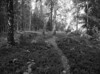
The south cairn is 14 metres in diameter and 2,5 metres in height. The cairn is overgrown with brush and smaller trees almost making details of the cairn impossible to see.
The cairn to the north is a little larger, 17 metres in diameter and 3 metres in height. It is also impossible to see trough the thicket.
You may be viewing yesterday's version of this page. To see the most up to date information please register for a free account.
")
")
Do not use the above information on other web sites or publications without permission of the contributor.
Nearby Images from Flickr
The above images may not be of the site on this page, but were taken nearby. They are loaded from Flickr so please click on them for image credits.
Click here to see more info for this site
Nearby sites
Click here to view sites on an interactive map of the areaKey: Red: member's photo, Blue: 3rd party photo, Yellow: other image, Green: no photo - please go there and take one, Grey: site destroyed
Download sites to:
KML (Google Earth)
GPX (GPS waypoints)
CSV (Garmin/Navman)
CSV (Excel)
To unlock full downloads you need to sign up as a Contributory Member. Otherwise downloads are limited to 50 sites.
Turn off the page maps and other distractions
Nearby sites listing. In the following links * = Image available
1.4km SSW 199° Løten Prestegård* Barrow Cemetery
1.8km SSW 205° Løten Kommunehus* Round Barrow(s)
1.9km W 262° Skrinhagan* Round Barrow(s)
2.1km SW 234° Veen* Stone Circle
2.2km SSW 209° Skøyen* Round Barrow(s)
2.3km SSW 207° Snipphaugen* Round Barrow(s)
2.5km SSW 199° Hommerstad-Bjørkerudveien* Cairn
2.7km WSW 253° Norderhov-Østre* Cairn
3.1km W 274° Doksrud Hillfort* Hillfort
3.5km SSW 213° Finstad-Store* Cairn
3.6km SSW 207° Ådalsbrukvegen-Finstad* Long Barrow
4.5km SSW 211° Bjørke Vestre* Round Barrow(s)
5.2km SW 222° Ådalsbruk-Løken Store* Barrow Cemetery
5.5km SW 215° Englaug Vestre* Round Barrow(s)
5.5km S 185° Ilseng* Barrow Cemetery
5.9km SW 230° Haukstad* Round Barrow(s)
6.0km SW 221° Byfeltet* Barrow Cemetery
6.4km WNW 291° Mørhaugen* Round Barrow(s)
6.6km W 278° Liberg Cairn* Cairn
8.0km W 259° Ingvoldstad Store* Round Barrow(s)
8.4km WSW 257° Hommelstadvegen* Round Barrow(s)
8.7km WSW 254° Dørumvegen* Round Barrow(s)
8.8km WSW 255° Forsøksgård-Dørum* Cairn
9.0km WSW 255° Sør-Dørum* Barrow Cemetery
9.3km WSW 258° Grindbakken* Round Barrow(s)
View more nearby sites and additional images


 We would like to know more about this location. Please feel free to add a brief description and any relevant information in your own language.
 Wir möchten mehr über diese Stätte erfahren. Bitte zögern Sie nicht, eine kurze Beschreibung und relevante Informationen in Deutsch hinzuzufügen.
 Nous aimerions en savoir encore un peu sur les lieux. S'il vous plaît n'hesitez pas à ajouter une courte description et tous les renseignements pertinents dans votre propre langue.
 Quisieramos informarnos un poco más de las lugares. No dude en añadir una breve descripción y otros datos relevantes en su propio idioma.