


<< Text Pages >> Lenzen Steingrab - Chambered Tomb in Germany in Mecklenburg-Western Pomerania
Submitted by holger_rix on Wednesday, 16 May 2012 Page Views: 2004
Neolithic and Bronze AgeSite Name: Lenzen Steingrab Alternative Name: Sprockhoff 377Country: Germany
NOTE: This site is 2.803 km away from the location you searched for.
Land: Mecklenburg-Western Pomerania Type: Chambered Tomb
Nearest Town: Güstrow Nearest Village: Lenzen
Latitude: 53.699815N Longitude: 12.009242E
Condition:
| 5 | Perfect |
| 4 | Almost Perfect |
| 3 | Reasonable but with some damage |
| 2 | Ruined but still recognisable as an ancient site |
| 1 | Pretty much destroyed, possibly visible as crop marks |
| 0 | No data. |
| -1 | Completely destroyed |
| 5 | Superb |
| 4 | Good |
| 3 | Ordinary |
| 2 | Not Good |
| 1 | Awful |
| 0 | No data. |
| 5 | Can be driven to, probably with disabled access |
| 4 | Short walk on a footpath |
| 3 | Requiring a bit more of a walk |
| 2 | A long walk |
| 1 | In the middle of nowhere, a nightmare to find |
| 0 | No data. |
| 5 | co-ordinates taken by GPS or official recorded co-ordinates |
| 4 | co-ordinates scaled from a detailed map |
| 3 | co-ordinates scaled from a bad map |
| 2 | co-ordinates of the nearest village |
| 1 | co-ordinates of the nearest town |
| 0 | no data |
Be the first person to rate this site - see the 'Contribute!' box in the right hand menu.
Internal Links:
External Links:
Chambered Tomb in Mecklenburg-Western Pomerania
Remains of a destroyed Chambered Tomb
You may be viewing yesterday's version of this page. To see the most up to date information please register for a free account.
")
Do not use the above information on other web sites or publications without permission of the contributor.
Nearby Images from Flickr
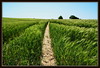

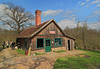
The above images may not be of the site on this page, but were taken nearby. They are loaded from Flickr so please click on them for image credits.
Click here to see more info for this site
Nearby sites
Click here to view sites on an interactive map of the areaKey: Red: member's photo, Blue: 3rd party photo, Yellow: other image, Green: no photo - please go there and take one, Grey: site destroyed
Download sites to:
KML (Google Earth)
GPX (GPS waypoints)
CSV (Garmin/Navman)
CSV (Excel)
To unlock full downloads you need to sign up as a Contributory Member. Otherwise downloads are limited to 50 sites.
Turn off the page maps and other distractions
Nearby sites listing. In the following links * = Image available
1.2km ESE 123° Lenzen Steintanz* Stone Circle
2.0km E 79° Klein Upahl Huegelgrab* Round Barrow(s)
2.0km E 79° Laehnwitz Huenenbett* Long Barrow
3.6km SSW 202° Woserin Riesenstein Natural Stone / Erratic / Other Natural Feature
4.1km SSW 210° Woserin Hügelgrab Round Barrow(s)
4.4km NNW 349° Forst Tarnow Herrenholz Steingrab 1* Chambered Tomb
5.7km N 1° Forst Tarnow Herrenholz Steingrab 2* Chambered Tomb
5.9km ESE 108° Lohmen Näpfchenstein* Rock Art
6.6km WSW 258° Hühnenmoorberg Chambered Tomb
7.0km WSW 237° Dabel Steingrab 1* Chambered Tomb
7.1km WSW 236° Dabel Steingrab 2* Chambered Tomb
7.2km NNW 345° Boitin Steingrab* Chambered Tomb
8.6km NNW 336° Kleiner Boitiner Steintanz* Stone Circle
8.8km NNW 336° Großer Boitiner Steintanz* Stone Circle
9.1km NNW 329° Boitin Grabhügel* Round Barrow(s)
9.5km WNW 296° Freilichtmuseum Groß Raden* Museum
9.9km WNW 294° Museum Groß Raden.* Museum
11.4km NW 321° Forst Tarnow Steingrab 2* Chambered Tomb
11.5km NW 320° Forst Tarnow Steingrab 1* Chambered Tomb
11.6km NW 320° Forst Tarnow Steingrab 3* Chambered Tomb
11.8km ENE 76° Bellin Steintanz* Stone Circle
12.8km ESE 103° Reimershagen Steingrab* Chambered Tomb
12.9km WNW 297° Grabhügel Groß Görnow* Round Barrow(s)
13.3km E 93° Marienhof Chambered Tomb
13.7km E 97° Hügelgrab Groß Tessin 1* Round Barrow(s)
View more nearby sites and additional images


 We would like to know more about this location. Please feel free to add a brief description and any relevant information in your own language.
 Wir möchten mehr über diese Stätte erfahren. Bitte zögern Sie nicht, eine kurze Beschreibung und relevante Informationen in Deutsch hinzuzufügen.
 Nous aimerions en savoir encore un peu sur les lieux. S'il vous plaît n'hesitez pas à ajouter une courte description et tous les renseignements pertinents dans votre propre langue.
 Quisieramos informarnos un poco más de las lugares. No dude en añadir una breve descripción y otros datos relevantes en su propio idioma.