


<< Text Pages >> Neuburg Steingrab - Chambered Tomb in Germany in Mecklenburg-Western Pomerania
Submitted by Klingon on Wednesday, 17 January 2007 Page Views: 2120
Neolithic and Bronze AgeSite Name: Neuburg SteingrabCountry: Germany
NOTE: This site is 2.496 km away from the location you searched for.
Land: Mecklenburg-Western Pomerania Type: Chambered Tomb
Nearest Town: Parchim Nearest Village: Neuburg
Latitude: 53.403200N Longitude: 11.915800E
Condition:
| 5 | Perfect |
| 4 | Almost Perfect |
| 3 | Reasonable but with some damage |
| 2 | Ruined but still recognisable as an ancient site |
| 1 | Pretty much destroyed, possibly visible as crop marks |
| 0 | No data. |
| -1 | Completely destroyed |
| 5 | Superb |
| 4 | Good |
| 3 | Ordinary |
| 2 | Not Good |
| 1 | Awful |
| 0 | No data. |
| 5 | Can be driven to, probably with disabled access |
| 4 | Short walk on a footpath |
| 3 | Requiring a bit more of a walk |
| 2 | A long walk |
| 1 | In the middle of nowhere, a nightmare to find |
| 0 | No data. |
| 5 | co-ordinates taken by GPS or official recorded co-ordinates |
| 4 | co-ordinates scaled from a detailed map |
| 3 | co-ordinates scaled from a bad map |
| 2 | co-ordinates of the nearest village |
| 1 | co-ordinates of the nearest town |
| 0 | no data |
Internal Links:
External Links:
I have visited· I would like to visit
Veronique visited on 20th Aug 2012 - their rating: Cond: -1 Nevermind, there is no grave- not even one Stone left.Sorry. I actually wanted to took a photo but it seemed to be useless to took a photo of a random site (you can`t call it even forrest) But if you like nature you might the stay anyway:)
Co-ordinates taken from a map.
You may be viewing yesterday's version of this page. To see the most up to date information please register for a free account.
Do not use the above information on other web sites or publications without permission of the contributor.
Nearby Images from Flickr
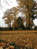
The above images may not be of the site on this page, but were taken nearby. They are loaded from Flickr so please click on them for image credits.
Click here to see more info for this site
Nearby sites
Click here to view sites on an interactive map of the areaKey: Red: member's photo, Blue: 3rd party photo, Yellow: other image, Green: no photo - please go there and take one, Grey: site destroyed
Download sites to:
KML (Google Earth)
GPX (GPS waypoints)
CSV (Garmin/Navman)
CSV (Excel)
To unlock full downloads you need to sign up as a Contributory Member. Otherwise downloads are limited to 50 sites.
Turn off the page maps and other distractions
Nearby sites listing. In the following links * = Image available
3.1km E 82° Siggelkow Steingrab* Chambered Tomb
6.2km S 173° Marlow Huegelgrab Round Barrow(s)
11.6km W 277° Sieben Sagensteine Spornitz* Stone Circle
11.9km ESE 103° Wilsen Steingrab* Chambered Tomb
12.2km ESE 111° Wahlstorf Chambered Tomb
12.3km NNW 341° Grebbin Steingrab* Chambered Tomb
12.5km NW 315° Domsuehl Steingrab 4* Chambered Tomb
12.7km NW 316° Domsuehl Steingrab 3* Chambered Tomb
13.0km NW 316° Domsuehl Steingrab 2* Chambered Tomb
13.1km NW 316° Domsuehl Steingrab 1* Chambered Tomb
14.9km NNW 331° Frauenmark Steingrab* Chambered Tomb
16.2km NNW 332° Frauenmark Langbett* Long Barrow
16.4km NW 326° Friedrichsruhe Steingrab* Chambered Tomb
16.5km NW 325° Friedrichsruhe Langbett 2* Long Barrow
16.5km NW 325° Friedrichsruhe Langbett 1* Long Barrow
18.0km E 81° Forst Sandkrug Steingrab 1* Chambered Tomb
18.8km E 86° Forst Sandkrug Steingrab 3 Chambered Tomb
19.0km E 79° Forst Sandkrug Steingrab 2 Chambered Tomb
19.5km NW 322° Goldenbow Teufelsbackofen* Chambered Tomb
22.7km NNW 331° Radepohl Langbett* Long Barrow
23.5km E 92° Twietfort Steingrab 2* Chambered Tomb
23.7km E 92° Twietfort Steingrab 1* Burial Chamber or Dolmen
26.1km E 94° Stuer Steingrab 1 Long Barrow
26.5km E 94° Stuer Steingrab 2* Long Barrow
26.8km E 93° Stuer Steingrab 7* Chambered Tomb
View more nearby sites and additional images


 We would like to know more about this location. Please feel free to add a brief description and any relevant information in your own language.
 Wir möchten mehr über diese Stätte erfahren. Bitte zögern Sie nicht, eine kurze Beschreibung und relevante Informationen in Deutsch hinzuzufügen.
 Nous aimerions en savoir encore un peu sur les lieux. S'il vous plaît n'hesitez pas à ajouter une courte description et tous les renseignements pertinents dans votre propre langue.
 Quisieramos informarnos un poco más de las lugares. No dude en añadir una breve descripción y otros datos relevantes en su propio idioma.