


<< Text Pages >> Oregård Troldhøj Jættestue - Passage Grave in Denmark in Sjælland
Submitted by Fortidsminder on Saturday, 19 June 2010 Page Views: 1795
Neolithic and Bronze AgeSite Name: Oregård Troldhøj Jættestue Alternative Name: Oregaard TroldhøiCountry: Denmark County: Sjælland Type: Passage Grave
Nearest Town: Næstved Nearest Village: Kastrup
Latitude: 55.022743N Longitude: 11.842653E
Condition:
| 5 | Perfect |
| 4 | Almost Perfect |
| 3 | Reasonable but with some damage |
| 2 | Ruined but still recognisable as an ancient site |
| 1 | Pretty much destroyed, possibly visible as crop marks |
| 0 | No data. |
| -1 | Completely destroyed |
| 5 | Superb |
| 4 | Good |
| 3 | Ordinary |
| 2 | Not Good |
| 1 | Awful |
| 0 | No data. |
| 5 | Can be driven to, probably with disabled access |
| 4 | Short walk on a footpath |
| 3 | Requiring a bit more of a walk |
| 2 | A long walk |
| 1 | In the middle of nowhere, a nightmare to find |
| 0 | No data. |
| 5 | co-ordinates taken by GPS or official recorded co-ordinates |
| 4 | co-ordinates scaled from a detailed map |
| 3 | co-ordinates scaled from a bad map |
| 2 | co-ordinates of the nearest village |
| 1 | co-ordinates of the nearest town |
| 0 | no data |
Be the first person to rate this site - see the 'Contribute!' box in the right hand menu.
Internal Links:
External Links:
Jættestue (Passage Grave) in Præstø
More information at www.kulturarv.dk: Danish Sites and Monuments Record: 050403-1
"Fortidsmindedata Copyright Kulturarvsstyrelsen"
You may be viewing yesterday's version of this page. To see the most up to date information please register for a free account.
Do not use the above information on other web sites or publications without permission of the contributor.
Nearby Images from Flickr
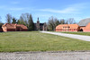
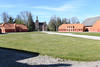
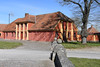

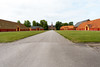
The above images may not be of the site on this page, but were taken nearby. They are loaded from Flickr so please click on them for image credits.
Click here to see more info for this site
Nearby sites
Click here to view sites on an interactive map of the areaKey: Red: member's photo, Blue: 3rd party photo, Yellow: other image, Green: no photo - please go there and take one, Grey: site destroyed
Download sites to:
KML (Google Earth)
GPX (GPS waypoints)
CSV (Garmin/Navman)
CSV (Excel)
To unlock full downloads you need to sign up as a Contributory Member. Otherwise downloads are limited to 50 sites.
Turn off the page maps and other distractions
Nearby sites listing. In the following links * = Image available
1.5km NW 314° Oreby Fredskov Runddysse* Burial Chamber or Dolmen
1.6km NW 326° Oreby Fredskov Jættestue* Passage Grave
2.2km NW 311° Knudsby Skov Langdysse 2* Long Barrow
2.3km NNW 330° Knudsby Langdysse 2* Long Barrow
2.4km NNE 17° Stuby Milehøj Jættestue* Passage Grave
3.3km NW 308° Knudsby Skov Langdysse 1* Long Barrow
3.7km NNE 22° Remkolde Jættestue 2* Passage Grave
4.2km NNE 14° Remkolde Jættestue 1* Passage Grave
4.2km NW 309° Knudsby Jættestue* Passage Grave
4.5km NW 304° Knudshoved Jættestue 2 Passage Grave
4.5km WNW 304° Knudshoved Jættestue 3 Passage Grave
5.8km NW 304° Knudsby Langdysse 1* Long Barrow
6.6km E 93° Djævlekrog Jættestue Passage Grave
6.7km NE 41° Snertinge Runddysse* Burial Chamber or Dolmen
7.1km ENE 77° Ørslev Rundkørsel Jættestue* Modern Stone Circle etc
7.2km WNW 300° Knudshoved Langdysse* Long Barrow
7.3km WNW 301° Knudshoved Jættestue 1* Passage Grave
7.3km S 184° Orehoved Skov Rundhøje* Barrow Cemetery
7.4km E 92° Græsbjerg Kohave Langdysse* Long Barrow
7.6km WNW 301° Knudsskov Runddysse* Burial Chamber or Dolmen
7.9km ESE 111° Vinterbølle Skov Afd.4 Jættestue* Passage Grave
8.1km NE 47° Udby Langdysse* Long Barrow
8.3km E 81° Rynkebjerg Kirkegård Langdysse* Long Barrow
8.3km E 81° Rynkebjerg Jættestue* Passage Grave
8.5km ESE 115° Vintersbølle Skov Langdysse* Long Barrow
View more nearby sites and additional images


 We would like to know more about this location. Please feel free to add a brief description and any relevant information in your own language.
 Wir möchten mehr über diese Stätte erfahren. Bitte zögern Sie nicht, eine kurze Beschreibung und relevante Informationen in Deutsch hinzuzufügen.
 Nous aimerions en savoir encore un peu sur les lieux. S'il vous plaît n'hesitez pas à ajouter une courte description et tous les renseignements pertinents dans votre propre langue.
 Quisieramos informarnos un poco más de las lugares. No dude en añadir una breve descripción y otros datos relevantes en su propio idioma.